How to get to Recovery Program Solutions of Virginia - Fairfax Center by bus?
Click on the bus route to see step by step directions with maps, line arrival times and updated time schedules.
From Nova- Alexandria Campus, Alexandria
69 minFrom Walmart, Arlington County
53 minFrom Eden Center, Falls Church
40 minFrom Seven Corners Center (Seven Corners Shopping Center Falls Church VA), Fairfax County
42 minFrom The Westin Arlington Gateway, Arlington County
51 minFrom Hilton Alexandria Mark Center, Alexandria
79 minFrom The Ritz-Carlton, Tysons Corner, Fairfax County
34 minFrom Springfield, VA, Fairfax County
56 minFrom Tysons Corner Center, Fairfax County
40 min
How to get to Recovery Program Solutions of Virginia - Fairfax Center by metro?
Click on the metro route to see step by step directions with maps, line arrival times and updated time schedules.
From Walmart, Arlington County
50 minFrom Eden Center, Falls Church
58 minFrom Seven Corners Center (Seven Corners Shopping Center Falls Church VA), Fairfax County
63 minFrom The Westin Arlington Gateway, Arlington County
50 minFrom The Ritz-Carlton, Tysons Corner, Fairfax County
61 minFrom Tysons Corner Center, Fairfax County
58 min
Bus stops near Recovery Program Solutions of Virginia - Fairfax Center in Fairfax County
Metro station near Recovery Program Solutions of Virginia - Fairfax Center in Fairfax County
- Dunn Loring Merrifield Metro Station, 27 min walk,VIEW
Bus lines to Recovery Program Solutions of Virginia - Fairfax Center in Fairfax County
What are the closest stations to Recovery Program Solutions of Virginia - Fairfax Center?
The closest stations to Recovery Program Solutions of Virginia - Fairfax Center are:
- Willow Oaks Corporate Dr & Williams Dr is 187 yards away, 3 min walk.
- Gallows Rd+Arlington Bl is 258 yards away, 4 min walk.
- Gallows Rd @ Arlington Blvd is 304 yards away, 4 min walk.
- Gallows @ Willow Oaks Corporate Dr is 338 yards away, 5 min walk.
- Williams Dr+Arlington Bl is 829 yards away, 10 min walk.
- Dunn Loring Merrifield Metro Station is 2209 yards away, 27 min walk.
Which bus lines stop near Recovery Program Solutions of Virginia - Fairfax Center?
These bus lines stop near Recovery Program Solutions of Virginia - Fairfax Center: 671, F60, F61.
Which metro line stops near Recovery Program Solutions of Virginia - Fairfax Center?
ORANGE (Vienna)
What’s the nearest metro station to Recovery Program Solutions of Virginia - Fairfax Center in Fairfax County?
The nearest metro station to Recovery Program Solutions of Virginia - Fairfax Center in Fairfax County is Dunn Loring Merrifield Metro Station. It’s a 27 min walk away.
What’s the nearest bus station to Recovery Program Solutions of Virginia - Fairfax Center in Fairfax County?
The nearest bus station to Recovery Program Solutions of Virginia - Fairfax Center in Fairfax County is Willow Oaks Corporate Dr & Williams Dr. It’s a 3 min walk away.
What time is the first metro to Recovery Program Solutions of Virginia - Fairfax Center in Fairfax County?
The ORANGE is the first metro that goes to Recovery Program Solutions of Virginia - Fairfax Center in Fairfax County. It stops nearby at 5:00 AM.
What time is the last metro to Recovery Program Solutions of Virginia - Fairfax Center in Fairfax County?
The ORANGE is the last metro that goes to Recovery Program Solutions of Virginia - Fairfax Center in Fairfax County. It stops nearby at 12:32 AM.
What time is the first bus to Recovery Program Solutions of Virginia - Fairfax Center in Fairfax County?
The 401 is the first bus that goes to Recovery Program Solutions of Virginia - Fairfax Center in Fairfax County. It stops nearby at 4:10 AM.
What time is the last bus to Recovery Program Solutions of Virginia - Fairfax Center in Fairfax County?
The F61 is the last bus that goes to Recovery Program Solutions of Virginia - Fairfax Center in Fairfax County. It stops nearby at 2:35 AM.
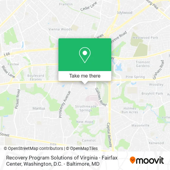
See Recovery Program Solutions of Virginia - Fairfax Center, Fairfax County, on the map
Public Transit to Recovery Program Solutions of Virginia - Fairfax Center in Fairfax County
Wondering how to get to Recovery Program Solutions of Virginia - Fairfax Center in Fairfax County? Moovit helps you find the best way to get to Recovery Program Solutions of Virginia - Fairfax Center with step-by-step directions from the nearest public transit station.
Moovit provides free maps and live directions to help you navigate through your city. View schedules, routes, timetables, and find out how long does it take to get to Recovery Program Solutions of Virginia - Fairfax Center in real time.
Looking for the nearest stop or station to Recovery Program Solutions of Virginia - Fairfax Center? Check out this list of stops closest to your destination: Willow Oaks Corporate Dr & Williams Dr; Gallows Rd+Arlington Bl; Gallows Rd @ Arlington Blvd; Gallows @ Willow Oaks Corporate Dr; Williams Dr+Arlington Bl; Dunn Loring Merrifield Metro Station.
Bus: 671, F60, F61, 402, 401, F62.Metro: ORANGE.
Want to see if there’s another route that gets you there at an earlier time? Moovit helps you find alternative routes or times. Get directions from and directions to Recovery Program Solutions of Virginia - Fairfax Center easily from the Moovit App or Website.
We make riding to Recovery Program Solutions of Virginia - Fairfax Center easy, which is why over 1.5 million users, including users in Fairfax County, trust Moovit as the best app for public transit. You don’t need to download an individual bus app or train app, Moovit is your all-in-one transit app that helps you find the best bus time or train time available.
For information on prices of bus and metro, costs and ride fares to Recovery Program Solutions of Virginia - Fairfax Center, please check the Moovit app.
Use the app to navigate to popular places including to the airport, hospital, stadium, grocery store, mall, coffee shop, school, college, and university.
Recovery Program Solutions of Virginia - Fairfax Center Address: 8221 Willow Oaks Corporate Dr Fairfax, VA 22031 street in Fairfax County
- Neighborhood Health,
- Inova Psychiatric Assessment Center,
- Willow Oaks Corp Dr & Woodburn Bldg,
- Merrifield Center,
- Fairfax Detoxification Center,
- Genoa Health Care,
- Northern Virginia Dental Clinic,
- Northern Virginia Association of Realtors,
- Nvar,
- Nvar Real Estate Store,
- Sheet Metal Workers National Pension Fund,
- Dewberry,
- Nvar Young Professionals Network,
- US-50,
- Boulevard Professional Center,
- Nationl Energy Management Inst Service,
- Jahan Shaukat, MD,
- Abu-Hamda Eyad MD,
- Donti Dental,
- Washington Nephrology
Places Near Recovery Program Solutions of Virginia - Fairfax Center (Fairfax County)
- PG Mall, Prince George's County,
- Rock Creek Tennis Center, Washington,
- Basilica of the National Shrine, Washington,
- National Museum of African American History and Culture, Washington,
- National Theatre, Washington,
- Pennsylvania Ave NW (3rd st and pennsylvania), Washington,
- Amazon Hq2, Arlington County,
- Westfield Montgomery Mall, Montgomery County,
- Georgetown, Washington,
- Washington National Cathedral, Washington,
- Capital One Arena, Washington,
- Warner Theatre, Washington,
- Marriott Marquis Washington, DC, Washington,
- Washington DC VA Medical Center, Washington,
- The Anthem, Washington,
- M&T Bank Stadium, Baltimore,
- National Zoo, Washington,
- Sibley Memorial Hospital, Washington,
- Camden Yards, Baltimore,
- Museum Of The Bible, Washington
How to get to popular places in Washington, D.C. - Baltimore, MD with public transit
Get around Fairfax County by public transit!
Traveling around Fairfax County has never been so easy. See step by step directions as you travel to any attraction, street or major public transit station. View bus and train schedules, arrival times, service alerts and detailed routes on a map, so you know exactly how to get to anywhere in Fairfax County.
When traveling to any destination around Fairfax County use Moovit's Live Directions with Get Off Notifications to know exactly where and how far to walk, how long to wait for your line, and how many stops are left. Moovit will alert you when it's time to get off — no need to constantly re-check whether yours is the next stop.
Wondering how to use public transit in Fairfax County or how to pay for public transit in Fairfax County? Moovit public transit app can help you navigate your way with public transit easily, and at minimum cost. It includes public transit fees, ticket prices, and costs. Looking for a map of Fairfax County public transit lines? Moovit public transit app shows all public transit maps in Fairfax County with all Bus, Train, Metro, Light Rail and Ferry routes and stops on an interactive map.
Washington, D.C. - Baltimore, MD has 5 transit type(s), including: Bus, Train, Metro, Light Rail and Ferry, operated by several transit agencies, including WMATA, Montgomery County Ride On, Fairfax Connector, TheBus, PRTC, DASH - Alexandria, Arlington Transit (ART), RTA of Central Maryland, MDOT MTA, MDOT MTA Light RailLink, MDOT MTA Commuter Bus, MDOT MTA Local Bus, FXBGO!, Virginia Railway Express (VRE) and MARC