How to get to Red Bunny Software by bus?
Click on the bus route to see step by step directions with maps, line arrival times and updated time schedules.
Bus stops near Red Bunny Software in Fort Myers
Bus lines to Red Bunny Software in Fort Myers
What are the closest stations to Red Bunny Software?
The closest stations to Red Bunny Software are:
- Wnklr Ave Ext @ Metro Pkwy is 226 yards away, 4 min walk.
- Metro Pkwy @ Winkler Ave 1 is 603 yards away, 8 min walk.
Which bus lines stop near Red Bunny Software?
These bus lines stop near Red Bunny Software: 10, 80.
What’s the nearest bus station to Red Bunny Software in Fort Myers?
The nearest bus station to Red Bunny Software in Fort Myers is Wnklr Ave Ext @ Metro Pkwy. It’s a 4 min walk away.
What time is the first bus to Red Bunny Software in Fort Myers?
The 5 is the first bus that goes to Red Bunny Software in Fort Myers. It stops nearby at 6:12 AM.
What time is the last bus to Red Bunny Software in Fort Myers?
The 5 is the last bus that goes to Red Bunny Software in Fort Myers. It stops nearby at 8:30 PM.
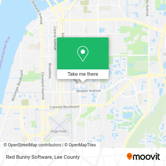
See Red Bunny Software, Fort Myers, on the map
Public Transit to Red Bunny Software in Fort Myers
Wondering how to get to Red Bunny Software in Fort Myers? Moovit helps you find the best way to get to Red Bunny Software with step-by-step directions from the nearest public transit station.
Moovit provides free maps and live directions to help you navigate through your city. View schedules, routes, timetables, and find out how long does it take to get to Red Bunny Software in real time.
Looking for the nearest stop or station to Red Bunny Software? Check out this list of stops closest to your destination: Wnklr Ave Ext @ Metro Pkwy; Metro Pkwy @ Winkler Ave 1.
Bus: 10, 80, 5.
Want to see if there’s another route that gets you there at an earlier time? Moovit helps you find alternative routes or times. Get directions from and directions to Red Bunny Software easily from the Moovit App or Website.
We make riding to Red Bunny Software easy, which is why over 1.5 million users, including users in Fort Myers, trust Moovit as the best app for public transit. You don’t need to download an individual bus app or train app, Moovit is your all-in-one transit app that helps you find the best bus time or train time available.
For information on prices of bus, costs and ride fares to Red Bunny Software, please check the Moovit app.
Use the app to navigate to popular places including to the airport, hospital, stadium, grocery store, mall, coffee shop, school, college, and university.
Red Bunny Software Address: 3624 Pine Oak Cir street in Fort Myers
- Hear Again Audiology Center,
- Faigy Fayette,
- Wilcox Supplies,
- Rodriguez Landscaping & Irrigation,
- Vimarc Flooring,
- Fort Myers Beach Florida,
- Carp US A,
- Blue Streak Couriers,
- Salvation Army,
- 4j Medical,
- SVN - Kova Fort Myers,
- Stephanie van Heerden DPM - Gardner Orthopedics,
- Vital Orthopedic & Spine Institute,
- Haven of Hope International,
- Frankmarine,
- Botanica Senora Blanca,
- Chiropractic Healing Arts,
- Magnolia's Boutique,
- Serrano Restaurant,
- Hi Tech Cleaners
Places Near Red Bunny Software (Fort Myers)
- Bonita Springs, FL, Bonita Springs,
- Amazon Warehouse Rsw5,
- Miromar Outlets, Estero,
- Edison Mall, Fort Myers,
- U.S.-41 / Colonial Blvd. Intersection, Fort Myers,
- Flixbus, Fort Myers,
- Pelican Landing Beach Shuttle, Bonita Springs,
- Matlacha Nude Beach, Matlacha Isles-Matlacha Shores,
- Walmart Supercenter, Fort Myers,
- Bonita Beach, Bonita Springs,
- I-75 & Colonial (Exit 136), Fort Myers,
- Bonita Bay Private Beach Club, Bonita Springs,
- Lee County Tax Collector, Cape Coral,
- Ft Myers Airport RSW,
- Rosa Parks Transportation Center, Fort Myers,
- All About U Naples Escorts, Pine Ridge,
- US-41, Fort Myers,
- I-75 & MLK (Exit 138), Fort Myers,
- Seminole Casino Hotel Immokalee,
- Lehigh Acres, FL, Lehigh Acres
How to get to popular places in Lee County with public transit
Get around Fort Myers by public transit!
Traveling around Fort Myers has never been so easy. See step by step directions as you travel to any attraction, street or major public transit station. View bus and train schedules, arrival times, service alerts and detailed routes on a map, so you know exactly how to get to anywhere in Fort Myers.
When traveling to any destination around Fort Myers use Moovit's Live Directions with Get Off Notifications to know exactly where and how far to walk, how long to wait for your line, and how many stops are left. Moovit will alert you when it's time to get off — no need to constantly re-check whether yours is the next stop.
Wondering how to use public transit in Fort Myers or how to pay for public transit in Fort Myers? Moovit public transit app can help you navigate your way with public transit easily, and at minimum cost. It includes public transit fees, ticket prices, and costs. Looking for a map of Fort Myers public transit lines? Moovit public transit app shows all public transit maps in Fort Myers with all bus routes and stops on an interactive map.
Lee County has 1 transit type(s), including: bus, operated by several transit agencies, including LeeTran, CAT and FlixBus-us