How to get to Red Chili Mahlberg by bus?
Click on the bus route to see step by step directions with maps, line arrival times and updated time schedules.
How to get to Red Chili Mahlberg by train?
Click on the train route to see step by step directions with maps, line arrival times and updated time schedules.
From Panorama-Bad Freudenstadt, Vereinbarte Verwaltungsgemeinschaft Freudenstadt
183 minFrom Parkplatz Bauhaus, Verwaltungsgemeinschaft Offenburg
68 minFrom Krankenhaus Freudenstadt, Vereinbarte Verwaltungsgemeinschaft Freudenstadt
188 minFrom Klinik Hohenfreudenstadt, Vereinbarte Verwaltungsgemeinschaft Freudenstadt
194 minFrom Hotel Palmenwald, Vereinbarte Verwaltungsgemeinschaft Freudenstadt
149 min
Bus stops near Red Chili Mahlberg in Verwaltungsgemeinschaft Ettenheim
Train station near Red Chili Mahlberg in Verwaltungsgemeinschaft Ettenheim
- Orschweier Bahnhof, 57 min walk,VIEW
Bus lines to Red Chili Mahlberg in Verwaltungsgemeinschaft Ettenheim
What are the closest stations to Red Chili Mahlberg?
The closest stations to Red Chili Mahlberg are:
- Mahlberg Tabakmuseum is 351 meters away, 5 min walk.
- Mahlberg Schule is 967 meters away, 13 min walk.
- Orschweier Bahnhof is 4445 meters away, 57 min walk.
Which bus line stops near Red Chili Mahlberg?
113 (Rust Rathaus)
Which train lines stop near Red Chili Mahlberg?
These train lines stop near Red Chili Mahlberg: RB 26, RB26, RE 7.
What’s the nearest bus station to Red Chili Mahlberg in Verwaltungsgemeinschaft Ettenheim?
The nearest bus station to Red Chili Mahlberg in Verwaltungsgemeinschaft Ettenheim is Mahlberg Tabakmuseum. It’s a 5 min walk away.
What time is the first train to Red Chili Mahlberg in Verwaltungsgemeinschaft Ettenheim?
The RE7 is the first train that goes to Red Chili Mahlberg in Verwaltungsgemeinschaft Ettenheim. It stops nearby at 4:40 AM.
What time is the last train to Red Chili Mahlberg in Verwaltungsgemeinschaft Ettenheim?
The RE7 is the last train that goes to Red Chili Mahlberg in Verwaltungsgemeinschaft Ettenheim. It stops nearby at 1:02 AM.
What time is the first bus to Red Chili Mahlberg in Verwaltungsgemeinschaft Ettenheim?
The 113 is the first bus that goes to Red Chili Mahlberg in Verwaltungsgemeinschaft Ettenheim. It stops nearby at 5:27 AM.
What time is the last bus to Red Chili Mahlberg in Verwaltungsgemeinschaft Ettenheim?
The 113 is the last bus that goes to Red Chili Mahlberg in Verwaltungsgemeinschaft Ettenheim. It stops nearby at 7:05 PM.
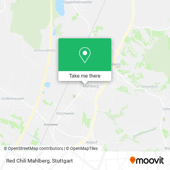
See Red Chili Mahlberg, Verwaltungsgemeinschaft Ettenheim, on the map
Public Transit to Red Chili Mahlberg in Verwaltungsgemeinschaft Ettenheim
Wondering how to get to Red Chili Mahlberg in Verwaltungsgemeinschaft Ettenheim? Moovit helps you find the best way to get to Red Chili Mahlberg with step-by-step directions from the nearest public transit station.
Moovit provides free maps and live directions to help you navigate through your city. View schedules, routes, timetables, and find out how long does it take to get to Red Chili Mahlberg in real time.
Looking for the nearest stop or station to Red Chili Mahlberg? Check out this list of stops closest to your destination: Mahlberg Tabakmuseum; Mahlberg Schule; Orschweier Bahnhof.
Bus: 113, 50, 53.Train: RB 26, RB26, RE 7, RE7, RB27.
Want to see if there’s another route that gets you there at an earlier time? Moovit helps you find alternative routes or times. Get directions from and directions to Red Chili Mahlberg easily from the Moovit App or Website.
We make riding to Red Chili Mahlberg easy, which is why over 1.5 million users, including users in Verwaltungsgemeinschaft Ettenheim, trust Moovit as the best app for public transit. You don’t need to download an individual bus app or train app, Moovit is your all-in-one transit app that helps you find the best bus time or train time available.
For information on prices of train, bus and light rail, costs and ride fares to Red Chili Mahlberg, please check the Moovit app.
Use the app to navigate to popular places including to the airport, hospital, stadium, grocery store, mall, coffee shop, school, college, and university.
Red Chili Mahlberg Address: Unterburgstraße 10 77972 Mahlberg street in Verwaltungsgemeinschaft Ettenheim
- Bäckerei Friedrich,
- Oberrheinisches Tabakmuseum,
- Iws Industrietechnik,
- Keienburg Architekten,
- C.J. von Türckheim-Böhl Architektur,
- Ferienhaus-Mahlberg,
- Schenker Storen Immobilien,
- Bürkle Weingut,
- Bürkle Richard Weingut,
- Bürkles Weinlaube,
- Schloß Mahlberg,
- René Naudascher,
- Tabakmuseum,
- Bürkle's Strauße,
- Gerd Rodermund Verwaltungs,
- Reisebüro Mahlberg,
- Friseursalon Elena,
- Dr. med. dent. Michael Fuchs,
- Dr. med. Amelie Hanke,
- Getränke Express Kleis
Places Near Red Chili Mahlberg (Verwaltungsgemeinschaft Ettenheim)
- FlixBus Haltestelle, Stuttgart,
- Waldfriedhof, Degerloch,
- Schleyerhalle, Bad Cannstatt,
- Klinikum Stuttgart - Katharinenhospital, Stuttgart-Mitte,
- Porsche-Arena, Bad Cannstatt,
- Geilhaus Haus 33a, Reutlingen-Betzingen,
- SI-Centrum, Möhringen,
- Hanns-Martin-Schleyer-Halle (Stuttgart Hans-Martin-Schleyerhalle), Bad Cannstatt,
- Hanns-Martin-Schleyer-Halle, Bad Cannstatt,
- Gasometer Pforzheim, Pforzheim,
- Marmorsaal Im Weissenburgpark, Stuttgart-Süd,
- Porsche Museum, Zuffenhausen,
- Mercedes-Benz Museum, Bad Cannstatt,
- Wilhelma (U-Bahn Wilhelma), Bad Cannstatt,
- Mercedes-Benz Museum (Mercedes Museum Stuttgart), Bad Cannstatt,
- Pariser Platz Stuttgart, Stuttgart-Mitte,
- Mettingen Eros-Center Puff Laufhaus, Esslingen Am Neckar,
- Gleis 101/102 (tief), Stuttgart-Mitte,
- Hauptbahnhof Stuttgart, Stuttgart-Mitte,
- Im Wizemann (Halle), Bad Cannstatt
How to get to popular places in Stuttgart with public transit
Get around Verwaltungsgemeinschaft Ettenheim by public transit!
Traveling around Verwaltungsgemeinschaft Ettenheim has never been so easy. See step by step directions as you travel to any attraction, street or major public transit station. View bus and train schedules, arrival times, service alerts and detailed routes on a map, so you know exactly how to get to anywhere in Verwaltungsgemeinschaft Ettenheim.
When traveling to any destination around Verwaltungsgemeinschaft Ettenheim use Moovit's Live Directions with Get Off Notifications to know exactly where and how far to walk, how long to wait for your line, and how many stops are left. Moovit will alert you when it's time to get off — no need to constantly re-check whether yours is the next stop.
Wondering how to use public transit in Verwaltungsgemeinschaft Ettenheim or how to pay for public transit in Verwaltungsgemeinschaft Ettenheim? Moovit public transit app can help you navigate your way with public transit easily, and at minimum cost. It includes public transit fees, ticket prices, and costs. Looking for a map of Verwaltungsgemeinschaft Ettenheim public transit lines? Moovit public transit app shows all public transit maps in Verwaltungsgemeinschaft Ettenheim with all Bus, Train, Subway, Light Rail, Ferry, S-Bahn and Funicular routes and stops on an interactive map.
Stuttgart has 7 transit type(s), including: Bus, Train, Subway, Light Rail, Ferry, S-Bahn and Funicular, operated by several transit agencies, including SSB - Stadtbahn, SSB, SSB - Seilbahn / Zacke, S-Bahn Stuttgart, Rhein-Neckar-Verkehr GmbH (rnv), Karlsruher Verkehrsverbund, DB AG, DB Regiobus BW, Arverio Baden-Württemberg GmbH, DB RegioNetz Verkehrs GmbH Westfrankenbahn, DB Regio AG Baden-Württemberg, Südwestdeutsche Verkehrs-AG, DB Regio AG Mitte Region Hessen, DB and Bodensee-Oberschwaben-Bahn