How to get to Red Cross by bus?
Click on the bus route to see step by step directions with maps, line arrival times and updated time schedules.
From FedEx, Scarborough
60 minFrom Chase, Scarborough
55 minFrom Sufficient Classic, South Portland
52 minFrom Sparkle Clean Car Wash, Scarborough
62 minFrom Gary's Moving, Scarborough
67 minFrom ATM, Westbrook
34 minFrom Bessey Crossing, Scarborough
64 minFrom Mainehealth Professional Building, Scarborough
60 min
Bus stops near Red Cross in Portland, ME
Ferry station near Red Cross in Portland, ME
- Casco Bay Lines Terminal, 21 min walk,VIEW
Train station near Red Cross in Portland, ME
- Portland Station, 37 min walk,VIEW
What are the closest stations to Red Cross?
The closest stations to Red Cross are:
- Forest Ave + Dartmouth St is 37 yards away, 1 min walk.
- Brighton Ave + Noyes St is 750 yards away, 9 min walk.
- Casco Bay Lines Terminal is 1736 yards away, 21 min walk.
- Portland Station is 3119 yards away, 37 min walk.
Which bus lines stop near Red Cross?
These bus lines stop near Red Cross: 2, 4, HSK.
What’s the nearest bus station to Red Cross in Portland, ME?
The nearest bus station to Red Cross in Portland, ME is Forest Ave + Dartmouth St. It’s a 1 min walk away.
What’s the nearest ferry station to Red Cross in Portland, ME?
The nearest ferry station to Red Cross in Portland, ME is Casco Bay Lines Terminal. It’s a 21 min walk away.
What time is the first train to Red Cross in Portland, ME?
The DOWNEASTER is the first train that goes to Red Cross in Portland, ME. It stops nearby at 5:18 AM.
What time is the last train to Red Cross in Portland, ME?
The DOWNEASTER is the last train that goes to Red Cross in Portland, ME. It stops nearby at 1:00 AM.
What time is the first bus to Red Cross in Portland, ME?
The 4 is the first bus that goes to Red Cross in Portland, ME. It stops nearby at 5:19 AM.
What time is the last bus to Red Cross in Portland, ME?
The 4 is the last bus that goes to Red Cross in Portland, ME. It stops nearby at 11:33 PM.
What time is the first ferry to Red Cross in Portland, ME?
The DB is the first ferry that goes to Red Cross in Portland, ME. It stops nearby at 5:00 AM.
What time is the last ferry to Red Cross in Portland, ME?
The PK is the last ferry that goes to Red Cross in Portland, ME. It stops nearby at 11:10 PM.
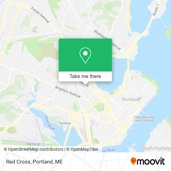
See Red Cross, Portland, ME, on the map
Public Transit to Red Cross in Portland, ME
Wondering how to get to Red Cross in Portland, ME? Moovit helps you find the best way to get to Red Cross with step-by-step directions from the nearest public transit station.
Moovit provides free maps and live directions to help you navigate through your city. View schedules, routes, timetables, and find out how long does it take to get to Red Cross in real time.
Looking for the nearest stop or station to Red Cross? Check out this list of stops closest to your destination: Forest Ave + Dartmouth St; Brighton Ave + Noyes St; Casco Bay Lines Terminal; Portland Station.
Bus: 2, 4, HSK.Train: DOWNEASTER.Ferry: DB, IB, PK.
Want to see if there’s another route that gets you there at an earlier time? Moovit helps you find alternative routes or times. Get directions from and directions to Red Cross easily from the Moovit App or Website.
We make riding to Red Cross easy, which is why over 1.5 million users, including users in Portland, ME, trust Moovit as the best app for public transit. You don’t need to download an individual bus app or train app, Moovit is your all-in-one transit app that helps you find the best bus time or train time available.
For information on prices of bus, costs and ride fares to Red Cross, please check the Moovit app.
Use the app to navigate to popular places including to the airport, hospital, stadium, grocery store, mall, coffee shop, school, college, and university.
Red Cross Address: 524 Forest Ave Portland, ME 04101 street in Portland, ME
- Alltown Car Wash,
- A Cleaner Way,
- Bethel Stone Painting & Power Washing,
- Maine Summer Camps,
- New England Region,
- Ssa Realty,
- National Association of Letter Carriers,
- Aident,
- Bustins Island Gift Certificates,
- Beam Skin Studio,
- Starbird Music & Piano Gallery ,
- Casco Bay Movers,
- Duane Thomas,
- The Center for Grieving Children, Maine,
- Center for Outcomes Reasearch,
- Sandy River Group,
- Maine Recovery Fund,
- Casco Bay Painting,
- Gateway Community Services,
- Soft Tissue
Places Near Red Cross (Portland, ME)
- Walmart Scarborough Supercenter,
- Maine Medical Center,
- Fort Gorges,
- Fort Williams Park, Cape Elizabeth,
- Portland International Jetport (PWM) (Portland International Jetport),
- Jewell Island,
- On a bus to Kennebunkport,
- L. L. Bean Outlet,
- Walmart,
- Southern Maine Community College, South Portland,
- Cape Elizabeth, ME, Cape Elizabeth,
- ZzZzZzZzZzZ, Westbrook,
- House Island,
- Cross Insurance Arena,
- The Old Port,
- Exit 45 Park And Ride, South Portland,
- Clarion Hotel Portland,
- Mercy Hospital - Fore River Campus,
- Portland Transportation Center,
- Casco Bay Ferry Terminal
How to get to popular places in Portland, ME with public transit
Get around Portland, ME by public transit!
Traveling around Portland, ME has never been so easy. See step by step directions as you travel to any attraction, street or major public transit station. View bus and train schedules, arrival times, service alerts and detailed routes on a map, so you know exactly how to get to anywhere in Portland, ME.
When traveling to any destination around Portland, ME use Moovit's Live Directions with Get Off Notifications to know exactly where and how far to walk, how long to wait for your line, and how many stops are left. Moovit will alert you when it's time to get off — no need to constantly re-check whether yours is the next stop.
Wondering how to use public transit in Portland, ME or how to pay for public transit in Portland, ME? Moovit public transit app can help you navigate your way with public transit easily, and at minimum cost. It includes public transit fees, ticket prices, and costs. Looking for a map of Portland, ME public transit lines? Moovit public transit app shows all public transit maps in Portland, ME with all Bus, Train and Ferry routes and stops on an interactive map.
Portland, ME has 3 transit type(s), including: Bus, Train and Ferry, operated by several transit agencies, including Greater Portland Metro, City of South Portland, Biddeford Saco Old Orchard Beach Transit, Casco Bay Lines, Amtrak, Greyhound-us and FlixBus-us