How to get to Red Cross by bus?
Click on the bus route to see step by step directions with maps, line arrival times and updated time schedules.
From Old Town Alexandria, Alexandria
45 minFrom King St Metro - Kiss And Ride Lot, Alexandria
54 minFrom American University, Washington
39 minFrom Army-Navy Country Club (ARL), Arlington County
54 minFrom Alexandria, VA, Alexandria
50 minFrom FSI, Arlington County
53 minFrom Alexandria Station - AMTRAK/VRE (ALX), Alexandria
56 minFrom Holy Cross Hospital, Montgomery County
71 minFrom Congressional Cemetery, Washington
47 minFrom RFK Stadium, Washington
57 min
How to get to Red Cross by train?
Click on the train route to see step by step directions with maps, line arrival times and updated time schedules.
How to get to Red Cross by metro?
Click on the metro route to see step by step directions with maps, line arrival times and updated time schedules.
From Old Town Alexandria, Alexandria
50 minFrom King St Metro - Kiss And Ride Lot, Alexandria
36 minFrom American University, Washington
50 minFrom Alexandria, VA, Alexandria
45 minFrom Alexandria Station - AMTRAK/VRE (ALX), Alexandria
38 minFrom Holy Cross Hospital, Montgomery County
50 minFrom Congressional Cemetery, Washington
39 minFrom RFK Stadium, Washington
36 min
Bus stops near Red Cross in Washington
- 20th St & E St NW Nb, 3 min walk,VIEW
- F St Nw+21 St NW, 3 min walk,VIEW
- Virginia Ave @ 21st St Nw, 4 min walk,VIEW
- Virginia Ave NW @ 21st St NW, 4 min walk,VIEW
- 19th St & E St NW Sb, 4 min walk,VIEW
- Virginia Ave & 21st St - State Dept, 4 min walk,VIEW
- 19th St & E St, 4 min walk,VIEW
- 19th St & F St, 4 min walk,VIEW
- Virginia Ave PM, 5 min walk,VIEW
Metro stations near Red Cross in Washington
Bus lines to Red Cross in Washington
- 715, 715/9 Golden Beach Park & Ride,VIEW
- 810, 810/2 Washington Dc,VIEW
- 820, 820/2 Washington Dc,VIEW
- 830, 830/3 Washington Dc,VIEW
- 840, 840/7 Prince Frederick / St Leonard,VIEW
- D74, East To Rhode Island Av,VIEW
- D82, North To Friendship Hts,VIEW
- D96, South To Potomac Park,VIEW
- 541, 541 - Washington Dc / State Department,VIEW
- 611, State Department / Washington Dc,VIEW
- 611-FR, Front Royal - Gainesville,VIEW
- 971, Horner / Telegraph / Dale City Lots Via Minnieville,VIEW
- 972-M, Eastern Lot Connector,VIEW
- 981, Pentagon / State Department / Washington Dc,VIEW
- 699, 699 Downtown D.C.,VIEW
- 305, 305/3 Washington Dc,VIEW
- 325, 325/1 Washington Dc / Capitol Hill,VIEW
- 335, 335/5 Clarksville,VIEW
- 345, 345/8 Long Gate Park & Ride,VIEW
- 630, 630/10 La Plata,VIEW
What are the closest stations to Red Cross?
The closest stations to Red Cross are:
- 20th St & E St NW Nb is 127 yards away, 3 min walk.
- F St Nw+21 St NW is 188 yards away, 3 min walk.
- Virginia Ave @ 21st St Nw is 220 yards away, 4 min walk.
- Virginia Ave NW @ 21st St NW is 227 yards away, 4 min walk.
- 19th St & E St NW Sb is 235 yards away, 4 min walk.
- Virginia Ave & 21st St - State Dept is 244 yards away, 4 min walk.
- 19th St & E St is 257 yards away, 4 min walk.
- 19th St & F St is 295 yards away, 4 min walk.
- Virginia Ave PM is 347 yards away, 5 min walk.
- Mcpherson Sq Metro Station is 601 yards away, 8 min walk.
- Farragut North is 996 yards away, 12 min walk.
Which bus lines stop near Red Cross?
These bus lines stop near Red Cross: 971, A49, D10, D74, F19.
Which train lines stop near Red Cross?
These train lines stop near Red Cross: MANASSAS LINE, MARC.
Which metro lines stop near Red Cross?
These metro lines stop near Red Cross: BLUE, ORANGE, RED, SILVER.
What’s the nearest metro station to Red Cross in Washington?
The nearest metro station to Red Cross in Washington is Mcpherson Sq Metro Station. It’s a 8 min walk away.
What’s the nearest bus station to Red Cross in Washington?
The nearest bus stations to Red Cross in Washington are 20th St & E St NW Nb and F St Nw+21 St NW. The closest one is a 3 min walk away.
What time is the first metro to Red Cross in Washington?
The BLUE is the first metro that goes to Red Cross in Washington. It stops nearby at 5:20 AM.
What time is the last metro to Red Cross in Washington?
The RED is the last metro that goes to Red Cross in Washington. It stops nearby at 12:08 AM.
What time is the first bus to Red Cross in Washington?
The 541 is the first bus that goes to Red Cross in Washington. It stops nearby at 5:12 AM.
What time is the last bus to Red Cross in Washington?
The D96 is the last bus that goes to Red Cross in Washington. It stops nearby at 12:18 AM.
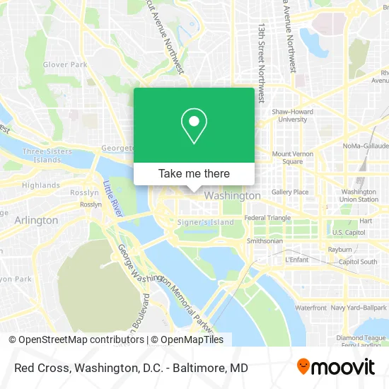
See Red Cross, Washington, on the map
Public Transit to Red Cross in Washington
Wondering how to get to Red Cross in Washington? Moovit helps you find the best way to get to Red Cross with step-by-step directions from the nearest public transit station.
Moovit provides free maps and live directions to help you navigate through your city. View schedules, routes, timetables, and find out how long does it take to get to Red Cross in real time.
Looking for the nearest stop or station to Red Cross? Check out this list of stops closest to your destination: 20th St & E St NW Nb; F St Nw+21 St NW; Virginia Ave @ 21st St Nw; Virginia Ave NW @ 21st St NW; 19th St & E St NW Sb; Virginia Ave & 21st St - State Dept; 19th St & E St; 19th St & F St; Virginia Ave PM; Mcpherson Sq Metro Station; Farragut North.
Bus: 971, A49, D10, D74, F19, 715, 810, 820, 830, 840, D82, D96, 541, 611, 611-FR, 972-M, 699.Train: MANASSAS LINE, MARC.Metro: BLUE, ORANGE, RED, SILVER.
Want to see if there’s another route that gets you there at an earlier time? Moovit helps you find alternative routes or times. Get directions from and directions to Red Cross easily from the Moovit App or Website.
We make riding to Red Cross easy, which is why over 1.5 million users, including users in Washington, trust Moovit as the best app for public transit. You don’t need to download an individual bus app or train app, Moovit is your all-in-one transit app that helps you find the best bus time or train time available.
For information on prices of bus, metro and train, costs and ride fares to Red Cross, please check the Moovit app.
Use the app to navigate to popular places including to the airport, hospital, stadium, grocery store, mall, coffee shop, school, college, and university.
Red Cross Address: 2025 E St NW street in Washington
- American Red Cross National Headquarters,
- Department Of State SA 9,
- American Red Cross Charles R. Drew Blood Donation Center,
- Courtyard by Marriott Washington D C Foggy Bottom,
- Courtyard Washington, DC / Foggy Bottom,
- Elliott School of International Affairs (Elliott School Graduate Student Services),
- State Dept (21st & Virginia Ave Metro Bus Stop),
- L-101,
- GWU - Elliott School of International Affairs,
- Metro Bus 31,32,36,80,
- Elliott School Harry Harding Auditorium,
- Paho / Who Federal Credit Union ,
- Washington Surgi-Clinic (Washington Surgical Clinic),
- Johns Hopkins,
- State Plaza Hotel Washington,
- US Passport Agency,
- State Plaza Hotel,
- Virginia Ave & 21st St, NW Bus Stop,
- Virginia Ave NW & E St NW,
- Thurston Hall
Places Near Red Cross (Washington)
- National Zoo, Washington,
- Camden Yards, Baltimore,
- PG Mall, Prince George's County,
- Rock Creek Tennis Center, Washington,
- Sibley Memorial Hospital, Washington,
- National Museum of African American History and Culture, Washington,
- Washington National Cathedral, Washington,
- National Mall, Washington,
- The Anthem, Washington,
- Washington DC VA Medical Center, Washington,
- Capital One Arena, Washington,
- Marriott Marquis Washington, DC, Washington,
- Warner Theatre, Washington,
- Georgetown, Washington,
- M&T Bank Stadium, Baltimore,
- Museum Of The Bible, Washington,
- Basilica of the National Shrine, Washington,
- Pennsylvania Ave NW (3rd st and pennsylvania), Washington,
- Westfield Montgomery Mall, Montgomery County,
- Amazon Hq2, Arlington County
How to get to popular places in Washington, D.C. - Baltimore, MD with public transit
Get around Washington by public transit!
Traveling around Washington has never been so easy. See step by step directions as you travel to any attraction, street or major public transit station. View bus and train schedules, arrival times, service alerts and detailed routes on a map, so you know exactly how to get to anywhere in Washington.
When traveling to any destination around Washington use Moovit's Live Directions with Get Off Notifications to know exactly where and how far to walk, how long to wait for your line, and how many stops are left. Moovit will alert you when it's time to get off — no need to constantly re-check whether yours is the next stop.
Wondering how to use public transit in Washington or how to pay for public transit in Washington? Moovit public transit app can help you navigate your way with public transit easily, and at minimum cost. It includes public transit fees, ticket prices, and costs. Looking for a map of Washington public transit lines? Moovit public transit app shows all public transit maps in Washington with all Bus, Train, Metro, Light Rail and Ferry routes and stops on an interactive map.
Washington, D.C. - Baltimore, MD has 5 transit type(s), including: Bus, Train, Metro, Light Rail and Ferry, operated by several transit agencies, including WMATA, Montgomery County Ride On, Fairfax Connector, TheBus, PRTC, DASH - Alexandria, Arlington Transit (ART), RTA of Central Maryland, MDOT MTA, MDOT MTA Light RailLink, MDOT MTA Commuter Bus, MDOT MTA Local Bus, FXBGO!, Virginia Railway Express (VRE) and MARC