Directions to Red Regency (Baltimore) with public transportation
The following transit lines have routes that pass near Red Regency
 Bus: CITYLINK PURPLE, 78, 34.
How to get to Red Regency by bus?
Click on the bus route to see step by step directions with maps, line arrival times and updated time schedules.
From Walters Art Museum, Baltimore
47 minFrom Randallstown, MD, Baltimore County
80 minFrom Mercy Medical Center, Baltimore
37 minFrom Harford Road, Baltimore
51 minFrom Baltimore Marriott Waterfront, Baltimore
43 minFrom MVA Glen Burnie, Anne Arundel County
63 minFrom Morgan State University, Baltimore
68 minFrom Hampden, Baltimore
59 minFrom Canton, Baltimore
56 minFrom Lexington Market, Baltimore
30 min
Bus stops near Red Regency in Baltimore
What are the closest stations to Red Regency?
The closest stations to Red Regency are:
- Athol Ave & Old Frederick Rd FS Nb is 69 yards away, 1 min walk.
- Frederick Ave & Tremont Rd Wb is 197 yards away, 3 min walk.
Which bus line stops near Red Regency?
CITYLINK PURPLE (Paradise)
What’s the nearest bus station to Red Regency in Baltimore?
The nearest bus station to Red Regency in Baltimore is Athol Ave & Old Frederick Rd FS Nb. It’s a 1 min walk away.
What time is the first bus to Red Regency in Baltimore?
The CITYLINK PURPLE is the first bus that goes to Red Regency in Baltimore. It stops nearby at 4:11 AM.
What time is the last bus to Red Regency in Baltimore?
The CITYLINK PURPLE is the last bus that goes to Red Regency in Baltimore. It stops nearby at 2:41 AM.
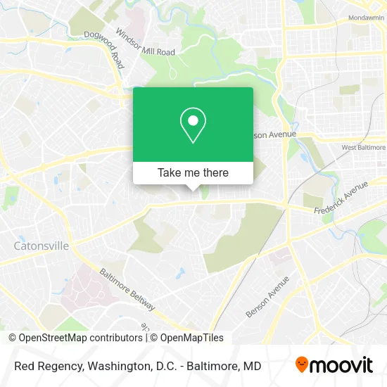
See Red Regency, Baltimore, on the map
Public Transit to Red Regency in Baltimore
Wondering how to get to Red Regency in Baltimore? Moovit helps you find the best way to get to Red Regency with step-by-step directions from the nearest public transit station.
Moovit provides free maps and live directions to help you navigate through your city. View schedules, routes, timetables, and find out how long does it take to get to Red Regency in real time.
Looking for the nearest stop or station to Red Regency? Check out this list of stops closest to your destination: Athol Ave & Old Frederick Rd FS Nb; Frederick Ave & Tremont Rd Wb.
Bus: CITYLINK PURPLE, 78, 34.
Want to see if there’s another route that gets you there at an earlier time? Moovit helps you find alternative routes or times. Get directions from and directions to Red Regency easily from the Moovit App or Website.
We make riding to Red Regency easy, which is why over 1.5 million users, including users in Baltimore, trust Moovit as the best app for public transit. You don’t need to download an individual bus app or train app, Moovit is your all-in-one transit app that helps you find the best bus time or train time available.
For information on prices of bus, costs and ride fares to Red Regency, please check the Moovit app.
Use the app to navigate to popular places including to the airport, hospital, stadium, grocery store, mall, coffee shop, school, college, and university.
Red Regency Address: 13 S Tremont Rd street in Baltimore
- Tremont, Maryland,
- 1,S Tremont Rd S Tremont Rd,
- New Street,
- Denoli,
- Kumon Math & Reading Center Of West Baltimore - Sankofa,
- Simply Sweet Treats,
- Kimistry Pressure Wash,
- General Painting Services Roses,
- BMG Mobile Service,
- Kickin Grass Yard Maintenance,
- Aqsa Services,
- Kwang Moo,
- Kiki African American Hair Braiding in Baltimore, MD,
- Tremont Food Market,
- Atholgate Ln Pen Lucy Rd,
- Beechfield and Frederick,
- S Beechfield Ave (frederick ave & S Beechfield Ave),
- Davidovski Florence MD,
- Calvin L Williams Funeral Home PA,
- Mt St Joseph's
Places Near Red Regency (Baltimore)
- Sibley Memorial Hospital, Washington,
- Georgetown, Washington,
- Washington National Cathedral, Washington,
- National Museum of African American History and Culture, Washington,
- M&T Bank Stadium, Baltimore,
- National Mall, Washington,
- Westfield Montgomery Mall, Montgomery County,
- PG Mall, Prince George's County,
- National Zoo, Washington,
- Museum Of The Bible, Washington,
- The Anthem, Washington,
- Pennsylvania Ave NW (3rd st and pennsylvania), Washington,
- Camden Yards, Baltimore,
- Rock Creek Tennis Center, Washington,
- Capital One Arena, Washington,
- Marriott Marquis Washington, DC, Washington,
- Washington DC VA Medical Center, Washington,
- Amazon Hq2, Arlington County,
- Warner Theatre, Washington,
- Basilica of the National Shrine, Washington
How to get to popular places in Washington, D.C. - Baltimore, MD with public transit
Get around Baltimore by public transit!
Traveling around Baltimore has never been so easy. See step by step directions as you travel to any attraction, street or major public transit station. View bus and train schedules, arrival times, service alerts and detailed routes on a map, so you know exactly how to get to anywhere in Baltimore.
When traveling to any destination around Baltimore use Moovit's Live Directions with Get Off Notifications to know exactly where and how far to walk, how long to wait for your line, and how many stops are left. Moovit will alert you when it's time to get off — no need to constantly re-check whether yours is the next stop.
Wondering how to use public transit in Baltimore or how to pay for public transit in Baltimore? Moovit public transit app can help you navigate your way with public transit easily, and at minimum cost. It includes public transit fees, ticket prices, and costs. Looking for a map of Baltimore public transit lines? Moovit public transit app shows all public transit maps in Baltimore with all Bus, Train, Metro, Light Rail and Ferry routes and stops on an interactive map.
Washington, D.C. - Baltimore, MD has 5 transit type(s), including: Bus, Train, Metro, Light Rail and Ferry, operated by several transit agencies, including WMATA, Montgomery County Ride On, Fairfax Connector, TheBus, PRTC, DASH - Alexandria, Arlington Transit (ART), RTA of Central Maryland, MDOT MTA, MDOT MTA Light RailLink, MDOT MTA Commuter Bus, MDOT MTA Local Bus, FXBGO!, Virginia Railway Express (VRE) and MARC