Directions to Redbeard Brewing (Staunton) with public transportation
The following transit lines have routes that pass near Redbeard Brewing
 Bus: 250 CONNECTOR, AFTON EXPRESS, BRCC SOUTH, BRCC NORTH, WEST / NORTH LOOP.
- Train: CARDINAL.
How to get to Redbeard Brewing by bus?
Click on the bus route to see step by step directions with maps, line arrival times and updated time schedules.
Bus stops near Redbeard Brewing in Staunton
Train station near Redbeard Brewing in Staunton
- Staunton Amtrak Station, 34 min walk,VIEW
Bus lines to Redbeard Brewing in Staunton
What are the closest stations to Redbeard Brewing?
The closest stations to Redbeard Brewing are:
- Central United Methodist Church is 190 yards away, 3 min walk.
- Middlebrook Ave / W Hampton St is 477 yards away, 6 min walk.
- Staunton Amtrak Station is 2858 yards away, 34 min walk.
Which bus lines stop near Redbeard Brewing?
These bus lines stop near Redbeard Brewing: 250 CONNECTOR, AFTON EXPRESS, BRCC SOUTH.
What’s the nearest bus station to Redbeard Brewing in Staunton?
The nearest bus station to Redbeard Brewing in Staunton is Central United Methodist Church. It’s a 3 min walk away.
What time is the first bus to Redbeard Brewing in Staunton?
The WEST / NORTH LOOP is the first bus that goes to Redbeard Brewing in Staunton. It stops nearby at 6:32 AM.
What time is the last bus to Redbeard Brewing in Staunton?
The 250 CONNECTOR is the last bus that goes to Redbeard Brewing in Staunton. It stops nearby at 9:28 PM.
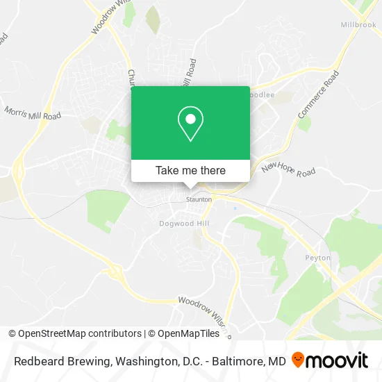
See Redbeard Brewing, Staunton, on the map
Public Transit to Redbeard Brewing in Staunton
Wondering how to get to Redbeard Brewing in Staunton? Moovit helps you find the best way to get to Redbeard Brewing with step-by-step directions from the nearest public transit station.
Moovit provides free maps and live directions to help you navigate through your city. View schedules, routes, timetables, and find out how long does it take to get to Redbeard Brewing in real time.
Looking for the nearest stop or station to Redbeard Brewing? Check out this list of stops closest to your destination: Central United Methodist Church; Middlebrook Ave / W Hampton St; Staunton Amtrak Station.
Bus: 250 CONNECTOR, AFTON EXPRESS, BRCC SOUTH, BRCC NORTH, WEST / NORTH LOOP.Train: CARDINAL.
Want to see if there’s another route that gets you there at an earlier time? Moovit helps you find alternative routes or times. Get directions from and directions to Redbeard Brewing easily from the Moovit App or Website.
We make riding to Redbeard Brewing easy, which is why over 1.5 million users, including users in Staunton, trust Moovit as the best app for public transit. You don’t need to download an individual bus app or train app, Moovit is your all-in-one transit app that helps you find the best bus time or train time available.
For information on prices of bus and train, costs and ride fares to Redbeard Brewing, please check the Moovit app.
Use the app to navigate to popular places including to the airport, hospital, stadium, grocery store, mall, coffee shop, school, college, and university.
Redbeard Brewing Address: 120 S Lewis St Staunton, VA 24401 street in Staunton
- Bitter Sweet Bakery,
- Chef Tony Catering,
- Globowl Cafe Mobile,
- Reliant Home Services,
- Alberto's Landscaping & House Cleaning,
- Rick Laughlin,
- Hook and Roll Towing,
- WPG Productions,
- Wesley Hodges Fly Fishing,
- Mibaby Pet Care,
- Gorgeous Gal Makeup,
- Wiseman Service & Repair,
- Same Day Delivery & Hauling,
- Ciders From Mars,
- Lynn Sisson & Rusty Ashby Voya Financial Advisors,
- Cathedral Security Associates,
- Lynn P Sisson,
- Danville Virginia,
- American Solutions for Business,
- Colonial River Wealth Management
Places Near Redbeard Brewing (Staunton)
- The Anthem, Washington,
- Warner Theatre, Washington,
- National Zoo, Washington,
- Rock Creek Tennis Center, Washington,
- National Museum of African American History and Culture, Washington,
- Museum Of The Bible, Washington,
- Westfield Montgomery Mall, Montgomery County,
- Georgetown, Washington,
- M&T Bank Stadium, Baltimore,
- Sibley Memorial Hospital, Washington,
- Basilica of the National Shrine, Washington,
- Capital One Arena, Washington,
- Marriott Marquis Washington, DC, Washington,
- National Theatre, Washington,
- PG Mall, Prince George's County,
- Pennsylvania Ave NW (3rd st and pennsylvania), Washington,
- Amazon Hq2, Arlington County,
- Washington National Cathedral, Washington,
- Camden Yards, Baltimore,
- Washington DC VA Medical Center, Washington
How to get to popular places in Washington, D.C. - Baltimore, MD with public transit
Get around Staunton by public transit!
Traveling around Staunton has never been so easy. See step by step directions as you travel to any attraction, street or major public transit station. View bus and train schedules, arrival times, service alerts and detailed routes on a map, so you know exactly how to get to anywhere in Staunton.
When traveling to any destination around Staunton use Moovit's Live Directions with Get Off Notifications to know exactly where and how far to walk, how long to wait for your line, and how many stops are left. Moovit will alert you when it's time to get off — no need to constantly re-check whether yours is the next stop.
Wondering how to use public transit in Staunton or how to pay for public transit in Staunton? Moovit public transit app can help you navigate your way with public transit easily, and at minimum cost. It includes public transit fees, ticket prices, and costs. Looking for a map of Staunton public transit lines? Moovit public transit app shows all public transit maps in Staunton with all Bus, Train, Metro, Light Rail and Ferry routes and stops on an interactive map.
Washington, D.C. - Baltimore, MD has 5 transit type(s), including: Bus, Train, Metro, Light Rail and Ferry, operated by several transit agencies, including WMATA, Montgomery County Ride On, Fairfax Connector, TheBus, PRTC, DASH - Alexandria, Arlington Transit (ART), RTA of Central Maryland, MDOT MTA, MDOT MTA Light RailLink, MDOT MTA Commuter Bus, MDOT MTA Local Bus, FXBGO!, Virginia Railway Express (VRE) and MARC