How to get to Rede Imagem by bus?
Click on the bus route to see step by step directions with maps, line arrival times and updated time schedules.
From Escola Áurea Pires da Gama, Cunhambebe
44 minFrom praia da biscaia, angra dos reis, Jacuecanga
73 minFrom Climasol, Angra Dos Reis
29 minFrom Estação Santa Luzia, Angra Dos Reis
25 minFrom Condominio Bracuhy, Cunhambebe
55 minFrom Vila Gale Eco Resort De Angra Conference & Spa, Angra Dos Reis
40 minFrom Rua do Monumento do Aquidabã 95, Jacuecanga
85 minFrom Avenida Antônio Bertholdo da Silva Jordão 7346, Jacuecanga
83 minFrom Mega Fran Gif, Angra Dos Reis
26 minFrom Praia de Monsuaba, Jacuecanga
72 min
Bus stops near Rede Imagem in Cunhambebe
Bus lines to Rede Imagem in Cunhambebe
- T20, Parque Mambucaba (via Praia Brava / Vila Histórica),VIEW
- T21, Frade,VIEW
- T21B, Praia Brava,VIEW
- T21C, Frade (via Itinga),VIEW
- L101, Angra dos Reis - Paraty,VIEW
- 202, Frade (via Sertãozinho / Beira Rio),VIEW
- 203, Serra D'Água,VIEW
- B203, Serra D'Agua (via Túnel),VIEW
- 204, Ariró,VIEW
- 206, Banqueta,VIEW
- B206, Banqueta (via Balneário),VIEW
- C206, Banqueta (via Vale da Banqueta),VIEW
- 208, Belém (Via São José),VIEW
- 221, Nova Angra,VIEW
- B221, Nova Angra (via Gamboa),VIEW
- 227, Centro - Parque Mambucaba (Expresso),VIEW
- 230, Itinga,VIEW
- 306, Belém - Jacuecanga,VIEW
- L407, Angra dos Reis - Lídice,VIEW
- L408, Angra dos Reis - Rio Claro (via Lídice),VIEW
What are the closest stations to Rede Imagem?
The closest stations to Rede Imagem are:
- Hospital Geral Da Japuíba / Sentido Centro is 98 meters away, 2 min walk.
- Rua Japoranga, 975-1237 is 169 meters away, 3 min walk.
- Rua Prefeito João Galindo, 290-488 is 195 meters away, 3 min walk.
Which bus lines stop near Rede Imagem?
These bus lines stop near Rede Imagem: 207, 225, 230, 300, T20.
What’s the nearest bus station to Rede Imagem in Cunhambebe?
The nearest bus station to Rede Imagem in Cunhambebe is Hospital Geral Da Japuíba / Sentido Centro. It’s a 2 min walk away.
What time is the first bus to Rede Imagem in Cunhambebe?
The T20 is the first bus that goes to Rede Imagem in Cunhambebe. It stops nearby at 5:06 AM.
What time is the last bus to Rede Imagem in Cunhambebe?
The T20 is the last bus that goes to Rede Imagem in Cunhambebe. It stops nearby at 1:25 AM.
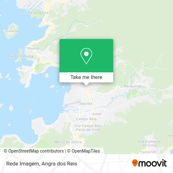
See Rede Imagem, Cunhambebe, on the map
Public Transit to Rede Imagem in Cunhambebe
Wondering how to get to Rede Imagem in Cunhambebe? Moovit helps you find the best way to get to Rede Imagem with step-by-step directions from the nearest public transit station.
Moovit provides free maps and live directions to help you navigate through your city. View schedules, routes, timetables, and find out how long does it take to get to Rede Imagem in real time.
Looking for the nearest stop or station to Rede Imagem? Check out this list of stops closest to your destination: Hospital Geral Da Japuíba / Sentido Centro; Rua Japoranga; Rua Prefeito João Galindo.
Bus: 207, 225, 230, 300, T20, T21, T21B, T21C, L101, 224, B207, A220, B220.
Want to see if there’s another route that gets you there at an earlier time? Moovit helps you find alternative routes or times. Get directions from and directions to Rede Imagem easily from the Moovit App or Website.
We make riding to Rede Imagem easy, which is why over 1.5 million users, including users in Cunhambebe, trust Moovit as the best app for public transit. You don’t need to download an individual bus app or train app, Moovit is your all-in-one transit app that helps you find the best bus time or train time available.
For information on prices of bus, costs and ride fares to Rede Imagem, please check the Moovit app.
Use the app to navigate to popular places including to the airport, hospital, stadium, grocery store, mall, coffee shop, school, college, and university.
Rede Imagem Address: Rua Japoranga, 1970 Japuíba Angra dos Reis-RJ 23934-055 street in Cunhambebe
- Odontoclin Carina Leal Vale,
- Gnv Angra,
- Planagro - Topografia, Meio Ambiente e Assessoria Agropecuária S / S,
- Hsvp - Angra,
- Construtora Matos Teixeira,
- Jr Veiculos Angra,
- Espaço Médico Japuíba,
- UPA 34 - Angra dos Reis,
- Cicom - Clínica de Imagem Computadorizada,
- Upa Infantil Agda Maria,
- UPA 24h Angra dos Reis-PS,
- Reciclagem Nova Angra,
- Rhf Talentos Unidade Angra dos Reis,
- Planet Marine,
- Clínica Médica e Endocrinologia,
- World Machine,
- Okey Veiculos,
- Big Mix Distribuidora,
- Vicentiny Noivas,
- Vertical Equipamentos
Places Near Rede Imagem (Cunhambebe)
- Rodovia BR 101, Km 533 s/n, Mambucaba,
- Rua Prefeito João Gregório Galindo, Cunhambebe,
- Rua Cônegos Bittencourt, Angra Dos Reis,
- Praia do Laboratório, Angra Dos Reis,
- BR 101, Km 508 s/n, Cunhambebe,
- Cachoeira do Tobogã, Parati,
- Garatucaia, Angra Dos Reis,
- Rodovia Procurador Haroldo Fernandes Duarte, Km 513,5 s / n, Cunhambebe,
- Rua Prefeito João Gregório Galindo 2487, Angra Dos Reis,
- Praia de Paraty Mirim, Parati,
- Vila Residencial De Mambucaba, Mambucaba,
- Vila Galé Eco Resort De Angra, Angra Dos Reis,
- praia jabaquara - parati, Parati,
- Condominio Laranjeiras, Parati Mirim,
- Verolme, Jacuecanga,
- Avenida Antônio Bertholdo da Silva Jordão 7346, Jacuecanga,
- Alambique Engenho D'Ouro, Parati,
- Mambucaba, Mambucaba,
- Avenida Almirante Jair Carneiro Toscano de Brito 110, Angra Dos Reis,
- Centro Histórico de Paraty, Parati
How to get to popular places in Angra dos Reis with public transit
Get around Cunhambebe by public transit!
Traveling around Cunhambebe has never been so easy. See step by step directions as you travel to any attraction, street or major public transit station. View bus and train schedules, arrival times, service alerts and detailed routes on a map, so you know exactly how to get to anywhere in Cunhambebe.
When traveling to any destination around Cunhambebe use Moovit's Live Directions with Get Off Notifications to know exactly where and how far to walk, how long to wait for your line, and how many stops are left. Moovit will alert you when it's time to get off — no need to constantly re-check whether yours is the next stop.
Wondering how to use public transit in Cunhambebe or how to pay for public transit in Cunhambebe? Moovit public transit app can help you navigate your way with public transit easily, and at minimum cost. It includes public transit fees, ticket prices, and costs. Looking for a map of Cunhambebe public transit lines? Moovit public transit app shows all public transit maps in Cunhambebe with all Bus and Ferry routes and stops on an interactive map.
Angra dos Reis has 2 transit type(s), including: Bus and Ferry, operated by several transit agencies, including Viação Senhor do Bonfim, Colitur Transportes Rodoviários, Cooparatyense (Vans), Costa Verde Transportes, Barcas Rio, Objetiva Tour, Vilanova Tour, Rodoviário Oceano, BusUFF and Colitur (Tarifa Zero - Paraty)