How to get to Redevelopment Works In Ft. Myers by bus?
Click on the bus route to see step by step directions with maps, line arrival times and updated time schedules.
From Select Specialty Hospital-Fort Myers (Promise Hospital of Fort Myers), Fort Myers
68 minFrom Ministerio Cristiano, Jesus Puente de Vida, Cape Coral
51 minFrom Asian Massage Spa, Villas
45 minFrom Budget, Fort Myers
30 minFrom Therapy Treatment Team, Villas
48 minFrom Coastal Edge Auction Emporium, Villas
48 minFrom Lee Memorial Health System, Fort Myers
59 minFrom Cushman & Wakefield, Villas
61 minFrom Ray V Pottorf Elementary, Fort Myers
62 minFrom Core Cleaning Services, Fort Myers
50 min
Bus stops near Redevelopment Works In Ft. Myers in Fort Myers
Bus lines to Redevelopment Works In Ft. Myers in Fort Myers
What are the closest stations to Redevelopment Works In Ft. Myers?
The closest stations to Redevelopment Works In Ft. Myers are:
- Monroe St @ Second St is 299 yards away, 4 min walk.
- Caloosa Sound Conv. Center - Harborside-Eb is 384 yards away, 5 min walk.
- Fowler St @ Second St is 727 yards away, 9 min walk.
Which bus lines stop near Redevelopment Works In Ft. Myers?
These bus lines stop near Redevelopment Works In Ft. Myers: 140, 70.
What’s the nearest bus station to Redevelopment Works In Ft. Myers in Fort Myers?
The nearest bus station to Redevelopment Works In Ft. Myers in Fort Myers is Monroe St @ Second St. It’s a 4 min walk away.
What time is the first bus to Redevelopment Works In Ft. Myers in Fort Myers?
The 20 is the first bus that goes to Redevelopment Works In Ft. Myers in Fort Myers. It stops nearby at 5:10 AM.
What time is the last bus to Redevelopment Works In Ft. Myers in Fort Myers?
The 100 is the last bus that goes to Redevelopment Works In Ft. Myers in Fort Myers. It stops nearby at 10:02 PM.
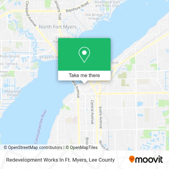
See Redevelopment Works In Ft. Myers, Fort Myers, on the map
Public Transit to Redevelopment Works In Ft. Myers in Fort Myers
Wondering how to get to Redevelopment Works In Ft. Myers in Fort Myers? Moovit helps you find the best way to get to Redevelopment Works In Ft. Myers with step-by-step directions from the nearest public transit station.
Moovit provides free maps and live directions to help you navigate through your city. View schedules, routes, timetables, and find out how long does it take to get to Redevelopment Works In Ft. Myers in real time.
Looking for the nearest stop or station to Redevelopment Works In Ft. Myers? Check out this list of stops closest to your destination: Monroe St @ Second St; Caloosa Sound Conv. Center - Harborside-Eb; Fowler St @ Second St.
Bus: 140, 70, 20, 100.
Want to see if there’s another route that gets you there at an earlier time? Moovit helps you find alternative routes or times. Get directions from and directions to Redevelopment Works In Ft. Myers easily from the Moovit App or Website.
We make riding to Redevelopment Works In Ft. Myers easy, which is why over 1.5 million users, including users in Fort Myers, trust Moovit as the best app for public transit. You don’t need to download an individual bus app or train app, Moovit is your all-in-one transit app that helps you find the best bus time or train time available.
For information on prices of bus, costs and ride fares to Redevelopment Works In Ft. Myers, please check the Moovit app.
Use the app to navigate to popular places including to the airport, hospital, stadium, grocery store, mall, coffee shop, school, college, and university.
Redevelopment Works In Ft. Myers Address: 1400 Jackson St street in Fort Myers
- Kynse Agles-RE/MAX Dream,
- US Artfest Fort Myers, Inc.,
- Gir Property Claims,
- Social Security,
- Mummert Law, PA,
- Gallery for Artists,
- Gir Medical Claims Fort Myers,
- Hollander & Hanuka Attorneys at Law,
- Edison Festival of Light,
- Shingle Roofing Tile Roofing,
- Deboest Stockman Decker Hagan Cheffer & Webb-Martin P.A.,
- FedEx,
- Bill Smith,
- The Irving Downtown,
- Hall Of 50 States,
- River District,
- Soho Downtown Fort Myers,
- Fort Myers Oktoberfest Festival,
- Prima Luce,
- Coleman Thomas G
Places Near Redevelopment Works In Ft. Myers (Fort Myers)
- Matlacha Nude Beach, Matlacha Isles-Matlacha Shores,
- Lee County Tax Collector, Cape Coral,
- Bonita Beach, Bonita Springs,
- Lehigh Acres, FL, Lehigh Acres,
- Rosa Parks Transportation Center, Fort Myers,
- I-75 & Colonial (Exit 136), Fort Myers,
- Bonita Bay Private Beach Club, Bonita Springs,
- Amazon Warehouse Rsw5,
- Pelican Landing Beach Shuttle, Bonita Springs,
- Miromar Outlets, Estero,
- Flixbus, Fort Myers,
- Walmart Supercenter, Fort Myers,
- Seminole Casino Hotel Immokalee,
- US-41, Fort Myers,
- Ft Myers Airport RSW,
- Bonita Springs, FL, Bonita Springs,
- U.S.-41 / Colonial Blvd. Intersection, Fort Myers,
- Edison Mall, Fort Myers,
- I-75 & MLK (Exit 138), Fort Myers,
- All About U Naples Escorts, Pine Ridge
How to get to popular places in Lee County with public transit
Get around Fort Myers by public transit!
Traveling around Fort Myers has never been so easy. See step by step directions as you travel to any attraction, street or major public transit station. View bus and train schedules, arrival times, service alerts and detailed routes on a map, so you know exactly how to get to anywhere in Fort Myers.
When traveling to any destination around Fort Myers use Moovit's Live Directions with Get Off Notifications to know exactly where and how far to walk, how long to wait for your line, and how many stops are left. Moovit will alert you when it's time to get off — no need to constantly re-check whether yours is the next stop.
Wondering how to use public transit in Fort Myers or how to pay for public transit in Fort Myers? Moovit public transit app can help you navigate your way with public transit easily, and at minimum cost. It includes public transit fees, ticket prices, and costs. Looking for a map of Fort Myers public transit lines? Moovit public transit app shows all public transit maps in Fort Myers with all bus routes and stops on an interactive map.
Lee County has 1 transit type(s), including: bus, operated by several transit agencies, including LeeTran, CAT and FlixBus-us