Directions to Reed Hall (Baltimore) with public transportation
The following transit lines have routes that pass near Reed Hall
 Bus: 120, 56, CITYLINK BROWN, CITYLINK LIME, CITYLINK PINK.
- Metro: METRO.
- Ferry: HC3.
How to get to Reed Hall by bus?
Click on the bus route to see step by step directions with maps, line arrival times and updated time schedules.
From Medstar Harbor Hospital, Baltimore
37 minFrom Pimlico Race Course, Baltimore
63 minFrom MVA Glen Burnie, Anne Arundel County
56 minFrom Mondawmin Mall, Baltimore
36 minFrom Walmart Supercenter, Baltimore County
49 minFrom Franklin Square Dr (franklin hospital), Baltimore County
37 minFrom Medstar Franklin Square Medical Center, Baltimore County
35 minFrom Reisterstown Road Plaza, Baltimore
55 minFrom University Of Maryland Baltimore (Umbc), Baltimore County
50 minFrom Baltimore Poly Tech High School, Baltimore
53 min
How to get to Reed Hall by metro?
Click on the metro route to see step by step directions with maps, line arrival times and updated time schedules.
Bus stops near Reed Hall in Baltimore
Metro station near Reed Hall in Baltimore
- Johns Hopkins Metro, 2 min walk,VIEW
Ferry station near Reed Hall in Baltimore
- Pier Five, 31 min walk,VIEW
Bus lines to Reed Hall in Baltimore
- GREEN ROUTE, Gay St. (Wb),VIEW
- CITYLINK BROWN, Dunbar Broadway,VIEW
- CITYLINK PINK, Cedonia - West Baltimore Marc,VIEW
- 56, Downtown - White Marsh,VIEW
- 105, Cedonia - Downtown,VIEW
- 115, Downtown - Perry Hall,VIEW
- 120, White Marsh - Downtown/hopkins,VIEW
- 411, 411/1 Hopkins Hospital,VIEW
- 420, 420/3 Johns Hopkins,VIEW
- CITYLINK LIME, Harbor East,VIEW
What are the closest stations to Reed Hall?
The closest stations to Reed Hall are:
- Johns Hopkins Sb (Wb) is 81 yards away, 2 min walk.
- N Broadway Sb & Monument Stns is 95 yards away, 2 min walk.
- Johns Hopkins Metro is 105 yards away, 2 min walk.
- Monument St & Broadway Eb is 112 yards away, 3 min walk.
- Monument St & Rutland Ave Eb is 281 yards away, 5 min walk.
- Caroline St & Monument St FS Nb is 301 yards away, 5 min walk.
- Pier Five is 2515 yards away, 31 min walk.
Which bus lines stop near Reed Hall?
These bus lines stop near Reed Hall: 120, 56, CITYLINK BROWN, CITYLINK LIME, CITYLINK PINK.
Which metro line stops near Reed Hall?
METRO (Towards John Hopkins)
What’s the nearest metro station to Reed Hall in Baltimore?
The nearest metro station to Reed Hall in Baltimore is Johns Hopkins Metro. It’s a 2 min walk away.
What’s the nearest bus station to Reed Hall in Baltimore?
The nearest bus stations to Reed Hall in Baltimore are Johns Hopkins Sb (Wb) and N Broadway Sb & Monument Stns. The closest one is a 2 min walk away.
What time is the first metro to Reed Hall in Baltimore?
The METRO is the first metro that goes to Reed Hall in Baltimore. It stops nearby at 4:21 AM.
What time is the last metro to Reed Hall in Baltimore?
The METRO is the last metro that goes to Reed Hall in Baltimore. It stops nearby at 12:29 AM.
What time is the first bus to Reed Hall in Baltimore?
The CITYLINK PINK is the first bus that goes to Reed Hall in Baltimore. It stops nearby at 3:02 AM.
What time is the last bus to Reed Hall in Baltimore?
The CITYLINK PINK is the last bus that goes to Reed Hall in Baltimore. It stops nearby at 3:03 AM.
What time is the first ferry to Reed Hall in Baltimore?
The HC3 is the first ferry that goes to Reed Hall in Baltimore. It stops nearby at 6:00 AM.
What time is the last ferry to Reed Hall in Baltimore?
The HC3 is the last ferry that goes to Reed Hall in Baltimore. It stops nearby at 8:07 PM.
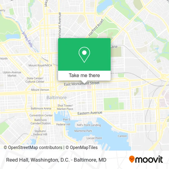
See Reed Hall, Baltimore, on the map
Public Transit to Reed Hall in Baltimore
Wondering how to get to Reed Hall in Baltimore? Moovit helps you find the best way to get to Reed Hall with step-by-step directions from the nearest public transit station.
Moovit provides free maps and live directions to help you navigate through your city. View schedules, routes, timetables, and find out how long does it take to get to Reed Hall in real time.
Looking for the nearest stop or station to Reed Hall? Check out this list of stops closest to your destination: Johns Hopkins Sb (Wb); N Broadway Sb & Monument Stns; Johns Hopkins Metro; Monument St & Broadway Eb; Monument St & Rutland Ave Eb; Caroline St & Monument St FS Nb; Pier Five.
Bus: 120, 56, CITYLINK BROWN, CITYLINK LIME, CITYLINK PINK, GREEN ROUTE, 105, 115, 411, 420.Metro: METRO.Ferry: HC3.
Want to see if there’s another route that gets you there at an earlier time? Moovit helps you find alternative routes or times. Get directions from and directions to Reed Hall easily from the Moovit App or Website.
We make riding to Reed Hall easy, which is why over 1.5 million users, including users in Baltimore, trust Moovit as the best app for public transit. You don’t need to download an individual bus app or train app, Moovit is your all-in-one transit app that helps you find the best bus time or train time available.
For information on prices of bus, metro and light rail, costs and ride fares to Reed Hall, please check the Moovit app.
Use the app to navigate to popular places including to the airport, hospital, stadium, grocery store, mall, coffee shop, school, college, and university.
Reed Hall Address: North Broadway street in Baltimore
- Dr. Babar Shafiq,
- Martin Makary, MD,
- Charm City Circulator Green Route - Johns Hopkins - #102,
- Broadway & Monument,
- Broadway & Monument St NB,
- Johns Hopkins Hospital Station,
- Johns Hopkins Hospital Marburg Pavilion,
- Marburg – Brady Urological Institute,
- The Johns Hopkins Hospital,
- 550 Building,
- Kennedy Krieger Institute,
- Johns Hopkins Parking,
- Maria del Carmen Lopez-Arvizu,
- Wilmer Eye Institute,
- Johns Hopkins Outpatient Center,
- Dunbar-Broadway,
- W3ft 146.67 Repeater Receiver,
- David S Cooper MD,
- Weinberg Outpatient Pharmacy,
- Johns Hopkins Hospital Farmers Market
Places Near Reed Hall (Baltimore)
- Georgetown, Washington,
- Basilica of the National Shrine, Washington,
- Capital One Arena, Washington,
- Marriott Marquis Washington, DC, Washington,
- Rock Creek Tennis Center, Washington,
- The Anthem, Washington,
- Washington DC VA Medical Center, Washington,
- Sibley Memorial Hospital, Washington,
- PG Mall, Prince George's County,
- Pennsylvania Ave NW (3rd st and pennsylvania), Washington,
- Museum Of The Bible, Washington,
- Amazon Hq2, Arlington County,
- Warner Theatre, Washington,
- National Museum of African American History and Culture, Washington,
- Westfield Montgomery Mall, Montgomery County,
- M&T Bank Stadium, Baltimore,
- National Zoo, Washington,
- Camden Yards, Baltimore,
- Washington National Cathedral, Washington,
- National Mall, Washington
How to get to popular places in Washington, D.C. - Baltimore, MD with public transit
Get around Baltimore by public transit!
Traveling around Baltimore has never been so easy. See step by step directions as you travel to any attraction, street or major public transit station. View bus and train schedules, arrival times, service alerts and detailed routes on a map, so you know exactly how to get to anywhere in Baltimore.
When traveling to any destination around Baltimore use Moovit's Live Directions with Get Off Notifications to know exactly where and how far to walk, how long to wait for your line, and how many stops are left. Moovit will alert you when it's time to get off — no need to constantly re-check whether yours is the next stop.
Wondering how to use public transit in Baltimore or how to pay for public transit in Baltimore? Moovit public transit app can help you navigate your way with public transit easily, and at minimum cost. It includes public transit fees, ticket prices, and costs. Looking for a map of Baltimore public transit lines? Moovit public transit app shows all public transit maps in Baltimore with all Bus, Train, Metro, Light Rail and Ferry routes and stops on an interactive map.
Washington, D.C. - Baltimore, MD has 5 transit type(s), including: Bus, Train, Metro, Light Rail and Ferry, operated by several transit agencies, including WMATA, Montgomery County Ride On, Fairfax Connector, TheBus, PRTC, DASH - Alexandria, Arlington Transit (ART), RTA of Central Maryland, MDOT MTA, MDOT MTA Light RailLink, MDOT MTA Commuter Bus, MDOT MTA Local Bus, FXBGO!, Virginia Railway Express (VRE) and MARC