How to get to Reel N Hook Charters by bus?
Click on the bus route to see step by step directions with maps, line arrival times and updated time schedules.
From Cinnamon Cove, Iona
77 minFrom Gulf Coast Office, Cape Coral
91 minFrom Billy Bobs Car Wash, Cape Coral
89 minFrom McGinnis Educational Services, Cypress Lake
27 minFrom LSH Group, Cypress Lake
29 minFrom Sun Splash Family Waterpark, Cape Coral
89 minFrom Samutech, Cape Coral
22 minFrom Cape Coral Surgery Center, Cape Coral
85 minFrom Massiel Alfonso-Folden, Cypress Lake
31 minFrom Eclectic Fort Myers Band, Cypress Lake
26 min
Bus stop near Reel N Hook Charters in Cape Coral
- Cape Coral Library -Wb, 3 min walk,VIEW
What are the closest stations to Reel N Hook Charters?
The closest stations to Reel N Hook Charters are:
- Cape Coral Library -Wb is 152 yards away, 3 min walk.
Which bus line stops near Reel N Hook Charters?
30 (South Fort Myers Transfer/P&R→Camelot Isles - SW 49th Ter @ SW 16th Pl)
What’s the nearest bus station to Reel N Hook Charters in Cape Coral?
The nearest bus station to Reel N Hook Charters in Cape Coral is Cape Coral Library -Wb. It’s a 3 min walk away.
What time is the first bus to Reel N Hook Charters in Cape Coral?
The 30 is the first bus that goes to Reel N Hook Charters in Cape Coral. It stops nearby at 7:14 AM.
What time is the last bus to Reel N Hook Charters in Cape Coral?
The 30 is the last bus that goes to Reel N Hook Charters in Cape Coral. It stops nearby at 8:48 PM.
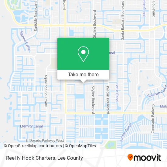
See Reel N Hook Charters, Cape Coral, on the map
Public Transit to Reel N Hook Charters in Cape Coral
Wondering how to get to Reel N Hook Charters in Cape Coral? Moovit helps you find the best way to get to Reel N Hook Charters with step-by-step directions from the nearest public transit station.
Moovit provides free maps and live directions to help you navigate through your city. View schedules, routes, timetables, and find out how long does it take to get to Reel N Hook Charters in real time.
Looking for the nearest stop or station to Reel N Hook Charters? Check out this list of stops closest to your destination: Cape Coral Library -Wb.
Bus: 30, 120.
Want to see if there’s another route that gets you there at an earlier time? Moovit helps you find alternative routes or times. Get directions from and directions to Reel N Hook Charters easily from the Moovit App or Website.
We make riding to Reel N Hook Charters easy, which is why over 1.5 million users, including users in Cape Coral, trust Moovit as the best app for public transit. You don’t need to download an individual bus app or train app, Moovit is your all-in-one transit app that helps you find the best bus time or train time available.
For information on prices of bus, costs and ride fares to Reel N Hook Charters, please check the Moovit app.
Use the app to navigate to popular places including to the airport, hospital, stadium, grocery store, mall, coffee shop, school, college, and university.
Reel N Hook Charters Address: 1012 Mohawk Pkwy Cape Coral, FL 33914 street in Cape Coral
- Cape Coral Public Library,
- United American,
- Re/Max Realty Group,
- Pawlik Marketing,
- American Garage Door,
- Minute Key,
- Vending Extreme,
- Latin Shack,
- SW 39th St,
- Donanthony's Pizza (Detroit Pizza Joint),
- Long Island Brothers Pizza,
- Choices in Living Adult Day Care,
- Shaklee Distributor,
- FLL Private Transportation,
- Palmira Golf and Country Club,
- Splinters Custom Woodworking,
- Laura Gotlin Wholistic Wellness,
- Gumption,
- Gce Services,
- Royal Palm Plumbing
Places Near Reel N Hook Charters (Cape Coral)
- Matlacha Nude Beach, Matlacha Isles-Matlacha Shores,
- Flixbus, Fort Myers,
- I-75 & MLK (Exit 138), Fort Myers,
- Lehigh Acres, FL, Lehigh Acres,
- Amazon Warehouse Rsw5,
- All About U Naples Escorts, Pine Ridge,
- I-75 & Colonial (Exit 136), Fort Myers,
- Bonita Beach, Bonita Springs,
- Walmart Supercenter, Fort Myers,
- U.S.-41 / Colonial Blvd. Intersection, Fort Myers,
- Bonita Springs, FL, Bonita Springs,
- Lee County Tax Collector, Cape Coral,
- Edison Mall, Fort Myers,
- Ft Myers Airport RSW,
- Rosa Parks Transportation Center, Fort Myers,
- Seminole Casino Hotel Immokalee,
- Pelican Landing Beach Shuttle, Bonita Springs,
- Bonita Bay Private Beach Club, Bonita Springs,
- Miromar Outlets, Estero,
- US-41, Fort Myers
How to get to popular places in Lee County with public transit
Get around Cape Coral by public transit!
Traveling around Cape Coral has never been so easy. See step by step directions as you travel to any attraction, street or major public transit station. View bus and train schedules, arrival times, service alerts and detailed routes on a map, so you know exactly how to get to anywhere in Cape Coral.
When traveling to any destination around Cape Coral use Moovit's Live Directions with Get Off Notifications to know exactly where and how far to walk, how long to wait for your line, and how many stops are left. Moovit will alert you when it's time to get off — no need to constantly re-check whether yours is the next stop.
Wondering how to use public transit in Cape Coral or how to pay for public transit in Cape Coral? Moovit public transit app can help you navigate your way with public transit easily, and at minimum cost. It includes public transit fees, ticket prices, and costs. Looking for a map of Cape Coral public transit lines? Moovit public transit app shows all public transit maps in Cape Coral with all bus routes and stops on an interactive map.
Lee County has 1 transit type(s), including: bus, operated by several transit agencies, including LeeTran, CAT and FlixBus-us