Directions to Reflexi Window Covering (Kendale Lakes-Tamiami) with public transportation
The following transit lines have routes that pass near Reflexi Window Covering
 Bus: HIAMAR.
How to get to Reflexi Window Covering by bus?
Click on the bus route to see step by step directions with maps, line arrival times and updated time schedules.
From HIALEAH FLAMINGO NORTH ROUTE, North Westside
80 minFrom Le Jeune Rd / E 49th St, Hialeah
83 minFrom Miami Lakes Educational Center, Hialeah
98 minFrom Miami - Dade County Turner Guilford Knight Correctional Center, North Westside
91 minFrom Walmart Supercenter, Hialeah
39 minFrom La Quinta Inn & Suites by Wyndham Miami Airport West, North Westside
63 minFrom MDT Metrorail - Hialeah Station, Hialeah
83 minFrom IKEA Miami, North Westside
82 minFrom Turnpike Exit @ Doral Blvd. (NW 41 Street), North Westside
99 minFrom Ada M Barreto P A, North Westside
65 min
Bus stop near Reflexi Window Covering in Kendale Lakes-Tamiami
- Nw 107 Av@#13090, 16 min walk,VIEW
Bus lines to Reflexi Window Covering in Kendale Lakes-Tamiami
- HIAMAR, City Of Hialeah Transit (Marlin),VIEW
What are the closest stations to Reflexi Window Covering?
The closest stations to Reflexi Window Covering are:
- Nw 107 Av@#13090 is 1301 yards away, 16 min walk.
Which bus line stops near Reflexi Window Covering?
HIAMAR (City Of Hialeah Transit (Marlin))
What time is the first bus to Reflexi Window Covering in Kendale Lakes-Tamiami?
The HIAMAR is the first bus that goes to Reflexi Window Covering in Kendale Lakes-Tamiami. It stops nearby at 6:13 AM.
What time is the last bus to Reflexi Window Covering in Kendale Lakes-Tamiami?
The HIAMAR is the last bus that goes to Reflexi Window Covering in Kendale Lakes-Tamiami. It stops nearby at 8:41 PM.
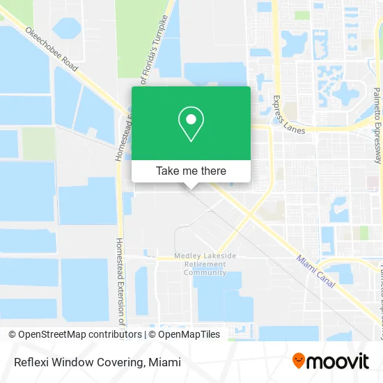
See Reflexi Window Covering, Kendale Lakes-Tamiami, on the map
Public Transit to Reflexi Window Covering in Kendale Lakes-Tamiami
Wondering how to get to Reflexi Window Covering in Kendale Lakes-Tamiami? Moovit helps you find the best way to get to Reflexi Window Covering with step-by-step directions from the nearest public transit station.
Moovit provides free maps and live directions to help you navigate through your city. View schedules, routes, timetables, and find out how long does it take to get to Reflexi Window Covering in real time.
Looking for the nearest stop or station to Reflexi Window Covering? Check out this list of stops closest to your destination: Nw 107 Av@#13090.
Bus: HIAMAR.
Want to see if there’s another route that gets you there at an earlier time? Moovit helps you find alternative routes or times. Get directions from and directions to Reflexi Window Covering easily from the Moovit App or Website.
We make riding to Reflexi Window Covering easy, which is why over 1.5 million users, including users in Kendale Lakes-Tamiami, trust Moovit as the best app for public transit. You don’t need to download an individual bus app or train app, Moovit is your all-in-one transit app that helps you find the best bus time or train time available.
For information on prices of bus and train, costs and ride fares to Reflexi Window Covering, please check the Moovit app.
Use the app to navigate to popular places including to the airport, hospital, stadium, grocery store, mall, coffee shop, school, college, and university.
Reflexi Window Covering Address: NW 122nd St Medley, FL 33178 street in Kendale Lakes-Tamiami
- Fox Solutions,
- KW Power Systems,
- Herco Freight Forwarders,
- Kitchens Studio,
- MDT Technologies Inc,
- Miami Warehouse Equipment,
- Seamar Divers,
- Maverick United Elevator,
- Alex Truck Tire,
- BFD Florida Group,
- Acceptance Now,
- Flat Rate Copiers,
- Complex Rehab Solutions LLC,
- Tu Envio Express,
- 66twelve,
- Exclusive Windows and Doors,
- Kitchens Studio (Metal and Wood Studio),
- Master Tech Gate Operators and Fence,
- Iron Sights Firearms,
- Interglobal Insurance Company
Places Near Reflexi Window Covering (Kendale Lakes-Tamiami)
- Port of Miami Cruise Terminal, Miami,
- Sawgrass Mall, Miami,
- Marlins Park, Miami,
- Miami Design District, Miami,
- Miami Freedom Park, Miami,
- Keiser University Flagship Campus, West Palm Beach,
- Zoo Miami, Miami,
- Dolphin Mall Bus, Miami,
- Wynwood, Miami,
- Dolphin Mall, Miami,
- Sawgrass mall ( FL ), Miami Beach,
- Brickell City Centre, Miami,
- Bayside Marketplace, Miami,
- Miami VA Hospital, Miami,
- Aventura Mall, Miami,
- Richard E. Gerstein Justice Building, Miami,
- Miami-Dade County Courthouse, Miami,
- Hard Rock Stadium, Miami Gardens,
- Little Havana, Miami,
- Aventura Mall, Miami Beach
How to get to popular places in Miami with public transit
Get around Kendale Lakes-Tamiami by public transit!
Traveling around Kendale Lakes-Tamiami has never been so easy. See step by step directions as you travel to any attraction, street or major public transit station. View bus and train schedules, arrival times, service alerts and detailed routes on a map, so you know exactly how to get to anywhere in Kendale Lakes-Tamiami.
When traveling to any destination around Kendale Lakes-Tamiami use Moovit's Live Directions with Get Off Notifications to know exactly where and how far to walk, how long to wait for your line, and how many stops are left. Moovit will alert you when it's time to get off — no need to constantly re-check whether yours is the next stop.
Wondering how to use public transit in Kendale Lakes-Tamiami or how to pay for public transit in Kendale Lakes-Tamiami? Moovit public transit app can help you navigate your way with public transit easily, and at minimum cost. It includes public transit fees, ticket prices, and costs. Looking for a map of Kendale Lakes-Tamiami public transit lines? Moovit public transit app shows all public transit maps in Kendale Lakes-Tamiami with all Bus, Train, Light Rail and Ferry routes and stops on an interactive map.
Miami has 4 transit type(s), including: Bus, Train, Light Rail and Ferry, operated by several transit agencies, including Broward County Transit, Miami-Dade Transit, Metrorail, Palm Tran, Tri-Rail, Brightline, MARTY, City of Homestead Trolley, Key West Transit, Treasure Coast Connector, GoLine IRT, Amtrak, Greyhound-us, FlixBus-us and Aventura Express Shuttle Bus