How to get to Piedmont Region by bus?
Click on the bus route to see step by step directions with maps, line arrival times and updated time schedules.
From Natalia Ginzburg Street 7/9, Ivrea
118 minFrom Sirio Lake, Ivrea
185 minFrom Viverone Lake, Viverone
110 minFrom Via Castiglia 27, Ivrea
122 minFrom Ivrea Hospital, Ivrea
113 minFrom Eporediese Clinic, Ivrea
123 minFrom Ivrea Civil Hospital, Ivrea
112 minFrom Stocazzo, Ivrea
122 minFrom Sirio Lake, Ivrea
197 min
Bus stops near Piedmont Region in Turin
Bus lines to Piedmont Region in Turin
- 331, 331 - Donato - Graglia - Biella,VIEW
- 332, 332 - Biella - Vaglio,VIEW
- 381, 381 - Ivrea - Mongrando,VIEW
- 599, 599 - School Circuits,VIEW
- 900, 900 - Urban Loop,VIEW
- 310, Valdengo - Town Hall,VIEW
- 321, Biella - San Paolo Railway Station - Movicentro,VIEW
- 549, Verrone - Lancia,VIEW
- 350, Sordevolo - Via Devalle Bona - Bus Shelter,VIEW
- 370, Biella - San Paolo Railway Station - Movicentro,VIEW
- 382, Candelo - IV November,VIEW
- 360, Biella Favaro - Caves - Terminus,VIEW
- 040, Vercelli - Biella,VIEW
- 300, 300 - Biella - Cossato - Vallemosso - Trivero,VIEW
- 322, 322 - Chiavazza - Ronco - Ternengo,VIEW
- 333, 333 - Vaglio - Pettinengo - Vallemosso,VIEW
- 340, 340 - Biella - Tollegno - Tavigliano - Piedicavallo,VIEW
- 390, 390 - Biella - Cavaglia - Viverone,VIEW
- 500, 500 - Biella - Verrone - Villanova - Carisio - Milano Molino Dorino,VIEW
- 551, 551 - Biella - Varallo,VIEW
What are the closest stations to Piedmont Region?
The closest stations to Piedmont Region are:
- Biella - Science High School is 56 meters away, 1 min walk.
- Biella - Classical High School is 382 meters away, 5 min walk.
- Biella - San Biagio - Itis is 490 meters away, 7 min walk.
- Biella - Ivrea Street - Technical Institute is 547 meters away, 8 min walk.
- Biella - Lamarmora Square is 657 meters away, 9 min walk.
- Biella - Piazza Vittorio Veneto - Porticos is 948 meters away, 13 min walk.
Which bus lines stop near Piedmont Region?
These bus lines stop near Piedmont Region: 360, 382, 549.
What’s the nearest bus station to Piedmont Region in Turin?
The nearest bus station to Piedmont Region in Turin is Biella - Science High School. It’s a 1 min walk away.
What time is the first bus to Piedmont Region in Turin?
The 300 is the first bus that goes to Piedmont Region in Turin. It stops nearby at 4:55 AM.
What time is the last bus to Piedmont Region in Turin?
The 549 is the last bus that goes to Piedmont Region in Turin. It stops nearby at 10:58 PM.
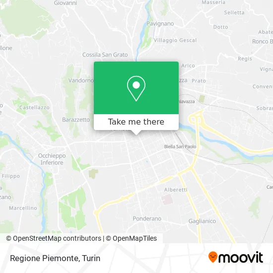
See Piedmont Region, Turin, on the map
Public Transit to Piedmont Region in Turin
Wondering how to get to Piedmont Region in Turin? Moovit helps you find the best way to get to Piedmont Region with step-by-step directions from the nearest public transit station.
Moovit provides free maps and live directions to help you navigate through your city. View schedules, routes, timetables, and find out how long does it take to get to Piedmont Region in real time.
Looking for the nearest stop or station to Piedmont Region? Check out this list of stops closest to your destination: Biella - Science High School; Biella - Classical High School; Biella - San Biagio - Itis; Biella - Ivrea Street - Technical Institute; Biella - Lamarmora Square; Biella - Piazza Vittorio Veneto - Porticos.
Bus: 360, 382, 549, 331, 332, 381, 599, 900, 310, 321, 350, 370, 040, 300, 322, 333, 340.
Want to see if there’s another route that gets you there at an earlier time? Moovit helps you find alternative routes or times. Get directions from and directions to Piedmont Region easily from the Moovit App or Website.
We make riding to Piedmont Region easy, which is why over 1.5 million users, including users in Turin, trust Moovit as the best app for public transit. You don’t need to download an individual bus app or train app, Moovit is your all-in-one transit app that helps you find the best bus time or train time available.
For information on prices of bus, costs and ride fares to Piedmont Region, please check the Moovit app.
Use the app to navigate to popular places including to the airport, hospital, stadium, grocery store, mall, coffee shop, school, college, and university.
Piedmont Region Address: Via Tripoli, 33 13900 Biella street in Turin
- Association of Volunteer Service Centers,
- Crema d'Italia Limited Liability Company,
- Social Consortium the Thread to Weave Social Cooperative Society,
- City of Coato,
- Poultry Shop,
- Sewing Workshop by Olaru Lenuta,
- Carisio Bakery by Gabriele Michela,
- Armonia,
- Rs,
- Roberta Hairstyling,
- CI in Biella,
- Giovanni Baltera by Gianfranco Baltera,
- The Little Esthetic,
- Mosca Real Estate by Roberto Mosca,
- Ceria Geom. Alessandro Technical Studio,
- Bertone / Giovanni,
- Charme Solarium Company by Boi Lorella,
- P.C. Software Solutions,
- United Students of Avogadro,
- Bossi Hairdressers Solarium
Places Near Piedmont Region (Turin)
- Porta Susa, Torino,
- CTO Hospital, Torino,
- Regina Margherita Children's Hospital, Torino,
- San Luigi Hospital, Orbassano,
- CDC Via Grazioli 11, Torino,
- Prarostino Street 10/A, Torino,
- Martini Hospital, Torino,
- Shopville Le Gru, Grugliasco,
- Molinette Hospital, Torino,
- Mauriziano Hospital, Torino,
- San Giovanni Bosco Hospital, Torino,
- Arturo Farinelli Street 25, Torino,
- Le Gru, Grugliasco,
- Castle Square, Torino,
- Pacchiotti Giacinto Street 4, Torino,
- Porta Palazzo, Torino,
- Cavour Street 31, Torino,
- Sant'Anna Hospital, Torino,
- New Gate, Torino,
- Koelliker Hospital, Torino
How to get to popular places in Turin with public transit
Get around Turin by public transit!
Traveling around Turin has never been so easy. See step by step directions as you travel to any attraction, street or major public transit station. View bus and train schedules, arrival times, service alerts and detailed routes on a map, so you know exactly how to get to anywhere in Turin.
When traveling to any destination around Turin use Moovit's Live Directions with Get Off Notifications to know exactly where and how far to walk, how long to wait for your line, and how many stops are left. Moovit will alert you when it's time to get off — no need to constantly re-check whether yours is the next stop.
Wondering how to use public transit in Turin or how to pay for public transit in Turin? Moovit public transit app can help you navigate your way with public transit easily, and at minimum cost. It includes public transit fees, ticket prices, and costs. Looking for a map of Turin public transit lines? Moovit public transit app shows all public transit maps in Turin with all Bus, Train, Metro, Light Rail, Funicular and Gondola routes and stops on an interactive map.
Turin has 6 transit type(s), including: Bus, Train, Metro, Light Rail, Funicular and Gondola, operated by several transit agencies, including GTT Urban Service, GTT Suburban Service, GTT Tourist Services, Trenitalia, Arenaways, Sadem, Cavourese, Grandabus Consortium, Bus Company - GrandaBus, Bus Company, Gelosobus, Nuova S.a.a.r., SAC, Giors Bus Lines and Allasia Bus Lines