How to get to Reha Point Offenburg by bus?
Click on the bus route to see step by step directions with maps, line arrival times and updated time schedules.
From Berghütte Lauterbad, Vereinbarte Verwaltungsgemeinschaft Freudenstadt
239 minFrom Panorama-Bad Freudenstadt, Vereinbarte Verwaltungsgemeinschaft Freudenstadt
227 minFrom Hotel Palmenwald, Vereinbarte Verwaltungsgemeinschaft Freudenstadt
233 minFrom Mercedes-Benz Werk Rastatt, Vereinbarte Verwaltungsgemeinschaft Rastatt
185 minFrom Klinik Hohenfreudenstadt, Vereinbarte Verwaltungsgemeinschaft Freudenstadt
212 minFrom Krankenhaus Freudenstadt, Vereinbarte Verwaltungsgemeinschaft Freudenstadt
229 minFrom Baden-Baden, Karlsruhe/Baden-Baden Airport, Rheinmünster
173 minFrom Grinde-Hütte, Seebach
164 minFrom Lotto-Annahmestelle, Vereinbarte Verwaltungsgemeinschaft Sinzheim
155 min
How to get to Reha Point Offenburg by train?
Click on the train route to see step by step directions with maps, line arrival times and updated time schedules.
From Panorama-Bad Freudenstadt, Vereinbarte Verwaltungsgemeinschaft Freudenstadt
129 minFrom Hotel Palmenwald, Vereinbarte Verwaltungsgemeinschaft Freudenstadt
107 minFrom Höhenhotel Pfeifle, Baiersbronn
116 minFrom Klinik Hohenfreudenstadt, Vereinbarte Verwaltungsgemeinschaft Freudenstadt
142 minFrom Krankenhaus Freudenstadt, Vereinbarte Verwaltungsgemeinschaft Freudenstadt
136 minFrom Lotto-Annahmestelle, Vereinbarte Verwaltungsgemeinschaft Sinzheim
76 min
Bus stops near Reha Point Offenburg in Verwaltungsgemeinschaft Offenburg
Train stations near Reha Point Offenburg in Verwaltungsgemeinschaft Offenburg
Bus lines to Reha Point Offenburg in Verwaltungsgemeinschaft Offenburg
- 7144, Kehl Rathaus,VIEW
- S3, Waltersweier Gewerbegebiet,VIEW
- S4, Offenburg Bahnhof / Zob,VIEW
- 7136, Offenburg Kreisschulzentrum (Bus),VIEW
- 7146, Kehl Rathaus,VIEW
- 7156, Urloffen Im Fritschengärtel,VIEW
- 301, Kehl Rathaus Bstg 2 - Kittersburg Süd,VIEW
- 7141, Lahr Schlüssel Bstg 1 - Offenburg Bahnhof / ZOB,VIEW
- R2, Altenheim Lindengasse - Offenburg Bahnhof / ZOB Bstg 2,VIEW
- R9, Höfen Binzburgstraße - Offenburg Bahnhof / ZOB Bstg 4,VIEW
- S10, Offenburg Bahnhof / ZOB Bstg 2 - Offenburg Hochschule,VIEW
- S6, Diersburg Rathaus - Offenburg Bahnhof / ZOB Bstg 2,VIEW
- S8, Zunsweier Wendeplatz - Offenburg Bahnhof / ZOB Bstg 7,VIEW
- S9, Zell-Weierbach Am Sahlesbach - Offenburg Schulztr. Nord,VIEW
- S1, Offenburg Altenburger Allee,VIEW
- 7134, Gengenbach Rathaus,VIEW
- 7160, Haslach,VIEW
- S2, Offenburg Bahnhof / Zob,VIEW
- S7, Offenburg Auferstehungskirche,VIEW
- 7135, Urloffen Straßburger Straße,VIEW
What are the closest stations to Reha Point Offenburg?
The closest stations to Reha Point Offenburg are:
- Offenburg Im Seewinkel is 341 meters away, 5 min walk.
- Offenburg Straßburger Straße is 397 meters away, 6 min walk.
- Offenburg Schulztr. Nord is 811 meters away, 11 min walk.
- Offenburg Marlener Straße is 887 meters away, 12 min walk.
- Offenburg Stadtkirche is 1168 meters away, 16 min walk.
- Offenburg is 2647 meters away, 35 min walk.
- Offenburg Bahnhof is 2647 meters away, 35 min walk.
Which train lines stop near Reha Point Offenburg?
These train lines stop near Reha Point Offenburg: RE 2, RS 1.
Which bus lines stop near Reha Point Offenburg?
These bus lines stop near Reha Point Offenburg: 7135, 7160.
What’s the nearest bus station to Reha Point Offenburg in Verwaltungsgemeinschaft Offenburg?
The nearest bus station to Reha Point Offenburg in Verwaltungsgemeinschaft Offenburg is Offenburg Im Seewinkel. It’s a 5 min walk away.
What time is the first train to Reha Point Offenburg in Verwaltungsgemeinschaft Offenburg?
The RS2 is the first train that goes to Reha Point Offenburg in Verwaltungsgemeinschaft Offenburg. It stops nearby at 4:03 AM.
What time is the last train to Reha Point Offenburg in Verwaltungsgemeinschaft Offenburg?
The 20N is the last train that goes to Reha Point Offenburg in Verwaltungsgemeinschaft Offenburg. It stops nearby at 6:42 AM.
What time is the first bus to Reha Point Offenburg in Verwaltungsgemeinschaft Offenburg?
The 7141 is the first bus that goes to Reha Point Offenburg in Verwaltungsgemeinschaft Offenburg. It stops nearby at 4:31 AM.
What time is the last bus to Reha Point Offenburg in Verwaltungsgemeinschaft Offenburg?
The 7141 is the last bus that goes to Reha Point Offenburg in Verwaltungsgemeinschaft Offenburg. It stops nearby at 11:59 PM.
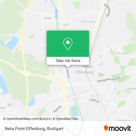
See Reha Point Offenburg, Verwaltungsgemeinschaft Offenburg, on the map
Public Transit to Reha Point Offenburg in Verwaltungsgemeinschaft Offenburg
Wondering how to get to Reha Point Offenburg in Verwaltungsgemeinschaft Offenburg? Moovit helps you find the best way to get to Reha Point Offenburg with step-by-step directions from the nearest public transit station.
Moovit provides free maps and live directions to help you navigate through your city. View schedules, routes, timetables, and find out how long does it take to get to Reha Point Offenburg in real time.
Looking for the nearest stop or station to Reha Point Offenburg? Check out this list of stops closest to your destination: Offenburg Im Seewinkel; Offenburg Straßburger Straße; Offenburg Schulztr. Nord; Offenburg Marlener Straße; Offenburg Stadtkirche; Offenburg; Offenburg Bahnhof.
Train: RE 2, RS 1, RS 2, RS 3, RS 4, TGD, RS1, RE2, RS2, RS3.Bus: 7135, 7160, 7144, S3, S4, 7136, 7146, 7156, 301, 7141, R2, R9, S10, S1.
Want to see if there’s another route that gets you there at an earlier time? Moovit helps you find alternative routes or times. Get directions from and directions to Reha Point Offenburg easily from the Moovit App or Website.
We make riding to Reha Point Offenburg easy, which is why over 1.5 million users, including users in Verwaltungsgemeinschaft Offenburg, trust Moovit as the best app for public transit. You don’t need to download an individual bus app or train app, Moovit is your all-in-one transit app that helps you find the best bus time or train time available.
For information on prices of bus and train, costs and ride fares to Reha Point Offenburg, please check the Moovit app.
Use the app to navigate to popular places including to the airport, hospital, stadium, grocery store, mall, coffee shop, school, college, and university.
Reha Point Offenburg Address: Kinzigstraße 6 77652 Offenburg street in Verwaltungsgemeinschaft Offenburg
- Reifen Dinser,
- Etsv Tennishalle,
- Ruf Küchen,
- Fitness Park Offenburg,
- Roland Stadelbacher,
- King's Palace Offenburg,
- Fitpur,
- Getränkemarkt Graf,
- Bernd Sikora,
- Sport-Physio Offenburg,
- BS Immo,
- Alfred Linck Automobile GmbH,
- Al Verwaltung 2,
- Falch Finance Invest,
- Stein Invest,
- Autohaus Linck GmbH,
- Lauftreff Offenburg,
- Tennishalle Offenburg,
- Esv,
- Leichtathletik-Offenburg
Places Near Reha Point Offenburg (Verwaltungsgemeinschaft Offenburg)
- Wilhelma (U-Bahn Wilhelma), Bad Cannstatt,
- FlixBus Haltestelle, Stuttgart,
- Porsche Museum, Zuffenhausen,
- Gleis 101/102 (tief), Stuttgart-Mitte,
- Mercedes-Benz Museum, Bad Cannstatt,
- SI-Centrum, Möhringen,
- Gasometer Pforzheim, Pforzheim,
- Hanns-Martin-Schleyer-Halle, Bad Cannstatt,
- Im Wizemann (Halle), Bad Cannstatt,
- Waldfriedhof, Degerloch,
- Geilhaus Haus 33a, Reutlingen-Betzingen,
- Mercedes-Benz Museum (Mercedes Museum Stuttgart), Bad Cannstatt,
- Schleyerhalle, Bad Cannstatt,
- Marmorsaal Im Weissenburgpark, Stuttgart-Süd,
- Mettingen Eros-Center Puff Laufhaus, Esslingen Am Neckar,
- Hanns-Martin-Schleyer-Halle (Stuttgart Hans-Martin-Schleyerhalle), Bad Cannstatt,
- Klinikum Stuttgart - Katharinenhospital, Stuttgart-Mitte,
- Porsche-Arena, Bad Cannstatt,
- Hauptbahnhof Stuttgart, Stuttgart-Mitte,
- Pariser Platz Stuttgart, Stuttgart-Mitte
How to get to popular places in Stuttgart with public transit
Get around Verwaltungsgemeinschaft Offenburg by public transit!
Traveling around Verwaltungsgemeinschaft Offenburg has never been so easy. See step by step directions as you travel to any attraction, street or major public transit station. View bus and train schedules, arrival times, service alerts and detailed routes on a map, so you know exactly how to get to anywhere in Verwaltungsgemeinschaft Offenburg.
When traveling to any destination around Verwaltungsgemeinschaft Offenburg use Moovit's Live Directions with Get Off Notifications to know exactly where and how far to walk, how long to wait for your line, and how many stops are left. Moovit will alert you when it's time to get off — no need to constantly re-check whether yours is the next stop.
Wondering how to use public transit in Verwaltungsgemeinschaft Offenburg or how to pay for public transit in Verwaltungsgemeinschaft Offenburg? Moovit public transit app can help you navigate your way with public transit easily, and at minimum cost. It includes public transit fees, ticket prices, and costs. Looking for a map of Verwaltungsgemeinschaft Offenburg public transit lines? Moovit public transit app shows all public transit maps in Verwaltungsgemeinschaft Offenburg with all Bus, Train, Subway, Light Rail, Ferry, S-Bahn and Funicular routes and stops on an interactive map.
Stuttgart has 7 transit type(s), including: Bus, Train, Subway, Light Rail, Ferry, S-Bahn and Funicular, operated by several transit agencies, including SSB - Stadtbahn, SSB, SSB - Seilbahn / Zacke, S-Bahn Stuttgart, Rhein-Neckar-Verkehr GmbH (rnv), Karlsruher Verkehrsverbund, DB AG, DB Regiobus BW, Arverio Baden-Württemberg GmbH, DB RegioNetz Verkehrs GmbH Westfrankenbahn, DB Regio AG Baden-Württemberg, Südwestdeutsche Verkehrs-AG, DB Regio AG Mitte Region Hessen, DB and Bodensee-Oberschwaben-Bahn