Directions to Rei das Quentinhas (Cidade Nova) with public transportation
The following transit lines have routes that pass near Rei das Quentinhas
 Bus: 109, 110, 2345, 432, 435.
- Metro: L1, L4, L2.
- Train: RAMAL DEODORO, RAMAL SANTA CRUZ, RAMAL JAPERI.
How to get to Rei das Quentinhas by bus?
Click on the bus route to see step by step directions with maps, line arrival times and updated time schedules.
From Shopping Nova América (Shopping Nova América Del Castilho), Del Castilho
31 minFrom Copa D'Or, Copacabana
28 minFrom Rua Voluntários da Pátria 445, Botafogo
31 minFrom Vidigal, Vidigal
48 minFrom Avenida Dom Hélder Câmara, Abolição
35 minFrom Leme, Leme
31 minFrom Linha 667 - Madureira / Méier, Encantado
30 minFrom Sesc Copacabana, Copacabana
30 minFrom Rocinha, Rocinha
39 minFrom Avenida Roberto Silveira, Niterói
35 min
How to get to Rei das Quentinhas by train?
Click on the train route to see step by step directions with maps, line arrival times and updated time schedules.
How to get to Rei das Quentinhas by metro?
Click on the metro route to see step by step directions with maps, line arrival times and updated time schedules.
Bus stops near Rei das Quentinhas in Cidade Nova
- Rua Ulysses Guimarães | Clube Dos Servidores Municipais, 3 min walk,VIEW
- BRS 2 4 - Cidade Nova, 3 min walk,VIEW
- BRS 1 3 5 - Cidade Nova, 3 min walk,VIEW
- Cidade Nova Rio De Janeiro - Rj Brasil, 4 min walk,VIEW
- Metrô Cidade Nova | Pista Central - Sentido Candelária, 4 min walk,VIEW
- Rua Ulysses Guimarães 16 | Metrô Estácio, 4 min walk,VIEW
- BRS 2 / 4 - Metrô Cidade Nova, 5 min walk,VIEW
- BRS 4 5 - Cidade Nova, 5 min walk,VIEW
- BRS 1 / 3 / 5 - Metrô Cidade Nova, 6 min walk,VIEW
- Avenida Presidente Vargas 3102, 7 min walk,VIEW
- BRS 1, 2, 4, I - Pça. Reverendo Álvaro Reis, 7 min walk,VIEW
Metro stations near Rei das Quentinhas in Cidade Nova
Light Rail stations near Rei das Quentinhas in Cidade Nova
- Praia Formosa, 21 min walk,VIEW
Train station near Rei das Quentinhas in Cidade Nova
- Praça Da Bandeira, 25 min walk,VIEW
Bus lines to Rei das Quentinhas in Cidade Nova
- 220, Usina (Via Saens Peña),VIEW
- 415, Usina (Via Praia Do Flamengo),VIEW
- SN 415, Usina,VIEW
- 232, Lins,VIEW
- SN 232, Lins,VIEW
- 247, Passeio (Área De Lazer),VIEW
- 249, Água Santa (Área De Lazer),VIEW
- 254, Madureira,VIEW
- 422, Grajaú,VIEW
- SN 422, Grajaú,VIEW
- 435, Gávea,VIEW
- 217, Andaraí - Carioca (Brs 1 - Via Saens Peña),VIEW
- 306, Praça Seca - Castelo (Brs 5 - Via Pau-Ferro),VIEW
- 341, Taquara - Candelária (Brs 5 - Via Maracanã),VIEW
- 363, Vila Valqueire - Candelária (Brs 5 - Via Dias da Cruz),VIEW
- SN 363, Vila Valqueire - Candelária (Brs 5 - Via Dias da Cruz),VIEW
- SR 363, Vila Valqueire - Candelária (Brs 5 - Expresso - Via Radial Oeste),VIEW
- 368, Riocentro - Candelária (Brs 5 - Via Maracanã),VIEW
- SN 368, Riocentro - Candelária (BRS 5 - via Maracanã),VIEW
- 383, Realengo - Praça da República (Brs 5),VIEW
What are the closest stations to Rei das Quentinhas?
The closest stations to Rei das Quentinhas are:
- Rua Ulysses Guimarães | Clube Dos Servidores Municipais is 162 meters away, 3 min walk.
- BRS 2 4 - Cidade Nova is 167 meters away, 3 min walk.
- Cidade Nova is 194 meters away, 3 min walk.
- BRS 1 3 5 - Cidade Nova is 214 meters away, 3 min walk.
- Cidade Nova Rio De Janeiro - Rj Brasil is 242 meters away, 4 min walk.
- Metrô Cidade Nova | Pista Central - Sentido Candelária is 258 meters away, 4 min walk.
- Rua Ulysses Guimarães 16 | Metrô Estácio is 285 meters away, 4 min walk.
- BRS 2 / 4 - Metrô Cidade Nova is 333 meters away, 5 min walk.
- BRS 4 5 - Cidade Nova is 347 meters away, 5 min walk.
- Estácio is 347 meters away, 5 min walk.
- BRS 1 / 3 / 5 - Metrô Cidade Nova is 413 meters away, 6 min walk.
- Avenida Presidente Vargas 3102 is 492 meters away, 7 min walk.
- BRS 1, 2, 4, I - Pça. Reverendo Álvaro Reis is 501 meters away, 7 min walk.
- Praia Formosa is 1578 meters away, 21 min walk.
- Praça Da Bandeira is 1941 meters away, 25 min walk.
Which bus lines stop near Rei das Quentinhas?
These bus lines stop near Rei das Quentinhas: 109, 110, 2345, 432, 435, 775D, SR 363.
Which metro lines stop near Rei das Quentinhas?
These metro lines stop near Rei das Quentinhas: L1, L4, L2.
Which train lines stop near Rei das Quentinhas?
These train lines stop near Rei das Quentinhas: RAMAL DEODORO, RAMAL SANTA CRUZ.
What’s the nearest light rail station to Rei das Quentinhas in Cidade Nova?
The nearest light rail station to Rei das Quentinhas in Cidade Nova is Praia Formosa. It’s a 21 min walk away.
What’s the nearest metro station to Rei das Quentinhas in Cidade Nova?
The nearest metro station to Rei das Quentinhas in Cidade Nova is Cidade Nova. It’s a 3 min walk away.
What’s the nearest train station to Rei das Quentinhas in Cidade Nova?
The nearest train station to Rei das Quentinhas in Cidade Nova is Praça Da Bandeira. It’s a 25 min walk away.
What’s the nearest bus station to Rei das Quentinhas in Cidade Nova?
The nearest bus stations to Rei das Quentinhas in Cidade Nova are Rua Ulysses Guimarães | Clube Dos Servidores Municipais, BRS 2 4 - Cidade Nova and BRS 1 3 5 - Cidade Nova. The closest one is a 3 min walk away.
What time is the first light rail to Rei das Quentinhas in Cidade Nova?
The L2 is the first light rail that goes to Rei das Quentinhas in Cidade Nova. It stops nearby at 5:00 AM.
What time is the last light rail to Rei das Quentinhas in Cidade Nova?
The L2 is the last light rail that goes to Rei das Quentinhas in Cidade Nova. It stops nearby at 11:00 PM.
What time is the first metro to Rei das Quentinhas in Cidade Nova?
The L1, L4 is the first metro that goes to Rei das Quentinhas in Cidade Nova. It stops nearby at 5:07 AM.
What time is the last metro to Rei das Quentinhas in Cidade Nova?
The L1, L4 is the last metro that goes to Rei das Quentinhas in Cidade Nova. It stops nearby at 12:35 AM.
What time is the first train to Rei das Quentinhas in Cidade Nova?
The RAMAL DEODORO is the first train that goes to Rei das Quentinhas in Cidade Nova. It stops nearby at 4:11 AM.
What time is the last train to Rei das Quentinhas in Cidade Nova?
The RAMAL SANTA CRUZ is the last train that goes to Rei das Quentinhas in Cidade Nova. It stops nearby at 11:57 PM.
What time is the first bus to Rei das Quentinhas in Cidade Nova?
The SN 298 is the first bus that goes to Rei das Quentinhas in Cidade Nova. It stops nearby at 3:00 AM.
What time is the last bus to Rei das Quentinhas in Cidade Nova?
The 388 is the last bus that goes to Rei das Quentinhas in Cidade Nova. It stops nearby at 4:53 AM.
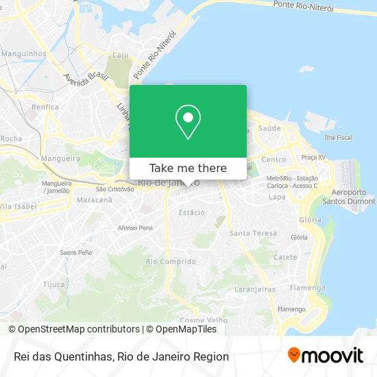
See Rei das Quentinhas, Cidade Nova, on the map
Public Transit to Rei das Quentinhas in Cidade Nova
Wondering how to get to Rei das Quentinhas in Cidade Nova? Moovit helps you find the best way to get to Rei das Quentinhas with step-by-step directions from the nearest public transit station.
Moovit provides free maps and live directions to help you navigate through your city. View schedules, routes, timetables, and find out how long does it take to get to Rei das Quentinhas in real time.
Looking for the nearest stop or station to Rei das Quentinhas? Check out this list of stops closest to your destination: Rua Ulysses Guimarães | Clube Dos Servidores Municipais; BRS 2 4 - Cidade Nova; Cidade Nova; BRS 1 3 5 - Cidade Nova; Cidade Nova Rio De Janeiro - Rj Brasil; Metrô Cidade Nova | Pista Central - Sentido Candelária; Rua Ulysses Guimarães 16 | Metrô Estácio; BRS 2 / 4 - Metrô Cidade Nova; BRS 4 5 - Cidade Nova; Estácio; BRS 1 / 3 / 5 - Metrô Cidade Nova; Avenida Presidente Vargas 3102; BRS 1; Praia Formosa; Praça Da Bandeira.
Bus: 109, 110, 2345, 432, 435, 775D, SR 363, 220, 415, SN 415, 232, SN 232, 247, 249, 254, 217, 306, 341, 363, SN 363.Metro: L1, L4, L2.Train: RAMAL DEODORO, RAMAL SANTA CRUZ, RAMAL JAPERI.
Want to see if there’s another route that gets you there at an earlier time? Moovit helps you find alternative routes or times. Get directions from and directions to Rei das Quentinhas easily from the Moovit App or Website.
We make riding to Rei das Quentinhas easy, which is why over 1.5 million users, including users in Cidade Nova, trust Moovit as the best app for public transit. You don’t need to download an individual bus app or train app, Moovit is your all-in-one transit app that helps you find the best bus time or train time available.
For information on prices of bus, metro and train, costs and ride fares to Rei das Quentinhas, please check the Moovit app.
Use the app to navigate to popular places including to the airport, hospital, stadium, grocery store, mall, coffee shop, school, college, and university.
Rei das Quentinhas Address: Rua Pinto de Azevedo, Cidade Nova Rio de Janeiro-RJ 20211-445 street in Cidade Nova
- Bradesco Cidade Nova,
- Rua Pinto de Azevedo 105,
- Caixa Econômica Federal,
- SMAC - Secretaria Municipal de Meio Ambiente,
- Edifício Condomínio Teleporto,
- smart Fit,
- Rua Ulisses Guimarães / Rua Pinto de Azevedo,
- Previ Rio - Prefeitura Da Cidade do Rio de Janeiro,
- Prefeitura do Rio – Centro Administrativo São Sebastião,
- Praça Rev. Álvaro Reis,
- Centro Empresarial Cidade Nova (Teleporto),
- Rua Afonso Cavalcanti 455,
- Prefeitura Do Rio De Janeiro,
- Centro Administrativo São Sebastião,
- Rua Júlio do Carmo 323,
- Santander,
- Prefeitura,
- Atento Teleporto,
- Centro de Operações Rio,
- Avenida Presidente Vargas 3131-3215
Places Near Rei das Quentinhas (Cidade Nova)
- Rua Ulysses Guimarães 16, Cidade Nova,
- Shopping Nova América, Del Castilho,
- Norte Shopping, Cachambi,
- Praia do Arpoador, Ipanema,
- Shopping Downtown, Barra Da Tijuca,
- Rio De Janeiro,
- Feirão De Malhas, Duque De Caxias,
- Avenida Venezuela 134, Saúde,
- Hospital Municipal Ronaldo Gazolla, Acari,
- Hospital Federal Do Andaraí, Andaraí,
- Hospital Federal Cardoso Fontes, Jacarepaguá,
- Niterói, Niterói,
- Avenida Rio Branco, Centro,
- Shopping RioSul, Botafogo,
- Rodoviária Novo Rio (Rodoviária do Rio de Janeiro), Santo Cristo,
- Rua Licínio Cardoso, São Francisco Xavier,
- Hospital Pedro Ernesto, Vila Isabel,
- Museu Do Amanhã, Centro,
- Shopping Rio Sul, Botafogo,
- Feira Livre da Gloria, Glória
How to get to popular places in Rio de Janeiro Region with public transit
Get around Cidade Nova by public transit!
Traveling around Cidade Nova has never been so easy. See step by step directions as you travel to any attraction, street or major public transit station. View bus and train schedules, arrival times, service alerts and detailed routes on a map, so you know exactly how to get to anywhere in Cidade Nova.
When traveling to any destination around Cidade Nova use Moovit's Live Directions with Get Off Notifications to know exactly where and how far to walk, how long to wait for your line, and how many stops are left. Moovit will alert you when it's time to get off — no need to constantly re-check whether yours is the next stop.
Wondering how to use public transit in Cidade Nova or how to pay for public transit in Cidade Nova? Moovit public transit app can help you navigate your way with public transit easily, and at minimum cost. It includes public transit fees, ticket prices, and costs. Looking for a map of Cidade Nova public transit lines? Moovit public transit app shows all public transit maps in Cidade Nova with all Bus, Train, Metro, Light Rail, Ferry, Cable Car, Gondola and Funicular routes and stops on an interactive map.
Rio de Janeiro Region has 8 transit type(s), including: Bus, Train, Metro, Light Rail, Ferry, Cable Car, Gondola and Funicular, operated by several transit agencies, including TrensRJ, Metrô Rio, VLT Carioca, Barcas Rio, BRT MOBI-Rio, Auto Viação Alpha, Auto Viação Tijuca, Gire Transportes, Transurb, Viação Nossa Senhora das Graças, Consórcio INTERSUL, Braso Lisboa (Municipal), Caprichosa Auto Ônibus, Auto Viação Três Amigos and Rodoviária Âncora Matias