How to get to Reitz Arena by bus?
Click on the bus route to see step by step directions with maps, line arrival times and updated time schedules.
From Baltimore Penn Station, Baltimore
54 minFrom I-695 @ Exit 18 (Liberty Rd/MD 26), Baltimore County
62 minFrom Baltimore VA Medical Center, Baltimore
45 minFrom Inner Harbor, Baltimore
31 minFrom Bwi2 Employee Shuttles, Baltimore
47 minFrom Medstar Harbor Hospital, Baltimore
40 minFrom B&O Railroad Museum, Baltimore
44 minFrom I-695 @ Exit 17 (Security Blvd/MD 122), Baltimore County
74 minFrom Walmart, Baltimore County
58 minFrom Hilton Baltimore, Baltimore
33 min
Bus stops near Reitz Arena in Baltimore
Light Rail stations near Reitz Arena in Baltimore
- Mt. Washington, 23 min walk,VIEW
What are the closest stations to Reitz Arena?
The closest stations to Reitz Arena are:
- Charles St & Cold Spring Ln FS Nb is 198 yards away, 3 min walk.
- Cold Spring Ln & Charles St Wb is 248 yards away, 4 min walk.
- Mt. Washington is 1953 yards away, 23 min walk.
Which bus lines stop near Reitz Arena?
These bus lines stop near Reitz Arena: 28, 51.
What’s the nearest light rail station to Reitz Arena in Baltimore?
The nearest light rail station to Reitz Arena in Baltimore is Mt. Washington. It’s a 23 min walk away.
What’s the nearest bus station to Reitz Arena in Baltimore?
The nearest bus station to Reitz Arena in Baltimore is Charles St & Cold Spring Ln FS Nb. It’s a 3 min walk away.
What time is the first light rail to Reitz Arena in Baltimore?
The LIGHT RAILLINK is the first light rail that goes to Reitz Arena in Baltimore. It stops nearby at 3:42 AM.
What time is the last light rail to Reitz Arena in Baltimore?
The LIGHT RAILLINK is the last light rail that goes to Reitz Arena in Baltimore. It stops nearby at 1:30 AM.
What time is the first bus to Reitz Arena in Baltimore?
The 28 is the first bus that goes to Reitz Arena in Baltimore. It stops nearby at 5:00 AM.
What time is the last bus to Reitz Arena in Baltimore?
The 28 is the last bus that goes to Reitz Arena in Baltimore. It stops nearby at 12:54 AM.
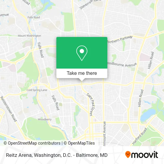
See Reitz Arena, Baltimore, on the map
Public Transit to Reitz Arena in Baltimore
Wondering how to get to Reitz Arena in Baltimore? Moovit helps you find the best way to get to Reitz Arena with step-by-step directions from the nearest public transit station.
Moovit provides free maps and live directions to help you navigate through your city. View schedules, routes, timetables, and find out how long does it take to get to Reitz Arena in real time.
Looking for the nearest stop or station to Reitz Arena? Check out this list of stops closest to your destination: Charles St & Cold Spring Ln FS Nb; Cold Spring Ln & Charles St Wb; Mt. Washington.
Bus: 28, 51.
Want to see if there’s another route that gets you there at an earlier time? Moovit helps you find alternative routes or times. Get directions from and directions to Reitz Arena easily from the Moovit App or Website.
We make riding to Reitz Arena easy, which is why over 1.5 million users, including users in Baltimore, trust Moovit as the best app for public transit. You don’t need to download an individual bus app or train app, Moovit is your all-in-one transit app that helps you find the best bus time or train time available.
For information on prices of bus, costs and ride fares to Reitz Arena, please check the Moovit app.
Use the app to navigate to popular places including to the airport, hospital, stadium, grocery store, mall, coffee shop, school, college, and university.
Reitz Arena Address: 4501 N Charles St Baltimore, MD 21212 street in Baltimore
- McManus Rehearsal Room,
- David Schaffer,
- Steve & Kate's Camp - Baltimore,
- Reverend Francis X Knott, Society of Jesus, Humanities Center,
- American Kodály Institute,
- Memorial Musalla of Our Lady,
- Black Students Association of Loyola University Maryland,
- Butler Hall,
- Loyola Houndserve,
- Loyola Farmers Market,
- Black Box Theater,
- Julio Fine Arts Gallery / Loyola University MD,
- Boulder Garden Cafe,
- Loyola University Maryland,
- Loyola Dance Company,
- DeChiaro College Center M009 (loyola university),
- ChargePoint,
- Jenkins Parking Lot,
- Iggy's Market,
- Dga Field
Places Near Reitz Arena (Baltimore)
- Capital One Arena, Washington,
- Warner Theatre, Washington,
- Camden Yards, Baltimore,
- National Zoo, Washington,
- National Museum of African American History and Culture, Washington,
- The Anthem, Washington,
- National Mall, Washington,
- M&T Bank Stadium, Baltimore,
- Basilica of the National Shrine, Washington,
- Marriott Marquis Washington, DC, Washington,
- Washington National Cathedral, Washington,
- PG Mall, Prince George's County,
- Pennsylvania Ave NW (3rd st and pennsylvania), Washington,
- Sibley Memorial Hospital, Washington,
- Georgetown, Washington,
- Washington DC VA Medical Center, Washington,
- Rock Creek Tennis Center, Washington,
- Amazon Hq2, Arlington County,
- Museum Of The Bible, Washington,
- Westfield Montgomery Mall, Montgomery County
How to get to popular places in Washington, D.C. - Baltimore, MD with public transit
Get around Baltimore by public transit!
Traveling around Baltimore has never been so easy. See step by step directions as you travel to any attraction, street or major public transit station. View bus and train schedules, arrival times, service alerts and detailed routes on a map, so you know exactly how to get to anywhere in Baltimore.
When traveling to any destination around Baltimore use Moovit's Live Directions with Get Off Notifications to know exactly where and how far to walk, how long to wait for your line, and how many stops are left. Moovit will alert you when it's time to get off — no need to constantly re-check whether yours is the next stop.
Wondering how to use public transit in Baltimore or how to pay for public transit in Baltimore? Moovit public transit app can help you navigate your way with public transit easily, and at minimum cost. It includes public transit fees, ticket prices, and costs. Looking for a map of Baltimore public transit lines? Moovit public transit app shows all public transit maps in Baltimore with all Bus, Train, Metro, Light Rail and Ferry routes and stops on an interactive map.
Washington, D.C. - Baltimore, MD has 5 transit type(s), including: Bus, Train, Metro, Light Rail and Ferry, operated by several transit agencies, including WMATA, Montgomery County Ride On, Fairfax Connector, TheBus, PRTC, DASH - Alexandria, Arlington Transit (ART), RTA of Central Maryland, MDOT MTA, MDOT MTA Light RailLink, MDOT MTA Commuter Bus, MDOT MTA Local Bus, FXBGO!, Virginia Railway Express (VRE) and MARC