How to get to Rekin's Temporary Command Center by bus?
Click on the bus route to see step by step directions with maps, line arrival times and updated time schedules.
From Ningbo Global Intime City, Yinzhou District
54 minFrom Sanjiang Shopping (Global City Branch), Yinzhou District
49 minFrom Qiu Ai Moonlight City Comprehensive Market, Yinzhou District
48 minFrom Haiyue Company - North Gate, Zhenhai District
45 minFrom Ningbo Sixth Hospital Parking Lot (Ningchuan Road), Jiangdong District
33 minFrom Zhonghai Huanyu Tiandi - Phase 1, Jiangdong District
33 minFrom Ningbo Museum, Yinzhou District
54 minFrom Magic Academy, Yinzhou District
55 minFrom Ningbo Lijing Plastics, Yinzhou District
52 minFrom TT Studio (University First Branch), Yinzhou District
49 min
How to get to Rekin's Temporary Command Center by metro?
Click on the metro route to see step by step directions with maps, line arrival times and updated time schedules.
Bus stops near Rekin's Temporary Command Center in Jiangbei District
Metro stations near Rekin's Temporary Command Center in Jiangbei District
Bus lines to Rekin's Temporary Command Center in Jiangbei District
- Route 13, Guangsha Yiting,VIEW
- Route 16, Baisha Bus Center,VIEW
- Route 17, Shuxiang Garden,VIEW
- 36, International Convention Center,VIEW
- Route 303, Jiangbei Chuangye Zone C,VIEW
- Route 202 Night Line, Ningbo Railway,VIEW
- Route 26, City Women's and Children's Hospital North,VIEW
- 3, Shuxiang Garden,VIEW
- Route 371, Zhenhai District Highway Passenger Transport Center,VIEW
- Route 825, South Yingjiali Garden,VIEW
- 517, Yao River,VIEW
- Route 806, Zhuangqiao Tongjia,VIEW
- Route 9, City Traditional Chinese Medicine Hospital,VIEW
- Route 118, Ningbo Nottingham Apartments,VIEW
- Route 527, Qinglin Bay Bus Station,VIEW
- Route 305, Zhenming Road Bus Station,VIEW
- 2, Ningbo Yileyuan - Gaotang New Village,VIEW
- Route 2 Night Line, Gaotang New Village - Ningbo Yile Garden,VIEW
- Route 510, Lianfeng New Village,VIEW
- Route 809, East Bus Station,VIEW
What are the closest stations to Rekin's Temporary Command Center?
The closest stations to Rekin's Temporary Command Center are:
- Gaotang Garden is 306 meters away, 5 min walk.
- Yongfeng North Road Fanjiang Bank Intersection is 316 meters away, 5 min walk.
- Gaotang New Village is 664 meters away, 9 min walk.
- Gao Tang Third Village is 670 meters away, 9 min walk.
- Gaotang Fourth Village is 804 meters away, 11 min walk.
- West Gate is 1282 meters away, 17 min walk.
- Drum Tower is 1652 meters away, 22 min walk.
Which bus lines stop near Rekin's Temporary Command Center?
These bus lines stop near Rekin's Temporary Command Center: Route 16, Route 26, 3, 517, Route 527, Route 9.
Which metro line stops near Rekin's Temporary Command Center?
Line 1 (Gaoxiao West)
What’s the nearest metro station to Rekin's Temporary Command Center in Jiangbei District?
The nearest metro station to Rekin's Temporary Command Center in Jiangbei District is West Gate. It’s a 17 min walk away.
What’s the nearest bus station to Rekin's Temporary Command Center in Jiangbei District?
The nearest bus stations to Rekin's Temporary Command Center in Jiangbei District are Gaotang Garden and Yongfeng North Road Fanjiang Bank Intersection. The closest one is a 5 min walk away.
What time is the first metro to Rekin's Temporary Command Center in Jiangbei District?
The Line 1 is the first metro that goes to Rekin's Temporary Command Center in Jiangbei District. It stops nearby at 6:14 AM.
What time is the last metro to Rekin's Temporary Command Center in Jiangbei District?
The Line 1 is the last metro that goes to Rekin's Temporary Command Center in Jiangbei District. It stops nearby at 10:54 PM.
What time is the first bus to Rekin's Temporary Command Center in Jiangbei District?
The Route 202 Night Line is the first bus that goes to Rekin's Temporary Command Center in Jiangbei District. It stops nearby at 3:00 AM.
What time is the last bus to Rekin's Temporary Command Center in Jiangbei District?
The Route 202 Night Line is the last bus that goes to Rekin's Temporary Command Center in Jiangbei District. It stops nearby at 3:00 AM.
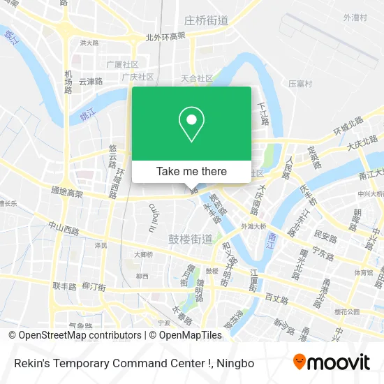
See Rekin's Temporary Command Center, Jiangbei District, on the map
Public Transit to Rekin's Temporary Command Center in Jiangbei District
Wondering how to get to Rekin's Temporary Command Center in Jiangbei District? Moovit helps you find the best way to get to Rekin's Temporary Command Center with step-by-step directions from the nearest public transit station.
Moovit provides free maps and live directions to help you navigate through your city. View schedules, routes, timetables, and find out how long does it take to get to Rekin's Temporary Command Center in real time.
Looking for the nearest stop or station to Rekin's Temporary Command Center? Check out this list of stops closest to your destination: Gaotang Garden; Yongfeng North Road Fanjiang Bank Intersection; Gaotang New Village; Gao Tang Third Village; Gaotang Fourth Village; West Gate; Drum Tower.
Bus: Route 16, Route 26, 3, 517, Route 527, Route 9, Route 13, Route 16, Route 17, 36, Route 303, Route 26, 3, Route 371, Route 825, 517, Route 806.Metro: Line 1, Line 1, Line 2.
Want to see if there’s another route that gets you there at an earlier time? Moovit helps you find alternative routes or times. Get directions from and directions to Rekin's Temporary Command Center easily from the Moovit App or Website.
We make riding to Rekin's Temporary Command Center easy, which is why over 1.5 million users, including users in Jiangbei District, trust Moovit as the best app for public transit. You don’t need to download an individual bus app or train app, Moovit is your all-in-one transit app that helps you find the best bus time or train time available.
For information on prices of bus and metro, costs and ride fares to Rekin's Temporary Command Center, please check the Moovit app.
Use the app to navigate to popular places including to the airport, hospital, stadium, grocery store, mall, coffee shop, school, college, and university.
Rekin's Temporary Command Center Address: Xinzhi Road street in Jiangbei District
- Oriental Venice Phase 2 (South Gate),
- No. 9-13 Building, Lane 73, Yongfeng North Road,
- Zhenghan Ginseng,
- Ningbo Social Welfare Center Hospital,
- Ningbo Civil Affairs Bureau - Social Donation Receiving Center,
- Yongfeng North Road / Yongfeng Bridge (Intersection),
- China Everbright Bank (Xinzhi Branch),
- Ningbo Urban Rail Transit Engineering Construction Management Station,
- Ningbo Civil Affairs Bureau - Reception Room,
- Peninsula Bay Seafood Restaurant,
- Xinghui Tong Holiday Hotel,
- Century Gaotang,
- Gaotang Apartment,
- Ningbo Civil Affairs Bureau,
- Ningbo Civil Affairs Bureau - Bicycle Rental Point,
- Oriental Venice - Parking Lot,
- A Liu Tou Seafood (Fan Jiang'an Branch),
- Ecological Farm Life Supermarket,
- Owen (Fanjiang'an Road Branch),
- Ningbo Shunzhou Computer Store
Places Near Rekin's Temporary Command Center (Jiangbei District)
- France · Woodpecker,
- Wanxiang City, Jiangbei District,
- Ningbo First Hospital - Inpatient Department, Haishu District,
- Ningbo Second Hospital-Emergency, Haishu District,
- Ningbo Traditional Chinese Medicine Hospital, Haishu District,
- Zhongle Dance Hall, Jiangbei District,
- Li Huili Eastern Hospital, Yinzhou District,
- Ningbo Cultural Creative Port, Jiangbei District,
- Ayuwang Temple, Yinzhou District,
- Wanxiang City (Under Construction), Jiangbei District,
- Gas Station, Yinzhou District,
- Ningbo Medical Center Li Huili Hospital East Hospital - Outpatient, Yinzhou District,
- Ningbo Jintian Copper (Group) Co., Ltd., Jiangbei District,
- Ningbo No. 6 Hospital, Jiangdong District,
- Sam's Club (Qinghe Road), Jiangbei District,
- Ningbo Medical Center Li Huili Eastern Hospital, Yinzhou District,
- City Hero (New City Wuyue Plaza), Zhenhai District,
- Ningbo Lishe International Airport, Yinzhou District,
- Nantang Old Street, Haishu District,
- Ningbo Foreigner Beach, Jiangbei District
How to get to popular places in Ningbo with public transit
Get around Jiangbei District by public transit!
Traveling around Jiangbei District has never been so easy. See step by step directions as you travel to any attraction, street or major public transit station. View bus and train schedules, arrival times, service alerts and detailed routes on a map, so you know exactly how to get to anywhere in Jiangbei District.
When traveling to any destination around Jiangbei District use Moovit's Live Directions with Get Off Notifications to know exactly where and how far to walk, how long to wait for your line, and how many stops are left. Moovit will alert you when it's time to get off — no need to constantly re-check whether yours is the next stop.
Wondering how to use public transit in Jiangbei District or how to pay for public transit in Jiangbei District? Moovit public transit app can help you navigate your way with public transit easily, and at minimum cost. It includes public transit fees, ticket prices, and costs. Looking for a map of Jiangbei District public transit lines? Moovit public transit app shows all public transit maps in Jiangbei District with all Bus and Metro routes and stops on an interactive map.
Ningbo has 2 transit type(s), including: Bus and Metro, operated by several transit agencies, including Ningbo Metro, Ningbo Bus and Yuyao Bus