How to get to Related Developmental Disorders by bus?
Click on the bus route to see step by step directions with maps, line arrival times and updated time schedules.
From The Westin Arlington Gateway, Arlington County
52 minFrom Sibley Memorial Hospital, Washington
114 minFrom Walmart, Arlington County
50 minFrom Fairfax County Courthouse, Fairfax County
57 minFrom King's Dominion, Fairfax County
50 minFrom Northern Virginia Community College - Annandale Campus, Fairfax County
56 minFrom Intelligence Community Campus—Bethesda, Montgomery County
110 minFrom Eden Center, Falls Church
44 minFrom Seven Corners Center (Seven Corners Shopping Center Falls Church VA), Fairfax County
48 minFrom Inova employee Shuttle, Fairfax County
38 min
How to get to Related Developmental Disorders by metro?
Click on the metro route to see step by step directions with maps, line arrival times and updated time schedules.
Bus stops near Related Developmental Disorders in Fairfax County
Metro stations near Related Developmental Disorders in Fairfax County
Bus lines to Related Developmental Disorders in Fairfax County
What are the closest stations to Related Developmental Disorders?
The closest stations to Related Developmental Disorders are:
- International Dr @ Fletcher St is 502 yards away, 7 min walk.
- International Dr And Fletcher St is 547 yards away, 7 min walk.
- Spring Hill is 1776 yards away, 22 min walk.
- Dunn Loring Merrifield Metro Station is 5055 yards away, 59 min walk.
Which bus lines stop near Related Developmental Disorders?
These bus lines stop near Related Developmental Disorders: 401, 660, 798, A70, F20.
Which metro line stops near Related Developmental Disorders?
SILVER (Ashburn)
What’s the nearest metro station to Related Developmental Disorders in Fairfax County?
The nearest metro station to Related Developmental Disorders in Fairfax County is Spring Hill. It’s a 22 min walk away.
What’s the nearest bus station to Related Developmental Disorders in Fairfax County?
The nearest bus stations to Related Developmental Disorders in Fairfax County are International Dr @ Fletcher St and International Dr And Fletcher St. The closest one is a 7 min walk away.
What time is the first metro to Related Developmental Disorders in Fairfax County?
The ORANGE is the first metro that goes to Related Developmental Disorders in Fairfax County. It stops nearby at 5:04 AM.
What time is the last metro to Related Developmental Disorders in Fairfax County?
The SILVER is the last metro that goes to Related Developmental Disorders in Fairfax County. It stops nearby at 12:43 AM.
What time is the first bus to Related Developmental Disorders in Fairfax County?
The 401 is the first bus that goes to Related Developmental Disorders in Fairfax County. It stops nearby at 4:27 AM.
What time is the last bus to Related Developmental Disorders in Fairfax County?
The F20 is the last bus that goes to Related Developmental Disorders in Fairfax County. It stops nearby at 2:02 AM.
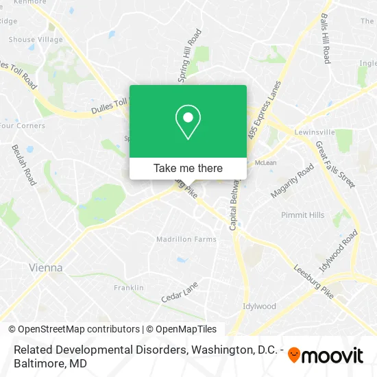
See Related Developmental Disorders, Fairfax County, on the map
Public Transit to Related Developmental Disorders in Fairfax County
Wondering how to get to Related Developmental Disorders in Fairfax County? Moovit helps you find the best way to get to Related Developmental Disorders with step-by-step directions from the nearest public transit station.
Moovit provides free maps and live directions to help you navigate through your city. View schedules, routes, timetables, and find out how long does it take to get to Related Developmental Disorders in real time.
Looking for the nearest stop or station to Related Developmental Disorders? Check out this list of stops closest to your destination: International Dr @ Fletcher St; International Dr And Fletcher St; Spring Hill; Dunn Loring Merrifield Metro Station.
Bus: 401, 660, 798, A70, F20, 402, 462, 467, 721.Metro: SILVER, ORANGE.
Want to see if there’s another route that gets you there at an earlier time? Moovit helps you find alternative routes or times. Get directions from and directions to Related Developmental Disorders easily from the Moovit App or Website.
We make riding to Related Developmental Disorders easy, which is why over 1.5 million users, including users in Fairfax County, trust Moovit as the best app for public transit. You don’t need to download an individual bus app or train app, Moovit is your all-in-one transit app that helps you find the best bus time or train time available.
For information on prices of bus and metro, costs and ride fares to Related Developmental Disorders, please check the Moovit app.
Use the app to navigate to popular places including to the airport, hospital, stadium, grocery store, mall, coffee shop, school, college, and university.
Related Developmental Disorders Address: 8230 Leesburg Pike Vienna, VA 22182 street in Fairfax County
- Care Dental,
- Direct Autocare,
- Ics Serka,
- Transformative Studio,
- Advanced 4 Healthcare,
- Sadiya Clinic,
- Saied Jamshidi MD (Dr Saied Jamshidi),
- Lincoln Financial Advisors,
- Vienna VA,
- Truist Bank,
- Sanu Postpartum Care,
- Atlant Appliance Repair,
- Wellness Approach,
- Natmad,
- USA Auto Glass,
- E&R Ventures LLC,
- Porcelanosa,
- Tysons Corner, VA,
- Brothers Paving & Con Corp,
- Mariscos El Malecon
Places Near Related Developmental Disorders (Fairfax County)
- Rock Creek Tennis Center, Washington,
- Amazon Hq2, Arlington County,
- Basilica of the National Shrine, Washington,
- National Museum of African American History and Culture, Washington,
- Camden Yards, Baltimore,
- PG Mall, Prince George's County,
- M&T Bank Stadium, Baltimore,
- Washington National Cathedral, Washington,
- Warner Theatre, Washington,
- The Anthem, Washington,
- Georgetown, Washington,
- Museum Of The Bible, Washington,
- National Zoo, Washington,
- Sibley Memorial Hospital, Washington,
- Washington DC VA Medical Center, Washington,
- Capital One Arena, Washington,
- Westfield Montgomery Mall, Montgomery County,
- National Mall, Washington,
- Marriott Marquis Washington, DC, Washington,
- Pennsylvania Ave NW (3rd st and pennsylvania), Washington
How to get to popular places in Washington, D.C. - Baltimore, MD with public transit
Get around Fairfax County by public transit!
Traveling around Fairfax County has never been so easy. See step by step directions as you travel to any attraction, street or major public transit station. View bus and train schedules, arrival times, service alerts and detailed routes on a map, so you know exactly how to get to anywhere in Fairfax County.
When traveling to any destination around Fairfax County use Moovit's Live Directions with Get Off Notifications to know exactly where and how far to walk, how long to wait for your line, and how many stops are left. Moovit will alert you when it's time to get off — no need to constantly re-check whether yours is the next stop.
Wondering how to use public transit in Fairfax County or how to pay for public transit in Fairfax County? Moovit public transit app can help you navigate your way with public transit easily, and at minimum cost. It includes public transit fees, ticket prices, and costs. Looking for a map of Fairfax County public transit lines? Moovit public transit app shows all public transit maps in Fairfax County with all Bus, Train, Metro, Light Rail and Ferry routes and stops on an interactive map.
Washington, D.C. - Baltimore, MD has 5 transit type(s), including: Bus, Train, Metro, Light Rail and Ferry, operated by several transit agencies, including WMATA, Montgomery County Ride On, Fairfax Connector, TheBus, PRTC, DASH - Alexandria, Arlington Transit (ART), RTA of Central Maryland, MDOT MTA, MDOT MTA Light RailLink, MDOT MTA Commuter Bus, MDOT MTA Local Bus, FXBGO!, Virginia Railway Express (VRE) and MARC