How to get to Relaytion by bus?
Click on the bus route to see step by step directions with maps, line arrival times and updated time schedules.
From Maison de santé Jeanne Garnier, Paris
72 minFrom Gare routière Pershing – Porte Maillot, Paris
61 minFrom Maison Médicale Jeanne Garnier, Paris
72 minFrom Consulat Général d'Espagne, Paris
82 minFrom TF1, Boulogne-Billancourt
81 minFrom 5 Rue de Berri, Paris
69 minFrom 25-27 Boulevard Victor Hugo, Neuilly-Sur-Seine
70 minFrom Rue de Lourmel, Paris
94 minFrom Musée d'Art Moderne de Paris (MAM), Paris
78 minFrom Pavillon d'Armenonville, Paris
55 min
Bus stops near Relaytion in Rueil-Malmaison
RER station near Relaytion in Rueil-Malmaison
- Chatou - Croissy, 13 min walk,VIEW
Bus lines to Relaytion in Rueil-Malmaison
- 367, Rueil-Malmaison RER,VIEW
- 1, Gare De Rueil-Malmaison - Gare Saint-Germain-En-Laye - Rue Thiers,VIEW
- B, Gare De Sartrouville - Gare De Rueil-Malmaison,VIEW
- N153, Gare Saint-Lazare - Saint-Germain-En-Laye Rer,VIEW
- 244, Rueil-Malmaison RER,VIEW
- 158, Rueil-Malmaison RER,VIEW
- 144, Rueil-Malmaison RER,VIEW
- 241, Porte D'Auteuil - Métro,VIEW
- 467, Rueil-Malmaison RER,VIEW
What are the closest stations to Relaytion?
The closest stations to Relaytion are:
- Rueil-Malmaison RER is 131 meters away, 2 min walk.
- Gare de Rueil-Malmaison is 258 meters away, 4 min walk.
- Chatou - Croissy is 1012 meters away, 13 min walk.
Which RER line stops near Relaytion?
A (Cergy le Haut / Poissy / Saint Germain en Laye)
Which bus lines stop near Relaytion?
These bus lines stop near Relaytion: 158, 244, 367, 467.
What’s the nearest bus station to Relaytion in Rueil-Malmaison?
The nearest bus station to Relaytion in Rueil-Malmaison is Rueil-Malmaison RER. It’s a 2 min walk away.
What’s the nearest RER station to Relaytion in Rueil-Malmaison?
The nearest RER station to Relaytion in Rueil-Malmaison is Chatou - Croissy. It’s a 13 min walk away.
What time is the first bus to Relaytion in Rueil-Malmaison?
The N153 is the first bus that goes to Relaytion in Rueil-Malmaison. It stops nearby at 3:10 AM.
What time is the last bus to Relaytion in Rueil-Malmaison?
The N153 is the last bus that goes to Relaytion in Rueil-Malmaison. It stops nearby at 3:10 AM.
What time is the first RER to Relaytion in Rueil-Malmaison?
The A is the first RER that goes to Relaytion in Rueil-Malmaison. It stops nearby at 4:58 AM.
What time is the last RER to Relaytion in Rueil-Malmaison?
The A is the last RER that goes to Relaytion in Rueil-Malmaison. It stops nearby at 1:21 AM.
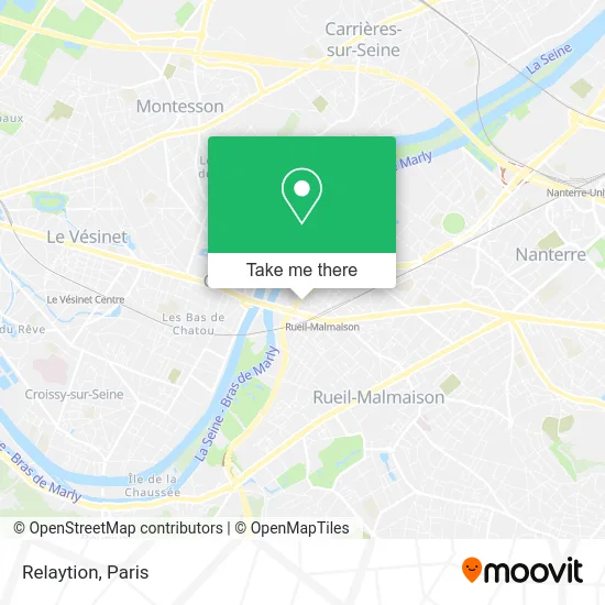
See Relaytion, Rueil-Malmaison, on the map
Public Transit to Relaytion in Rueil-Malmaison
Wondering how to get to Relaytion in Rueil-Malmaison? Moovit helps you find the best way to get to Relaytion with step-by-step directions from the nearest public transit station.
Moovit provides free maps and live directions to help you navigate through your city. View schedules, routes, timetables, and find out how long does it take to get to Relaytion in real time.
Looking for the nearest stop or station to Relaytion? Check out this list of stops closest to your destination: Rueil-Malmaison RER; Gare de Rueil-Malmaison; Chatou - Croissy.
RER: A.Bus: 158, 244, 367, 467, 1, B, N153, 241.
Want to see if there’s another route that gets you there at an earlier time? Moovit helps you find alternative routes or times. Get directions from and directions to Relaytion easily from the Moovit App or Website.
We make riding to Relaytion easy, which is why over 1.5 million users, including users in Rueil-Malmaison, trust Moovit as the best app for public transit. You don’t need to download an individual bus app or train app, Moovit is your all-in-one transit app that helps you find the best bus time or train time available.
For information on prices of RER, metro, bus and light rail, costs and ride fares to Relaytion, please check the Moovit app.
Use the app to navigate to popular places including to the airport, hospital, stadium, grocery store, mall, coffee shop, school, college, and university.
Relaytion Address: 30 Avenue Édouard Belin 92500 Rueil-Malmaison street in Rueil-Malmaison
- It Finance,
- Optic Daguerre,
- Observatoire des,
- Association Pôle Santé Rueil Apsr,
- Adecco,
- Sem@For 77,
- C.D.S. Dentaire de France,
- Ao Conseils,
- Le Nouveau Siècle,
- Le Plazale Plaza,
- Associés Dentaires Édouard Belin,
- Isabelle Anziani,
- Dr. Zenati Charlotte,
- Sophie Malys,
- Mrg,
- CAISSE D'ÉPARGNE,
- Dr. Zagdoun-Perez Patricia,
- Blanc Nacre l'Atelier de Longle,
- Racines Créoles,
- Cimolia
Places Near Relaytion (Rueil-Malmaison)
- Hôpital Beaujon, Clichy,
- Centre Hospitalier des 15/20, Paris,
- 29 Rue Manin, Paris,
- Hôpital Pitié Salpêtrière, Paris,
- Marché Saint-Pierre, Paris,
- Hôpital Necker, Paris,
- Créteil Soleil, Creteil,
- Hopital Foch, Suresnes,
- Hôpital Saint-Joseph, Paris,
- Hôpital Cochin, Paris,
- Beaugrenelle, Paris,
- Atelier Des Lumieres, Paris,
- Fondation Louis Vuitton, Paris,
- Galeries Lafayette Haussmann, Paris,
- Galeries Lafayette, Paris,
- Hôpital Henri Mondor, Creteil,
- Gare Routière Flixbus, Paris,
- Théâtre Mogador, Paris,
- Hopital Lariboisière, Paris,
- Hôpital de la Pitié-Salpêtrière, Paris
How to get to popular places in Paris with public transit
Get around Rueil-Malmaison by public transit!
Traveling around Rueil-Malmaison has never been so easy. See step by step directions as you travel to any attraction, street or major public transit station. View bus and train schedules, arrival times, service alerts and detailed routes on a map, so you know exactly how to get to anywhere in Rueil-Malmaison.
When traveling to any destination around Rueil-Malmaison use Moovit's Live Directions with Get Off Notifications to know exactly where and how far to walk, how long to wait for your line, and how many stops are left. Moovit will alert you when it's time to get off — no need to constantly re-check whether yours is the next stop.
Wondering how to use public transit in Rueil-Malmaison or how to pay for public transit in Rueil-Malmaison? Moovit public transit app can help you navigate your way with public transit easily, and at minimum cost. It includes public transit fees, ticket prices, and costs. Looking for a map of Rueil-Malmaison public transit lines? Moovit public transit app shows all public transit maps in Rueil-Malmaison with all Bus, Train, Metro, Light Rail, RER, Funicular and Gondola routes and stops on an interactive map.
Paris has 7 transit type(s), including: Bus, Train, Metro, Light Rail, RER, Funicular and Gondola, operated by several transit agencies, including RATP, RER, RER Bus de remplacement, Train, Train Bus de remplacement, Tramway Bus de remplacement, TER, ADP, Magical Shuttle, Argenteuil - Boucles de Seine, Autocars Dominique, Bièvre, Brie et 2 Morin, Le Bus - C.C. du Clermontois and Cœur d’Essonne