Directions to Reliable Transport Logistics (Charles County) with public transportation
The following transit lines have routes that pass near Reliable Transport Logistics
How to get to Reliable Transport Logistics by bus?
Click on the bus route to see step by step directions with maps, line arrival times and updated time schedules.
From Oxon Hill Rivertowne, Prince George's County
75 minFrom Oxon Hill, MD, Prince George's County
74 minFrom The Capital Wheel at the National Harbor, Prince George's County
70 minFrom Fort Washington, MD, Prince George's County
116 minFrom Inova Mount Vernon Hospital, Fairfax County
379 minFrom Tanger Outlets, Prince George's County
64 minFrom MGM National Harbor Resort & Casino, Prince George's County
67 minFrom Clinton, MD, Prince George's County
105 minFrom Tanger Outlet National Harbor, Prince George's County
67 min
Bus stops near Reliable Transport Logistics in Charles County
Bus lines to Reliable Transport Logistics in Charles County
What are the closest stations to Reliable Transport Logistics?
The closest stations to Reliable Transport Logistics are:
- St Charles Pkwy & Dartmouth Rd is 238 yards away, 4 min walk.
- Smallwood Village Ctr is 1045 yards away, 13 min walk.
Which bus line stops near Reliable Transport Logistics?
620 (620/12 Waldorf)
What’s the nearest bus station to Reliable Transport Logistics in Charles County?
The nearest bus station to Reliable Transport Logistics in Charles County is St Charles Pkwy & Dartmouth Rd. It’s a 4 min walk away.
What time is the first bus to Reliable Transport Logistics in Charles County?
The 640 is the first bus that goes to Reliable Transport Logistics in Charles County. It stops nearby at 4:48 AM.
What time is the last bus to Reliable Transport Logistics in Charles County?
The 301 PARK & RIDE TRANSFER POINT - WALDORF TRANSFER POINT is the last bus that goes to Reliable Transport Logistics in Charles County. It stops nearby at 9:50 PM.
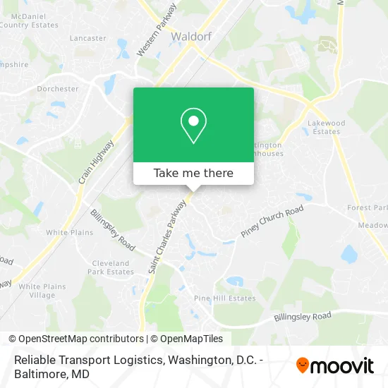
See Reliable Transport Logistics, Charles County, on the map
Public Transit to Reliable Transport Logistics in Charles County
Wondering how to get to Reliable Transport Logistics in Charles County? Moovit helps you find the best way to get to Reliable Transport Logistics with step-by-step directions from the nearest public transit station.
Moovit provides free maps and live directions to help you navigate through your city. View schedules, routes, timetables, and find out how long does it take to get to Reliable Transport Logistics in real time.
Looking for the nearest stop or station to Reliable Transport Logistics? Check out this list of stops closest to your destination: St Charles Pkwy & Dartmouth Rd; Smallwood Village Ctr.
Bus: 620, 301 PARK & RIDE TRANSFER POINT - WALDORF TRANSFER POINT, 640.
Want to see if there’s another route that gets you there at an earlier time? Moovit helps you find alternative routes or times. Get directions from and directions to Reliable Transport Logistics easily from the Moovit App or Website.
We make riding to Reliable Transport Logistics easy, which is why over 1.5 million users, including users in Charles County, trust Moovit as the best app for public transit. You don’t need to download an individual bus app or train app, Moovit is your all-in-one transit app that helps you find the best bus time or train time available.
For information on prices of bus and metro, costs and ride fares to Reliable Transport Logistics, please check the Moovit app.
Use the app to navigate to popular places including to the airport, hospital, stadium, grocery store, mall, coffee shop, school, college, and university.
Reliable Transport Logistics Address: 2001 Darnell Ct Waldorf, MD 20602 street in Charles County
- Lobisch Birch Communications MD J,
- Creative Beginnings Home Daycare,
- FBB Transitions,
- One Source Solutions,
- Arlington - Electrician,
- Ceiling Fan Repairs,
- Ace of Fades Barbershop,
- Famale Office Supply Company,
- Done Up Right Salon,
- Harley Landscaping,
- Sign N Serve,
- Paty's Catering,
- Daa Butterfly Effect,
- Direct Flow Plumbing,
- Tanay's Cleaning,
- Hughesville Apartments,
- Cushman & Wakefield,
- Winston M McIntosh DDS,
- Hair Salon,
- Convenient Self Storage
Places Near Reliable Transport Logistics (Charles County)
- Sibley Memorial Hospital, Washington,
- National Museum of African American History and Culture, Washington,
- Camden Yards, Baltimore,
- Westfield Montgomery Mall, Montgomery County,
- Rock Creek Tennis Center, Washington,
- The Anthem, Washington,
- National Mall, Washington,
- Amazon Hq2, Arlington County,
- Georgetown, Washington,
- Pennsylvania Ave NW (3rd st and pennsylvania), Washington,
- Museum Of The Bible, Washington,
- Warner Theatre, Washington,
- Capital One Arena, Washington,
- M&T Bank Stadium, Baltimore,
- Marriott Marquis Washington, DC, Washington,
- Washington National Cathedral, Washington,
- National Zoo, Washington,
- Washington DC VA Medical Center, Washington,
- PG Mall, Prince George's County,
- Basilica of the National Shrine, Washington
How to get to popular places in Washington, D.C. - Baltimore, MD with public transit
Get around Charles County by public transit!
Traveling around Charles County has never been so easy. See step by step directions as you travel to any attraction, street or major public transit station. View bus and train schedules, arrival times, service alerts and detailed routes on a map, so you know exactly how to get to anywhere in Charles County.
When traveling to any destination around Charles County use Moovit's Live Directions with Get Off Notifications to know exactly where and how far to walk, how long to wait for your line, and how many stops are left. Moovit will alert you when it's time to get off — no need to constantly re-check whether yours is the next stop.
Wondering how to use public transit in Charles County or how to pay for public transit in Charles County? Moovit public transit app can help you navigate your way with public transit easily, and at minimum cost. It includes public transit fees, ticket prices, and costs. Looking for a map of Charles County public transit lines? Moovit public transit app shows all public transit maps in Charles County with all Bus, Train, Metro, Light Rail and Ferry routes and stops on an interactive map.
Washington, D.C. - Baltimore, MD has 5 transit type(s), including: Bus, Train, Metro, Light Rail and Ferry, operated by several transit agencies, including WMATA, Montgomery County Ride On, Fairfax Connector, TheBus, PRTC, DASH - Alexandria, Arlington Transit (ART), RTA of Central Maryland, MDOT MTA, MDOT MTA Light RailLink, MDOT MTA Commuter Bus, MDOT MTA Local Bus, FXBGO!, Virginia Railway Express (VRE) and MARC