Directions to Relocation Advisory Services (Manhattan) with public transportation
The following transit lines have routes that pass near Relocation Advisory Services
 Bus: 50TH ST, BXM4, M103, M15-SBS, M4.
- Train: 2, YEL, BABYLON BRANCH, CITY TERMINAL ZONE, FAR ROCKAWAY BRANCH.
- Subway: 4, 6, 6X, S, 7.
How to get to Relocation Advisory Services by bus?
Click on the bus route to see step by step directions with maps, line arrival times and updated time schedules.
From 22 Cortlandt Street, Manhattan
47 minFrom Greyhound NYC To Foxwoods Casino, Bronx
78 minFrom Wall Street, Manhattan
43 minFrom The Shops At Atlas Park, Queens
43 minFrom Armory (Track), Manhattan
82 minFrom 9/11 Memorial & Museum, Manhattan
49 minFrom Brook Ave, Bronx
69 minFrom Armory Track & Field, Manhattan
72 minFrom Century 21 Department Store, Manhattan
49 minFrom Walmart Supercenter, Secaucus
56 min
How to get to Relocation Advisory Services by train?
Click on the train route to see step by step directions with maps, line arrival times and updated time schedules.
How to get to Relocation Advisory Services by subway?
Click on the subway route to see step by step directions with maps, line arrival times and updated time schedules.
From 22 Cortlandt Street, Manhattan
25 minFrom Greyhound NYC To Foxwoods Casino, Bronx
37 minFrom Wall Street, Manhattan
28 minFrom Armory (Track), Manhattan
44 minFrom 9/11 Memorial & Museum, Manhattan
32 minFrom Brook Ave, Bronx
47 minFrom Armory Track & Field, Manhattan
43 minFrom Century 21 Department Store, Manhattan
25 min
Bus stops near Relocation Advisory Services in Manhattan
Subway stations near Relocation Advisory Services in Manhattan
Train stations near Relocation Advisory Services in Manhattan
Bus lines to Relocation Advisory Services in Manhattan
- BXM1, Riverdale 263 St Via Inwood Via H. Hudson Pky,VIEW
- M50, West Side 42 St Pier Crosstown,VIEW
- 50TH ST, Midtown / W 39th Street,VIEW
- M101, Ft George Via 3 Av Via Amsterdam Av,VIEW
- M102, East Village 6 St Via Lex Av,VIEW
- M103, City Hall Via Lex Av,VIEW
- SHORTLINE HUDSON, New York,VIEW
- HAMPTON JITNEY MONTAUK, ,VIEW
- QM34, Glendale - Midtown Express,VIEW
- QM40, Lefrak City - Midtown Express,VIEW
- QM42, Forest Hills - Midtown Express,VIEW
- QM31, Fresh Meadows - Midtown Express,VIEW
- QM32, Bay Terrace - Midtown Express,VIEW
- QM35, Glen Oaks - Midtown Express,VIEW
- QM36, Lake Success - Midtown Express,VIEW
- QM44, Electchester - Midtown Express,VIEW
What are the closest stations to Relocation Advisory Services?
The closest stations to Relocation Advisory Services are:
- 3 Av/E 49 St is 103 yards away, 2 min walk.
- E 49 St/3 Av is 119 yards away, 2 min walk.
- E 49th St & 3rd Ave is 128 yards away, 2 min walk.
- 3 Av/E 50 St is 161 yards away, 3 min walk.
- Lexington Ave & E 48th St is 199 yards away, 3 min walk.
- 51 St is 302 yards away, 6 min walk.
- Grand Central-42 St is 349 yards away, 5 min walk.
- Grand Central Madison is 413 yards away, 5 min walk.
- Grand Central is 502 yards away, 7 min walk.
Which bus lines stop near Relocation Advisory Services?
These bus lines stop near Relocation Advisory Services: 50TH ST, BXM4, M103, M15-SBS, M4, M42, M5, QM34.
Which train lines stop near Relocation Advisory Services?
These train lines stop near Relocation Advisory Services: 2, YEL.
Which subway lines stop near Relocation Advisory Services?
These subway lines stop near Relocation Advisory Services: 4, 6, 6X, S.
What’s the nearest subway station to Relocation Advisory Services in Manhattan?
The nearest subway station to Relocation Advisory Services in Manhattan is 51 St. It’s a 6 min walk away.
What’s the nearest train station to Relocation Advisory Services in Manhattan?
The nearest train station to Relocation Advisory Services in Manhattan is Grand Central Madison. It’s a 5 min walk away.
What’s the nearest bus station to Relocation Advisory Services in Manhattan?
The nearest bus stations to Relocation Advisory Services in Manhattan are 3 Av/E 49 St, E 49 St/3 Av and E 49th St & 3rd Ave. The closest one is a 2 min walk away.
What time is the first subway to Relocation Advisory Services in Manhattan?
The 6X is the first subway that goes to Relocation Advisory Services in Manhattan. It stops nearby at 3:02 AM.
What time is the last subway to Relocation Advisory Services in Manhattan?
The 6 is the last subway that goes to Relocation Advisory Services in Manhattan. It stops nearby at 3:44 AM.
What time is the first train to Relocation Advisory Services in Manhattan?
The CITY TERMINAL ZONE is the first train that goes to Relocation Advisory Services in Manhattan. It stops nearby at 5:28 AM.
What time is the last train to Relocation Advisory Services in Manhattan?
The 1 is the last train that goes to Relocation Advisory Services in Manhattan. It stops nearby at 2:12 AM.
What time is the first bus to Relocation Advisory Services in Manhattan?
The M103 is the first bus that goes to Relocation Advisory Services in Manhattan. It stops nearby at 3:01 AM.
What time is the last bus to Relocation Advisory Services in Manhattan?
The M103 is the last bus that goes to Relocation Advisory Services in Manhattan. It stops nearby at 3:12 AM.
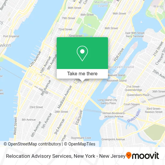
See Relocation Advisory Services, Manhattan, on the map
Public Transit to Relocation Advisory Services in Manhattan
Wondering how to get to Relocation Advisory Services in Manhattan? Moovit helps you find the best way to get to Relocation Advisory Services with step-by-step directions from the nearest public transit station.
Moovit provides free maps and live directions to help you navigate through your city. View schedules, routes, timetables, and find out how long does it take to get to Relocation Advisory Services in real time.
Looking for the nearest stop or station to Relocation Advisory Services? Check out this list of stops closest to your destination: 3 Av/E 49 St; E 49 St/3 Av; E 49th St & 3rd Ave; 3 Av/E 50 St; Lexington Ave & E 48th St; 51 St; Grand Central-42 St; Grand Central Madison; Grand Central.
Bus: 50TH ST, BXM4, M103, M15-SBS, M4, M42, M5, QM34, BXM1, M50.Train: 2, YEL, BABYLON BRANCH, CITY TERMINAL ZONE, FAR ROCKAWAY BRANCH, HEMPSTEAD BRANCH, LONG BEACH BRANCH, 1, 3, 4, 5.Subway: 4, 6, 6X, S, 7, 7X, 5.
Want to see if there’s another route that gets you there at an earlier time? Moovit helps you find alternative routes or times. Get directions from and directions to Relocation Advisory Services easily from the Moovit App or Website.
We make riding to Relocation Advisory Services easy, which is why over 1.5 million users, including users in Manhattan, trust Moovit as the best app for public transit. You don’t need to download an individual bus app or train app, Moovit is your all-in-one transit app that helps you find the best bus time or train time available.
For information on prices of subway, bus and train, costs and ride fares to Relocation Advisory Services, please check the Moovit app.
Use the app to navigate to popular places including to the airport, hospital, stadium, grocery store, mall, coffee shop, school, college, and university.
Relocation Advisory Services Address: 160 E 48th St street in Manhattan
- Consul General Alsion Wilson,
- Sea Fire Grill,
- Fearless Re'Volution - Personal Fitness Trainer, Sensusal Fitness & Life Coachnyc,
- E 48th and 3rd,
- Development Dimensions International,
- Garr & White, P.C.,
- Cooperman Lester Miller Carus Llp,
- Mercer Advisors - New York,
- Bergstein Flynn Knowlton & Pollina,
- Rug Cleaning Nyc,
- 767 3rd Ave,
- Amazon Locker @ Central Parking Garage (Morava),
- Reonomy, An Altus Group Business,
- Thomas Gonzalez - Iron Birch Advisors,
- Joshua D. Kirshner Brafman & Associates, Pc,
- Family Mediation Llp,
- Rosemary's Cafe,
- Aarp NY,
- La Rukico Custom Suits,
- Senator Charles E Schumer
Places Near Relocation Advisory Services (Manhattan)
- Hudson Yards, Manhattan,
- SoHo, Manhattan,
- Rockefeller Center, Manhattan,
- Katz's Deli, Manhattan,
- Chinatown, Manhattan,
- 3 Stone St, Manhattan,
- 911 Memorial, Manhattan,
- Times Square, Manhattan,
- 376 Hudson Street, Manhattan,
- Queens Center Mall, Queens,
- Pier 83, Manhattan,
- qqqq, Manhattan,
- Mountainside Hospital, Glen Ridge,
- 26 Federal Plaza, Manhattan,
- Wall Street, Manhattan,
- 111 Centre New York City Supreme Court, Manhattan,
- Bellevue Hospital, Manhattan,
- 1 Police Plaza, Manhattan,
- 66 John Street, Manhattan,
- San Gennaro Feast, Manhattan
How to get to popular places in New York - New Jersey with public transit
Get around Manhattan by public transit!
Traveling around Manhattan has never been so easy. See step by step directions as you travel to any attraction, street or major public transit station. View bus and train schedules, arrival times, service alerts and detailed routes on a map, so you know exactly how to get to anywhere in Manhattan.
When traveling to any destination around Manhattan use Moovit's Live Directions with Get Off Notifications to know exactly where and how far to walk, how long to wait for your line, and how many stops are left. Moovit will alert you when it's time to get off — no need to constantly re-check whether yours is the next stop.
Wondering how to use public transit in Manhattan or how to pay for public transit in Manhattan? Moovit public transit app can help you navigate your way with public transit easily, and at minimum cost. It includes public transit fees, ticket prices, and costs. Looking for a map of Manhattan public transit lines? Moovit public transit app shows all public transit maps in Manhattan with all Bus, Train, Subway, Light Rail, Ferry and Cable Car routes and stops on an interactive map.
New York - New Jersey has 6 transit type(s), including: Bus, Train, Subway, Light Rail, Ferry and Cable Car, operated by several transit agencies, including MTA Subway, Metro-North Railroad, LIRR, PATH, MTA New York City Transit - Express routes, MTA Bus, NJ Transit, NYC Ferry, NICE bus, Bee-Line Bus, NJ Transit Rail, Norwalk Transit District, Hartford Line, River Valley Transit and HART