How to get to Relvane by bus?
Click on the bus route to see step by step directions with maps, line arrival times and updated time schedules.
From City Hall 141 Worth Street, Manhattan
52 minFrom Franklin Ave, Bronx
71 minFrom Aaaaa Aaaa, Bronx
103 minFrom Astoria, Queens
90 minFrom 168 St, Manhattan
61 minFrom 125th St & Park Ave, Manhattan
56 minFrom 233 Broadway, Manhattan
48 minFrom Fort Lee, NJ, Fort Lee
49 minFrom King Spa, Palisades Park
41 min
How to get to Relvane by train?
Click on the train route to see step by step directions with maps, line arrival times and updated time schedules.
How to get to Relvane by subway?
Click on the subway route to see step by step directions with maps, line arrival times and updated time schedules.
Subway stations near Relvane in Manhattan
Bus stops near Relvane in Manhattan
Bus lines to Relvane in Manhattan
What are the closest stations to Relvane?
The closest stations to Relvane are:
- 42 St-Port Authority Bus Terminal is 125 yards away, 2 min walk.
- W 49th St & 8th Ave is 230 yards away, 3 min walk.
- W 49 St/8 Av is 230 yards away, 3 min walk.
- 8th Ave & W 49th St is 235 yards away, 3 min walk.
- 9 Av/W 50 St is 327 yards away, 4 min walk.
- 49 St is 340 yards away, 5 min walk.
- 50 St is 616 yards away, 8 min walk.
- 7 Av is 670 yards away, 8 min walk.
Which bus lines stop near Relvane?
These bus lines stop near Relvane: 156, 50TH ST, M11, M20, M5, M7, ROCKLAND COACHES.
Which train lines stop near Relvane?
These train lines stop near Relvane: 2, FAR ROCKAWAY BRANCH, YEL.
Which subway lines stop near Relvane?
These subway lines stop near Relvane: 2, C, N, R, W.
What’s the nearest subway station to Relvane in Manhattan?
The nearest subway station to Relvane in Manhattan is 42 St-Port Authority Bus Terminal. It’s a 2 min walk away.
What’s the nearest bus station to Relvane in Manhattan?
The nearest bus stations to Relvane in Manhattan are W 49th St & 8th Ave, W 49 St/8 Av and 8th Ave & W 49th St. The closest one is a 3 min walk away.
What time is the first subway to Relvane in Manhattan?
The 1 is the first subway that goes to Relvane in Manhattan. It stops nearby at 3:01 AM.
What time is the last subway to Relvane in Manhattan?
The A is the last subway that goes to Relvane in Manhattan. It stops nearby at 3:59 AM.
What time is the first bus to Relvane in Manhattan?
The M104 is the first bus that goes to Relvane in Manhattan. It stops nearby at 3:21 AM.
What time is the last bus to Relvane in Manhattan?
The M104 is the last bus that goes to Relvane in Manhattan. It stops nearby at 2:36 AM.
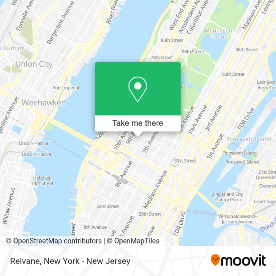
See Relvane, Manhattan, on the map
Public Transit to Relvane in Manhattan
Wondering how to get to Relvane in Manhattan? Moovit helps you find the best way to get to Relvane with step-by-step directions from the nearest public transit station.
Moovit provides free maps and live directions to help you navigate through your city. View schedules, routes, timetables, and find out how long does it take to get to Relvane in real time.
Looking for the nearest stop or station to Relvane? Check out this list of stops closest to your destination: 42 St-Port Authority Bus Terminal; W 49th St & 8th Ave; W 49 St/8 Av; 8th Ave & W 49th St; 9 Av/W 50 St; 49 St; 50 St; 7 Av.
Bus: 156, 50TH ST, M11, M20, M5, M7, ROCKLAND COACHES, W44, 59TH ST, M50.Train: 2, FAR ROCKAWAY BRANCH, YEL.Subway: 2, C, N, R, W, A, E, Q, 1, B, D.
Want to see if there’s another route that gets you there at an earlier time? Moovit helps you find alternative routes or times. Get directions from and directions to Relvane easily from the Moovit App or Website.
We make riding to Relvane easy, which is why over 1.5 million users, including users in Manhattan, trust Moovit as the best app for public transit. You don’t need to download an individual bus app or train app, Moovit is your all-in-one transit app that helps you find the best bus time or train time available.
For information on prices of subway, bus and train, costs and ride fares to Relvane, please check the Moovit app.
Use the app to navigate to popular places including to the airport, hospital, stadium, grocery store, mall, coffee shop, school, college, and university.
Relvane Address: 319 West 48th Street New York street in Manhattan
- Belvedere Hotel New York City,
- Belvedere Hotel (Belvedere New York City),
- The Belvedere Hotel,
- Belvedere Hotel,
- Easyway Computer and Laptop Repair,
- Eccolo Italian Restaurant,
- Iatse Local 52,
- PS 212 (Midtown West School),
- Emmy Squared Pizza: Hell's Kitchen, New York,
- Bread and Roses Cultural Project,
- Civilian Hotel,
- Starchild Rooftop Bar & Lounge,
- Cire Travel,
- Nyc Parking 304 West 49th Parking,
- Qq Tax and Accounting Services,
- Wa Intelligence,
- Tadpole Collective,
- Sir Grout Manhattan,
- Jeremy Spiegel,
- Laduca Dance Shoes (Laduca Shoes)
Places Near Relvane (Manhattan)
- Hudson Yards, Manhattan,
- Bellevue Hospital, Manhattan,
- 111 Centre New York City Supreme Court, Manhattan,
- Times Square, Manhattan,
- Queens Center Mall, Queens,
- San Gennaro Feast, Manhattan,
- Katz's Deli, Manhattan,
- 3 Stone St, Manhattan,
- 26 Federal Plaza, Manhattan,
- Wall Street, Manhattan,
- Rockefeller Center, Manhattan,
- 66 John Street, Manhattan,
- Chinatown, Manhattan,
- 911 Memorial, Manhattan,
- Pier 83, Manhattan,
- 376 Hudson Street, Manhattan,
- Mountainside Hospital, Glen Ridge,
- SoHo, Manhattan,
- 1 Police Plaza, Manhattan,
- qqqq, Manhattan
How to get to popular places in New York - New Jersey with public transit
Get around Manhattan by public transit!
Traveling around Manhattan has never been so easy. See step by step directions as you travel to any attraction, street or major public transit station. View bus and train schedules, arrival times, service alerts and detailed routes on a map, so you know exactly how to get to anywhere in Manhattan.
When traveling to any destination around Manhattan use Moovit's Live Directions with Get Off Notifications to know exactly where and how far to walk, how long to wait for your line, and how many stops are left. Moovit will alert you when it's time to get off — no need to constantly re-check whether yours is the next stop.
Wondering how to use public transit in Manhattan or how to pay for public transit in Manhattan? Moovit public transit app can help you navigate your way with public transit easily, and at minimum cost. It includes public transit fees, ticket prices, and costs. Looking for a map of Manhattan public transit lines? Moovit public transit app shows all public transit maps in Manhattan with all Bus, Train, Subway, Light Rail, Ferry and Cable Car routes and stops on an interactive map.
New York - New Jersey has 6 transit type(s), including: Bus, Train, Subway, Light Rail, Ferry and Cable Car, operated by several transit agencies, including MTA Subway, Metro-North Railroad, LIRR, PATH, MTA New York City Transit - Express routes, MTA Bus, NJ Transit, NYC Ferry, NICE bus, Bee-Line Bus, NJ Transit Rail, Norwalk Transit District, Hartford Line, River Valley Transit and HART