Directions to Renaissance (Arlington County) with public transportation
The following transit lines have routes that pass near Renaissance
 Bus: 43, A1X, 598, 282, 482.
- Train: MANASSAS LINE, FREDERICKSBURG LINE.
- Metro: BLUE, YELLOW, METRO STATION CLOSURE SHUTTLE.
How to get to Renaissance by bus?
Click on the bus route to see step by step directions with maps, line arrival times and updated time schedules.
From Ming Li's Happy Endings Massage Parlor, Washington
130 minFrom Jaleo, Washington
73 minFrom Arboretum, Washington
117 minFrom Washington Ballet, Washington
60 minFrom Club Quarters Hotel in Washington DC, Washington
54 minFrom Basilica of the National Shrine, Washington
120 minFrom US Passport Agency, Washington
58 minFrom United States National Arboretum, Washington
110 minFrom 8th St SE A St, Washington
91 minFrom Zaytinya, Washington
68 min
How to get to Renaissance by train?
Click on the train route to see step by step directions with maps, line arrival times and updated time schedules.
How to get to Renaissance by metro?
Click on the metro route to see step by step directions with maps, line arrival times and updated time schedules.
From Ming Li's Happy Endings Massage Parlor, Washington
66 minFrom Jaleo, Washington
34 minFrom Washington Ballet, Washington
63 minFrom Club Quarters Hotel in Washington DC, Washington
35 minFrom Basilica of the National Shrine, Washington
52 minFrom US Passport Agency, Washington
42 minFrom 8th St SE A St, Washington
52 minFrom Zaytinya, Washington
34 min
Bus stops near Renaissance in Arlington County
Metro station near Renaissance in Arlington County
- Pentagon City, 28 min walk,VIEW
Train station near Renaissance in Arlington County
- Crystal City, 38 min walk,VIEW
Bus lines to Renaissance in Arlington County
- A1X, South To Braddock Rd,VIEW
- 598, 598 Pentagon - Crystal City,VIEW
- 282, Crystal City Via Rosslyn & Pentagon,VIEW
- 482, Crystal City Via Rosslyn And Pentagon,VIEW
- 682, East Gate Via Stone Ridge II,VIEW
- 882, Loudoun Gateway,VIEW
- 972-C, Pentagon / Dale City,VIEW
- A11, North To Pentagon,VIEW
- A70, East To Potomac Yard,VIEW
What are the closest stations to Renaissance?
The closest stations to Renaissance are:
- Crystal City Transitway+27 St S is 176 yards away, 3 min walk.
- 23rd St @ Crystal Drive is 762 yards away, 10 min walk.
- 23rd St And Crystal Dr is 791 yards away, 10 min walk.
- Rt 1+23 St S is 895 yards away, 11 min walk.
- S Glebe Rd+S Eads St is 989 yards away, 12 min walk.
- Pentagon City is 2318 yards away, 28 min walk.
- Crystal City is 3263 yards away, 38 min walk.
Which bus lines stop near Renaissance?
These bus lines stop near Renaissance: 43, A1X.
Which train line stops near Renaissance?
MANASSAS LINE (Broad Run)
Which metro lines stop near Renaissance?
These metro lines stop near Renaissance: BLUE, YELLOW.
What’s the nearest metro station to Renaissance in Arlington County?
The nearest metro station to Renaissance in Arlington County is Pentagon City. It’s a 28 min walk away.
What’s the nearest bus station to Renaissance in Arlington County?
The nearest bus station to Renaissance in Arlington County is Crystal City Transitway+27 St S. It’s a 3 min walk away.
What time is the first metro to Renaissance in Arlington County?
The YELLOW is the first metro that goes to Renaissance in Arlington County. It stops nearby at 5:08 AM.
What time is the last metro to Renaissance in Arlington County?
The BLUE is the last metro that goes to Renaissance in Arlington County. It stops nearby at 12:29 AM.
What time is the first train to Renaissance in Arlington County?
The MANASSAS LINE is the first train that goes to Renaissance in Arlington County. It stops nearby at 6:04 AM.
What time is the last train to Renaissance in Arlington County?
The MANASSAS LINE is the last train that goes to Renaissance in Arlington County. It stops nearby at 7:15 PM.
What time is the first bus to Renaissance in Arlington County?
The A11 is the first bus that goes to Renaissance in Arlington County. It stops nearby at 4:56 AM.
What time is the last bus to Renaissance in Arlington County?
The A11 is the last bus that goes to Renaissance in Arlington County. It stops nearby at 1:41 AM.
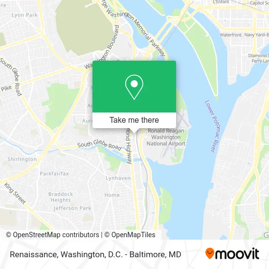
See Renaissance, Arlington County, on the map
Public Transit to Renaissance in Arlington County
Wondering how to get to Renaissance in Arlington County? Moovit helps you find the best way to get to Renaissance with step-by-step directions from the nearest public transit station.
Moovit provides free maps and live directions to help you navigate through your city. View schedules, routes, timetables, and find out how long does it take to get to Renaissance in real time.
Looking for the nearest stop or station to Renaissance? Check out this list of stops closest to your destination: Crystal City Transitway+27 St S; 23rd St @ Crystal Drive; 23rd St And Crystal Dr; Rt 1+23 St S; S Glebe Rd+S Eads St; Pentagon City; Crystal City.
Bus: 43, A1X, 598, 282, 482, 682, 882, 972-C, A11.Train: MANASSAS LINE, FREDERICKSBURG LINE.Metro: BLUE, YELLOW, METRO STATION CLOSURE SHUTTLE.
Want to see if there’s another route that gets you there at an earlier time? Moovit helps you find alternative routes or times. Get directions from and directions to Renaissance easily from the Moovit App or Website.
We make riding to Renaissance easy, which is why over 1.5 million users, including users in Arlington County, trust Moovit as the best app for public transit. You don’t need to download an individual bus app or train app, Moovit is your all-in-one transit app that helps you find the best bus time or train time available.
For information on prices of bus, metro and train, costs and ride fares to Renaissance, please check the Moovit app.
Use the app to navigate to popular places including to the airport, hospital, stadium, grocery store, mall, coffee shop, school, college, and university.
Renaissance Address: 2800 Potomac Ave Arlington, VA 22202 street in Arlington County
- 2800,S Potomac Ave Potomac Ave,
- Renaissance-Capital View Hotel,
- Renaissance Arlington Capital View Hotel,
- Courtyard by Marriott Arlington Crystal City / Reagan National Airport,
- Residence Inn Arlington Capital View,
- Courtyard by Marriott-Arlington-Crystal City ,
- 2800-2900 Crystal Drive Property,
- PGN,
- Financial Consulting Medical,
- Vista Technology Services,
- Crystal Bowl,
- Crystal City Dental Care,
- Residence Inn,
- Residence Inn Arlington Capital View ,
- Residence Inn by Marriott Arlington Capital View,
- Blerdcon,
- Hyatt Regency Crystal City at Reagan National Airport,
- Crystal City,
- Strategic Insight,
- Enterprise Commercial Trucks
Places Near Renaissance (Arlington County)
- Camden Yards, Baltimore,
- Capital One Arena, Washington,
- Rock Creek Tennis Center, Washington,
- National Museum of African American History and Culture, Washington,
- M&T Bank Stadium, Baltimore,
- Basilica of the National Shrine, Washington,
- Museum Of The Bible, Washington,
- Georgetown, Washington,
- PG Mall, Prince George's County,
- Amazon Hq2, Arlington County,
- Sibley Memorial Hospital, Washington,
- The Anthem, Washington,
- Marriott Marquis Washington, DC, Washington,
- Washington DC VA Medical Center, Washington,
- Pennsylvania Ave NW (3rd st and pennsylvania), Washington,
- Westfield Montgomery Mall, Montgomery County,
- Washington National Cathedral, Washington,
- Warner Theatre, Washington,
- National Mall, Washington,
- National Zoo, Washington
How to get to popular places in Washington, D.C. - Baltimore, MD with public transit
Get around Arlington County by public transit!
Traveling around Arlington County has never been so easy. See step by step directions as you travel to any attraction, street or major public transit station. View bus and train schedules, arrival times, service alerts and detailed routes on a map, so you know exactly how to get to anywhere in Arlington County.
When traveling to any destination around Arlington County use Moovit's Live Directions with Get Off Notifications to know exactly where and how far to walk, how long to wait for your line, and how many stops are left. Moovit will alert you when it's time to get off — no need to constantly re-check whether yours is the next stop.
Wondering how to use public transit in Arlington County or how to pay for public transit in Arlington County? Moovit public transit app can help you navigate your way with public transit easily, and at minimum cost. It includes public transit fees, ticket prices, and costs. Looking for a map of Arlington County public transit lines? Moovit public transit app shows all public transit maps in Arlington County with all Bus, Train, Metro, Light Rail and Ferry routes and stops on an interactive map.
Washington, D.C. - Baltimore, MD has 5 transit type(s), including: Bus, Train, Metro, Light Rail and Ferry, operated by several transit agencies, including WMATA, Montgomery County Ride On, Fairfax Connector, TheBus, PRTC, DASH - Alexandria, Arlington Transit (ART), RTA of Central Maryland, MDOT MTA, MDOT MTA Light RailLink, MDOT MTA Commuter Bus, MDOT MTA Local Bus, FXBGO!, Virginia Railway Express (VRE) and MARC