Directions to Rendezvous (New Haven) with public transportation
The following transit lines have routes that pass near Rendezvous
 Bus: 261, 271, 278, GREYHOUND US0240, GREYHOUND US0255S.
- Train: 3, NORTHEAST REGIONAL, VERMONTER, AMTRAK HARTFORD LINE, COMMUTER RAIL.
How to get to Rendezvous by bus?
Click on the bus route to see step by step directions with maps, line arrival times and updated time schedules.
How to get to Rendezvous by train?
Click on the train route to see step by step directions with maps, line arrival times and updated time schedules.
Bus stops near Rendezvous in New Haven
- Chapel St @ Orange St, 1 min walk,VIEW
- Chapel St & State St, 2 min walk,VIEW
- State St @ State St Rr Station, 3 min walk,VIEW
- Church St @ Center St, 3 min walk,VIEW
- Church St & Chapel St, 3 min walk,VIEW
- Chapel St @ Church St, 3 min walk,VIEW
- Chapel St @ Temple St, 4 min walk,VIEW
- Church St @ George St, 5 min walk,VIEW
Train stations near Rendezvous in New Haven
Bus lines to Rendezvous in New Haven
- 204, 204 - New Haven Via Forbes Ave,VIEW
- 206, 206f - East Chapel St-Ferry St,VIEW
- 212, 212ux - Universal Dr Via I-91,VIEW
- 223, 223 - Lombard St-Downtown New Haven,VIEW
- 274, 274 - Sargent Dr-Long Wharf,VIEW
- 950, 950 - Meriden-New Haven Express,VIEW
- 278, 278 - New Haven Connector-Downtown New Haven State St Rr Stn,VIEW
- 213, 213x - North Branford-Foxon Rd Via I-91,VIEW
- 215, 215m - Meriden-Amazon-Wallingford Rr Stn,VIEW
- 254, 254 - West Chapel St-Ella Grasso Blvd,VIEW
- 255, 255 - New Haven Via George St,VIEW
- 261, 261 - Boston Post Rd-Downtown New Haven,VIEW
- 262, 262 - Orange-New Haven,VIEW
- 265, 265b - Congress Ave-Bull Hill Ln,VIEW
- 268, 268c - Washington Ave-Veterans Hosp- West Haven Rr Stn,VIEW
- 271, 271r - Kimberly Ave-Bayshore Dr Via Jones Hill Rd Via Union Station,VIEW
- 272, 272 - Union Ave-Union Station-Columbus & Howard,VIEW
- 224, 224d - State St-Dmv-Devine St,VIEW
- 228, 228c - Whitney Ave-Centerville-Quinnipiac Univ,VIEW
- 229, 229 - Waterbury-Centerville Via Whitney Ave,VIEW
What are the closest stations to Rendezvous?
The closest stations to Rendezvous are:
- Chapel St @ Orange St is 1 yards away, 1 min walk.
- Chapel St & State St is 84 yards away, 2 min walk.
- State St @ State St Rr Station is 211 yards away, 3 min walk.
- Church St @ Center St is 212 yards away, 3 min walk.
- Church St & Chapel St is 218 yards away, 3 min walk.
- Chapel St @ Church St is 225 yards away, 3 min walk.
- Chapel St @ Temple St is 303 yards away, 4 min walk.
- Church St @ George St is 378 yards away, 5 min walk.
- New Haven State Street is 2217 yards away, 26 min walk.
- New Haven is 3727 yards away, 44 min walk.
Which bus lines stop near Rendezvous?
These bus lines stop near Rendezvous: 261, 271, 278, GREYHOUND US0240, GREYHOUND US0255S, USS.
Which train lines stop near Rendezvous?
These train lines stop near Rendezvous: 3, NORTHEAST REGIONAL, VERMONTER.
What’s the nearest train station to Rendezvous in New Haven?
The nearest train station to Rendezvous in New Haven is New Haven State Street. It’s a 26 min walk away.
What’s the nearest bus station to Rendezvous in New Haven?
The nearest bus station to Rendezvous in New Haven is Chapel St @ Orange St. It’s a 1 min walk away.
What time is the first train to Rendezvous in New Haven?
The 3 is the first train that goes to Rendezvous in New Haven. It stops nearby at 3:17 AM.
What time is the last train to Rendezvous in New Haven?
The 3 is the last train that goes to Rendezvous in New Haven. It stops nearby at 3:56 AM.
What time is the first bus to Rendezvous in New Haven?
The 243 is the first bus that goes to Rendezvous in New Haven. It stops nearby at 4:25 AM.
What time is the last bus to Rendezvous in New Haven?
The 228 is the last bus that goes to Rendezvous in New Haven. It stops nearby at 1:45 AM.
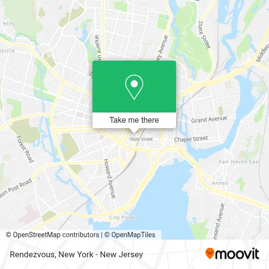
See Rendezvous, New Haven, on the map
Public Transit to Rendezvous in New Haven
Wondering how to get to Rendezvous in New Haven? Moovit helps you find the best way to get to Rendezvous with step-by-step directions from the nearest public transit station.
Moovit provides free maps and live directions to help you navigate through your city. View schedules, routes, timetables, and find out how long does it take to get to Rendezvous in real time.
Looking for the nearest stop or station to Rendezvous? Check out this list of stops closest to your destination: Chapel St @ Orange St; Chapel St & State St; State St @ State St Rr Station; Church St @ Center St; Church St & Chapel St; Chapel St @ Church St; Chapel St @ Temple St; Church St @ George St; New Haven State Street; New Haven.
Bus: 261, 271, 278, GREYHOUND US0240, GREYHOUND US0255S, USS, 204, 206, 212, 223, 274, 950, 224, 228, 229, 234.Train: 3, NORTHEAST REGIONAL, VERMONTER, AMTRAK HARTFORD LINE, COMMUTER RAIL, VALLEY FLYER, HARTFORD LINE, ACELA, COMMUTER RAIL.
Want to see if there’s another route that gets you there at an earlier time? Moovit helps you find alternative routes or times. Get directions from and directions to Rendezvous easily from the Moovit App or Website.
We make riding to Rendezvous easy, which is why over 1.5 million users, including users in New Haven, trust Moovit as the best app for public transit. You don’t need to download an individual bus app or train app, Moovit is your all-in-one transit app that helps you find the best bus time or train time available.
For information on prices of bus and train, costs and ride fares to Rendezvous, please check the Moovit app.
Use the app to navigate to popular places including to the airport, hospital, stadium, grocery store, mall, coffee shop, school, college, and university.
Location: New Haven, New York - New Jersey
- Rainbow Shops,
- Wireless Wiz,
- Rundown New Haven,
- Jonathan Perkins Injury Lawyers,
- Studio 101,
- Mile Zero 2 Smoke Shop,
- Coinflip Bitcoin Atm - Mile Zero 2 Smoke Shop (New Haven),
- Raw Juicescape,
- Flex Solutions Dental Lab Llc,
- Sans Serif Recording,
- Pine & Iron Axe Throwing,
- 37 Ways Inc,
- Dae,
- Market 360,
- Dryyp Sauna,
- B-Natural! (Formerly Woodland Coffee & Tea),
- Fletcher Cameron Design,
- Cita Park,
- A1 Chimney,
- The Department Of What Happened
Places Near Rendezvous (New Haven)
- 111 Centre New York City Supreme Court, Manhattan,
- Mountainside Hospital, Glen Ridge,
- qqqq, Manhattan,
- 1 Police Plaza, Manhattan,
- SoHo, Manhattan,
- 66 John Street, Manhattan,
- Pier 83, Manhattan,
- Wall Street, Manhattan,
- Hudson Yards, Manhattan,
- 376 Hudson Street, Manhattan,
- Times Square, Manhattan,
- Queens Center Mall, Queens,
- Rockefeller Center, Manhattan,
- 3 Stone St, Manhattan,
- 26 Federal Plaza, Manhattan,
- 911 Memorial, Manhattan,
- Katz's Deli, Manhattan,
- Chinatown, Manhattan,
- Bellevue Hospital, Manhattan,
- San Gennaro Feast, Manhattan
How to get to popular places in New York - New Jersey with public transit
Get around New Haven by public transit!
Traveling around New Haven has never been so easy. See step by step directions as you travel to any attraction, street or major public transit station. View bus and train schedules, arrival times, service alerts and detailed routes on a map, so you know exactly how to get to anywhere in New Haven.
When traveling to any destination around New Haven use Moovit's Live Directions with Get Off Notifications to know exactly where and how far to walk, how long to wait for your line, and how many stops are left. Moovit will alert you when it's time to get off — no need to constantly re-check whether yours is the next stop.
Wondering how to use public transit in New Haven or how to pay for public transit in New Haven? Moovit public transit app can help you navigate your way with public transit easily, and at minimum cost. It includes public transit fees, ticket prices, and costs. Looking for a map of New Haven public transit lines? Moovit public transit app shows all public transit maps in New Haven with all Bus, Train, Subway, Light Rail, Ferry and Cable Car routes and stops on an interactive map.
New York - New Jersey has 6 transit type(s), including: Bus, Train, Subway, Light Rail, Ferry and Cable Car, operated by several transit agencies, including MTA Subway, Metro-North Railroad, LIRR, PATH, MTA New York City Transit - Express routes, MTA Bus, NJ Transit, NYC Ferry, NICE bus, Bee-Line Bus, NJ Transit Rail, Norwalk Transit District, Hartford Line, River Valley Transit and HART