How to get to Rene Descartes 320 Urb. by bus?
Click on the bus route to see step by step directions with maps, line arrival times and updated time schedules.
From Av. Salaverry / Av. 28 de Julio, Jesus Mari
49 minFrom Paradero Aviación con Javier Prado, San Borja
34 minFrom PLAZA DE ARMAS, Lima
46 minFrom Avenida Arenales, Lima
55 minFrom Av. Canada con Av. Circunvalación, San Luis
36 minFrom Centro Comercial Chacarilla, Santiago D
39 minFrom EsSalud Policlínico Chincha, Lima
52 minFrom C.C. Jockey Plaza, San Borja
35 minFrom Cercado de Lima, Lima
52 min
Bus stops near Rene Descartes 320 Urb. in Ate
Metro station near Rene Descartes 320 Urb. in Ate
- Estación Mercado Santa Anita, 25 min walk,VIEW
Bus lines to Rene Descartes 320 Urb. in Ate
- 1112, Pachacamac - La Victoria - Pachacamac,VIEW
- 1235, Santo Domingo (Carabayllo) - Manchay (Pachacamac),VIEW
- 1281, Santa Clara (Ate) - Minka (Callao),VIEW
- 209, San Marcos (San Miguel) - Tagore (Ate),VIEW
- 1027, Ate - Rímac,VIEW
- 1073, Ate - Miraflores - Ate,VIEW
- 1074, San Isidro - Ate ,VIEW
- 1261, Bertello (Callao) - Santa Clara (Ate),VIEW
What are the closest stations to Rene Descartes 320 Urb.?
The closest stations to Rene Descartes 320 Urb. are:
- Flora Tristán is 290 meters away, 4 min walk.
- Huarochirí is 355 meters away, 6 min walk.
- Estación Mercado Santa Anita is 1955 meters away, 25 min walk.
Which bus lines stop near Rene Descartes 320 Urb.?
These bus lines stop near Rene Descartes 320 Urb.: 1027, 1073, 209.
What’s the nearest metro station to Rene Descartes 320 Urb. in Ate?
The nearest metro station to Rene Descartes 320 Urb. in Ate is Estación Mercado Santa Anita. It’s a 25 min walk away.
What’s the nearest bus station to Rene Descartes 320 Urb. in Ate?
The nearest bus station to Rene Descartes 320 Urb. in Ate is Flora Tristán. It’s a 4 min walk away.
What time is the first metro to Rene Descartes 320 Urb. in Ate?
The LINEA 2 is the first metro that goes to Rene Descartes 320 Urb. in Ate. It stops nearby at 6:00 AM.
What time is the last metro to Rene Descartes 320 Urb. in Ate?
The LINEA 2 is the last metro that goes to Rene Descartes 320 Urb. in Ate. It stops nearby at 11:02 PM.
What time is the first bus to Rene Descartes 320 Urb. in Ate?
The 1281 is the first bus that goes to Rene Descartes 320 Urb. in Ate. It stops nearby at 4:15 AM.
What time is the last bus to Rene Descartes 320 Urb. in Ate?
The 209 is the last bus that goes to Rene Descartes 320 Urb. in Ate. It stops nearby at 11:42 PM.
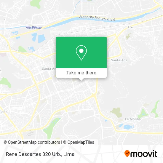
See Rene Descartes 320 Urb., Ate, on the map
Public Transit to Rene Descartes 320 Urb. in Ate
Wondering how to get to Rene Descartes 320 Urb. in Ate? Moovit helps you find the best way to get to Rene Descartes 320 Urb. with step-by-step directions from the nearest public transit station.
Moovit provides free maps and live directions to help you navigate through your city. View schedules, routes, timetables, and find out how long does it take to get to Rene Descartes 320 Urb. in real time.
Looking for the nearest stop or station to Rene Descartes 320 Urb.? Check out this list of stops closest to your destination: Flora Tristán; Huarochirí; Estación Mercado Santa Anita.
Bus: 1027, 1073, 209, 1112, 1235, 1281, 1074, 1261.Metro: LINEA 2.
Want to see if there’s another route that gets you there at an earlier time? Moovit helps you find alternative routes or times. Get directions from and directions to Rene Descartes 320 Urb. easily from the Moovit App or Website.
We make riding to Rene Descartes 320 Urb. easy, which is why over 1.5 million users, including users in Ate, trust Moovit as the best app for public transit. You don’t need to download an individual bus app or train app, Moovit is your all-in-one transit app that helps you find the best bus time or train time available.
For information on prices of bus, costs and ride fares to Rene Descartes 320 Urb., please check the Moovit app.
Use the app to navigate to popular places including to the airport, hospital, stadium, grocery store, mall, coffee shop, school, college, and university.
Rene Descartes 320 Urb. Address: Rene Descartes 320 Urb., Ate 15012, Perú street in Ate
- Resertec S.A.C,
- Importadora Sayan y Asociados,
- Santa Raquel 2 Etapa,
- Grupo Shanoc,
- Rene Descartes,
- New Expo SAC,
- Laboratorios SMASAC,
- Av Separadora Industrial Mz B Lote 11 12 Urb Santa Raquel,
- Comedor Santa Raquel - BCP,
- Fundición Central sa,
- Huaca Santa Raquel,
- Transportes 77 S.A.,
- Avenida Separadora Industrial 3208,
- Avenida Arboleda 157,
- Jr Javier Heraud 445 Dpto 203,
- Restaurant - Cevicheria Mi Norte Querido,
- Salón Del Reino De Los Testigos De Jehová,
- Av Arboleda 226 Dpto 102 (Urb Santa Raquel Tercera Etapa),
- Apolo,
- calle rene descartes 302 urbanizacion Santa Raquel
Places Near Rene Descartes 320 Urb. (Ate)
- Larcomar, Miraflores,
- Av. Salaverry, Jesus Mari,
- Mall Del Sur,
- Aeropuerto Internacional Jorge Chávez, Ventanilla,
- Circuito Mágico Del Agua, Lima,
- Real Plaza Puruchuco, Ate,
- Gamarra,
- Parque Kennedy, Miraflores,
- Parque de las Leyendas, San Miguel,
- Av. La Marina, San Miguel,
- av arequipa, Lima,
- Plaza San Miguel, San Miguel,
- Pontificia Universidad Católica del Perú - PUCP, San Miguel,
- Av. Abancay, Lima,
- Paradero Av.Brasil,
- Hospital Edgardo Rebagliati Martins, Jesus Mari,
- Centro Comercial Plaza Norte, Independen,
- Jockey Plaza, Santiago D,
- Barranco, Barranco,
- Miraflores, Miraflores
How to get to popular places in Lima with public transit
Get around Ate by public transit!
Traveling around Ate has never been so easy. See step by step directions as you travel to any attraction, street or major public transit station. View bus and train schedules, arrival times, service alerts and detailed routes on a map, so you know exactly how to get to anywhere in Ate.
When traveling to any destination around Ate use Moovit's Live Directions with Get Off Notifications to know exactly where and how far to walk, how long to wait for your line, and how many stops are left. Moovit will alert you when it's time to get off — no need to constantly re-check whether yours is the next stop.
Wondering how to use public transit in Ate or how to pay for public transit in Ate? Moovit public transit app can help you navigate your way with public transit easily, and at minimum cost. It includes public transit fees, ticket prices, and costs. Looking for a map of Ate public transit lines? Moovit public transit app shows all public transit maps in Ate with all Bus, Metro and Ferry routes and stops on an interactive map.
Lima has 3 transit type(s), including: Bus, Metro and Ferry, operated by several transit agencies, including Metro de Lima Línea 2 , Metro de Lima, Corredor Rojo, Metropolitano, Metropolitano - Alimentadores, Corredor Morado, Corredor Azul, Rutas Tradicionales, Transportes y Servicios La Esperanza S.A., Las Flores S.A., Virgen de la Asunción S.A., Consorcio HAM, Transportes y Service Canadá S.A., ETUL4SA and ETUCHISA