How to get to Reno by bus?
Click on the bus route to see step by step directions with maps, line arrival times and updated time schedules.
From Calle Diego de Leon, Madrid
50 minFrom Hospital General Universitario Gregorio Marañón., Área Metropolitana De Madrid Y Corredor Del Henares
42 minFrom C.C. Arturo Soria Plaza, Área Metropolitana De Madrid Y Corredor Del Henares
65 minFrom Julián Camarillo, Madrid
66 minFrom El Corte Inglés, Pozuelo De Alarcón
66 minFrom Calle Ulises, Madrid
64 minFrom Avenida de Manoteras 46 bis, Madrid
76 minFrom Metro Mar de Cristal, Madrid
77 minFrom Cibeles, Madrid
76 minFrom Alcalá 540- Edif. A - planta baja, Madrid
69 min
How to get to Reno by train?
Click on the train route to see step by step directions with maps, line arrival times and updated time schedules.
How to get to Reno by metro?
Click on the metro route to see step by step directions with maps, line arrival times and updated time schedules.
From Calle Diego de Leon, Madrid
33 minFrom Hospital General Universitario Gregorio Marañón., Área Metropolitana De Madrid Y Corredor Del Henares
42 minFrom C.C. Arturo Soria Plaza, Área Metropolitana De Madrid Y Corredor Del Henares
48 minFrom Julián Camarillo, Madrid
59 minFrom Calle Ulises, Madrid
42 minFrom Avenida de Manoteras 46 bis, Madrid
56 minFrom Metro Mar de Cristal, Madrid
36 minFrom Cibeles, Madrid
56 minFrom Alcalá 540- Edif. A - planta baja, Madrid
52 min
Bus stops near Reno in Madrid
Metro stations near Reno in Madrid
Train station near Reno in Madrid
- Príncipe Pío, 20 min walk,VIEW
Bus lines to Reno in Madrid
- 158, Plaza De España,VIEW
- 31, Plaza Mayor - Aluche,VIEW
- 36, Atocha - Campamento,VIEW
- 39, Plaza de España - Colonia San Ignacio de Loyola,VIEW
- 65, Plaza de Jacinto Benavente - Colonia Gran Capitan,VIEW
- N19, Plaza de Cibeles - Colonia San Ignacio de Loyola,VIEW
- 33, Casa De Campo,VIEW
- SC1, Legazpi,VIEW
- SC2, Cuatro Caminos,VIEW
- N18, Las Águilas,VIEW
- 138, Cristo Rey,VIEW
What are the closest stations to Reno?
The closest stations to Reno are:
- Paseo Jesuitas - Santa Úrsula is 26 meters away, 1 min walk.
- Paseo De Extremadura - Albéniz is 176 meters away, 3 min walk.
- Puerta Del Ángel is 297 meters away, 5 min walk.
- Metro Puerta Del Ángel is 548 meters away, 8 min walk.
- Lago is 1046 meters away, 14 min walk.
- Príncipe Pío is 1502 meters away, 20 min walk.
Which bus lines stop near Reno?
These bus lines stop near Reno: 158, 36, 39.
Which train line stops near Reno?
C10 (Villalba De Guadarrama)
Which metro line stops near Reno?
M-6 (Circular Andén 1)
What’s the nearest metro station to Reno in Madrid?
The nearest metro station to Reno in Madrid is Puerta Del Ángel. It’s a 7 min walk away.
What’s the nearest train station to Reno in Madrid?
The nearest train station to Reno in Madrid is Príncipe Pío. It’s a 20 min walk away.
What’s the nearest bus station to Reno in Madrid?
The nearest bus station to Reno in Madrid is Paseo Jesuitas - Santa Úrsula. It’s a 1 min walk away.
What time is the first metro to Reno in Madrid?
The M-6 is the first metro that goes to Reno in Madrid. It stops nearby at 6:05 AM.
What time is the last metro to Reno in Madrid?
The M-10 is the last metro that goes to Reno in Madrid. It stops nearby at 1:55 AM.
What time is the first train to Reno in Madrid?
The C7 is the first train that goes to Reno in Madrid. It stops nearby at 6:09 AM.
What time is the last train to Reno in Madrid?
The C7 is the last train that goes to Reno in Madrid. It stops nearby at 12:12 AM.
What time is the first bus to Reno in Madrid?
The 158 is the first bus that goes to Reno in Madrid. It stops nearby at 7:14 AM.
What time is the last bus to Reno in Madrid?
The N19 is the last bus that goes to Reno in Madrid. It stops nearby at 3:14 AM.
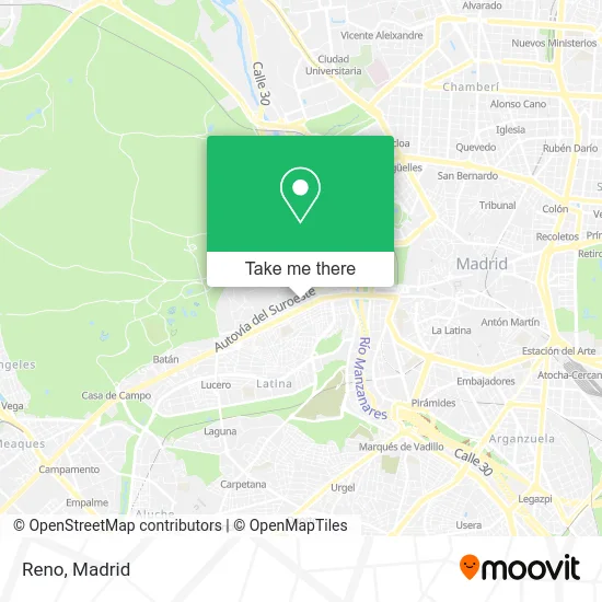
See Reno, Madrid, on the map
Public Transit to Reno in Madrid
Wondering how to get to Reno in Madrid? Moovit helps you find the best way to get to Reno with step-by-step directions from the nearest public transit station.
Moovit provides free maps and live directions to help you navigate through your city. View schedules, routes, timetables, and find out how long does it take to get to Reno in real time.
Looking for the nearest stop or station to Reno? Check out this list of stops closest to your destination: Paseo Jesuitas - Santa Úrsula; Paseo De Extremadura - Albéniz; Puerta Del Ángel; Metro Puerta Del Ángel; Lago; Príncipe Pío.
Bus: 158, 36, 39, 31, 65, N19.Train: C10, C7, MD, REG.Metro: M-6, M-10, M-R.
Want to see if there’s another route that gets you there at an earlier time? Moovit helps you find alternative routes or times. Get directions from and directions to Reno easily from the Moovit App or Website.
We make riding to Reno easy, which is why over 1.5 million users, including users in Madrid, trust Moovit as the best app for public transit. You don’t need to download an individual bus app or train app, Moovit is your all-in-one transit app that helps you find the best bus time or train time available.
For information on prices of metro, bus and train, costs and ride fares to Reno, please check the Moovit app.
Use the app to navigate to popular places including to the airport, hospital, stadium, grocery store, mall, coffee shop, school, college, and university.
Reno Address: Avenida de Portugal, 95 28011 Puerta del Ángel Madrid street in Madrid
- Luthier Germain Trumpf,
- Mappo,
- Campamentos Peñas Blancas,
- Arquidite,
- Revive Hair-Makeup,
- Vida y Salud,
- Mini Supermercado,
- Waffles & Bites,
- Hnos Ortiz Sanz,
- Taxi Licencia 507,
- Miguel Gonzalez Hernández,
- Parking de Avenida de Portugal,
- Hipertextil Cavero,
- Naturalfruit,
- Casañez,
- Peluquería y Cristina,
- Gabinete Aidac,
- Ministerio de Fomento,
- Calle Principal de Provincias 9,
- La Patoteca
Places Near Reno (Madrid)
- Mercadillo de Majadahonda, Majadahonda,
- Estadio Wanda Metropolitano, Área Metropolitana De Madrid Y Corredor Del Henares,
- Hospital Universitario Ramón y Cajal, Madrid,
- Centro Comercial Oasiz Madrid, Área Metropolitana De Madrid Y Corredor Del Henares,
- Rastro De Madrid, Área Metropolitana De Madrid Y Corredor Del Henares,
- Centro Comercial Islazul, Área Metropolitana De Madrid Y Corredor Del Henares,
- Centro Comercial La Gavia, Área Metropolitana De Madrid Y Corredor Del Henares,
- Hospital Universitario La Paz, Madrid,
- Sala La Riviera, Madrid,
- Centro Comercial La Vaguada, Área Metropolitana De Madrid Y Corredor Del Henares,
- Plenilunio, Área Metropolitana De Madrid Y Corredor Del Henares,
- Nassica, Área Metropolitana De Madrid Y Corredor Del Henares,
- Estacion de Chamartin, Madrid,
- Hospital Clínico Universitario San Carlos, Madrid,
- Calle de López de Hoyos 169, Madrid,
- Mendez Alvaro, Madrid,
- Plaza Mayor, Madrid,
- Palacio De Vistalegre, Área Metropolitana De Madrid Y Corredor Del Henares,
- Tres Aguas, Alcorcón,
- Wizink Center, Madrid
How to get to popular places in Madrid with public transit
Get around Madrid by public transit!
Traveling around Madrid has never been so easy. See step by step directions as you travel to any attraction, street or major public transit station. View bus and train schedules, arrival times, service alerts and detailed routes on a map, so you know exactly how to get to anywhere in Madrid.
When traveling to any destination around Madrid use Moovit's Live Directions with Get Off Notifications to know exactly where and how far to walk, how long to wait for your line, and how many stops are left. Moovit will alert you when it's time to get off — no need to constantly re-check whether yours is the next stop.
Wondering how to use public transit in Madrid or how to pay for public transit in Madrid? Moovit public transit app can help you navigate your way with public transit easily, and at minimum cost. It includes public transit fees, ticket prices, and costs. Looking for a map of Madrid public transit lines? Moovit public transit app shows all public transit maps in Madrid with all Bus, Train, Metro and Light Rail routes and stops on an interactive map.
Madrid has 4 transit type(s), including: Bus, Train, Metro and Light Rail, operated by several transit agencies, including Metro de Madrid, Metro Ligero, Tranvía de Parla, Renfe Cercanías - Servicios de Autobús especiales, Renfe Cercanias, Renfe Cercanías, EMT, Interurbanos, Urbanos de Alcalá de Henares, Urbanos de Alcobendas, Urbanos de Alcorcón, Urbanos de Algete, Urbanos de Aranjuez, Urbanos de Arganda del Rey and Urbanos de Arroyomolinos