How to get to Rent-A-Center by bus?
Click on the bus route to see step by step directions with maps, line arrival times and updated time schedules.
From New Day Meadery Tap Room & Production Facility, Indianapolis City (Balance)
59 minFrom TACO BELL, Indianapolis City (Balance)
65 minFrom Broad Ripple Park Tennis Courts, Indianapolis City (Balance)
70 minFrom Imilestones, Indianapolis City (Balance)
54 minFrom Pepsico, Indianapolis City (Balance)
41 minFrom Scottish Rite West Lot, Indianapolis City (Balance)
27 minFrom Binford Blvd / Allisonville Rd, Indianapolis City (Balance)
65 minFrom Indiana Senate, Indianapolis City (Balance)
29 minFrom Invent Learning Hub, Indianapolis City (Balance)
68 minFrom Lilly Corporate Center (Eli Lilly & Co), Indianapolis City (Balance)
41 min
Bus stops near Rent-A-Center in Indianapolis City (Balance)
Bus lines to Rent-A-Center in Indianapolis City (Balance)
What are the closest stations to Rent-A-Center?
The closest stations to Rent-A-Center are:
- Lafayette Rd & Roberta Dr is 178 yards away, 3 min walk.
- Noble Of Indiana - Tibbs Ave is 785 yards away, 10 min walk.
- 30th St & Kessler Blvd N Dr is 887 yards away, 11 min walk.
Which bus lines stop near Rent-A-Center?
These bus lines stop near Rent-A-Center: 30, 37.
What’s the nearest bus station to Rent-A-Center in Indianapolis City (Balance)?
The nearest bus station to Rent-A-Center in Indianapolis City (Balance) is Lafayette Rd & Roberta Dr. It’s a 3 min walk away.
What time is the first bus to Rent-A-Center in Indianapolis City (Balance)?
The 15 is the first bus that goes to Rent-A-Center in Indianapolis City (Balance). It stops nearby at 4:47 AM.
What time is the last bus to Rent-A-Center in Indianapolis City (Balance)?
The 37 is the last bus that goes to Rent-A-Center in Indianapolis City (Balance). It stops nearby at 11:20 PM.
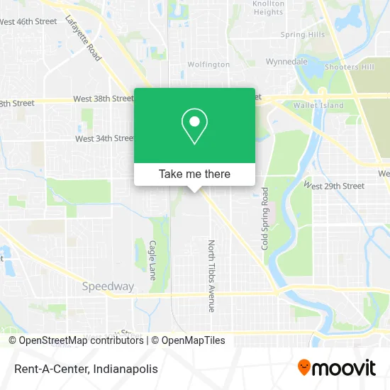
See Rent-A-Center, Indianapolis City (Balance), on the map
Public Transit to Rent-A-Center in Indianapolis City (Balance)
Wondering how to get to Rent-A-Center in Indianapolis City (Balance)? Moovit helps you find the best way to get to Rent-A-Center with step-by-step directions from the nearest public transit station.
Moovit provides free maps and live directions to help you navigate through your city. View schedules, routes, timetables, and find out how long does it take to get to Rent-A-Center in real time.
Looking for the nearest stop or station to Rent-A-Center? Check out this list of stops closest to your destination: Lafayette Rd & Roberta Dr; Noble Of Indiana - Tibbs Ave; 30th St & Kessler Blvd N Dr.
Bus: 30, 37, 25, 15.
Want to see if there’s another route that gets you there at an earlier time? Moovit helps you find alternative routes or times. Get directions from and directions to Rent-A-Center easily from the Moovit App or Website.
We make riding to Rent-A-Center easy, which is why over 1.5 million users, including users in Indianapolis City (Balance), trust Moovit as the best app for public transit. You don’t need to download an individual bus app or train app, Moovit is your all-in-one transit app that helps you find the best bus time or train time available.
For information on prices of bus, costs and ride fares to Rent-A-Center, please check the Moovit app.
Use the app to navigate to popular places including to the airport, hospital, stadium, grocery store, mall, coffee shop, school, college, and university.
Rent-A-Center Address: 2802 Lafayette Rd street in Indianapolis City (Balance)
- THE NORTH FACE,
- New Generation Church NGC,
- T-Mobile,
- Eagledale Healthcare Clinic,
- Five Star Restaurant,
- La Cascada Salon de Eventos,
- Fiscal Tax,
- Eagledale Plaza Shopping Center,
- Ricks Cafe Administration,
- Westend Dental,
- Affordable Dental Care,
- Dr. Tavel Family Eye Care,
- Amvets 99,
- Dr. Tavel Corporate Office,
- Amazon Locker-Benedettina,
- Maxx Taxx,
- Rainbowshops,
- Latino Express Professional Multi Tax Services,
- Independent Pleasure & Benefit,
- First Karen Baptist Church
Places Near Rent-A-Center (Indianapolis City (Balance))
- Indiana, Indianapolis City (Balance),
- Lucas Oil Stadium, Indianapolis City (Balance),
- Indianapolis Motor Speedway, Speedway,
- 119 W 19th St Parking, Indianapolis City (Balance),
- Plainfield, IN, Plainfield,
- Castleton Square Mall, Indianapolis,
- Cotter's Massage Parlor With Happy Endings, Indianapolis City (Balance),
- Train Ride At Castleton Mall, Indianapolis City (Balance),
- Lilly Corporate Center (Eli Lilly & Co), Indianapolis City (Balance),
- Eskenazi Hospital, Indianapolis City (Balance),
- I U Health Methodist Hospital, Indianapolis City (Balance),
- Gainbridge Fieldhouse, Indianapolis City (Balance),
- Indianapolis Airport Zone 2, Indianapolis City (Balance),
- Methodist Hospital of Indianapolis, Indianapolis City (Balance),
- St. Vincent Hospital - Indianapolis, Indianapolis City (Balance),
- Jersey Barn, Indianapolis City (Balance),
- I-465 / I-65 Interchange, Indianapolis City (Balance),
- THE BALT, Indianapolis City (Balance),
- St. Vincent entrance #1, Indianapolis City (Balance),
- Indiana Convention Center, Indianapolis City (Balance)
How to get to popular places in Indianapolis with public transit
Get around Indianapolis City (Balance) by public transit!
Traveling around Indianapolis City (Balance) has never been so easy. See step by step directions as you travel to any attraction, street or major public transit station. View bus and train schedules, arrival times, service alerts and detailed routes on a map, so you know exactly how to get to anywhere in Indianapolis City (Balance).
When traveling to any destination around Indianapolis City (Balance) use Moovit's Live Directions with Get Off Notifications to know exactly where and how far to walk, how long to wait for your line, and how many stops are left. Moovit will alert you when it's time to get off — no need to constantly re-check whether yours is the next stop.
Wondering how to use public transit in Indianapolis City (Balance) or how to pay for public transit in Indianapolis City (Balance)? Moovit public transit app can help you navigate your way with public transit easily, and at minimum cost. It includes public transit fees, ticket prices, and costs. Looking for a map of Indianapolis City (Balance) public transit lines? Moovit public transit app shows all public transit maps in Indianapolis City (Balance) with all bus routes and stops on an interactive map.
Indianapolis has 1 transit type(s), including: bus, operated by several transit agencies, including IndyGo, FlixBus-us and Greyhound-us