How to get to Rental Assistance Website by bus?
Click on the bus route to see step by step directions with maps, line arrival times and updated time schedules.
Bus stops near Rental Assistance Website in Virginia Beach
Light Rail stations near Rental Assistance Website in Virginia Beach
- Newtown Road Station, 36 min walk,VIEW
Bus lines to Rental Assistance Website in Virginia Beach
What are the closest stations to Rental Assistance Website?
The closest stations to Rental Assistance Website are:
- Baker & Hampshire is 189 yards away, 3 min walk.
- Newtown & Lake Edward is 458 yards away, 6 min walk.
- Newtown Road Station is 3021 yards away, 36 min walk.
Which bus lines stop near Rental Assistance Website?
These bus lines stop near Rental Assistance Website: 020, 027.
What’s the nearest bus station to Rental Assistance Website in Virginia Beach?
The nearest bus station to Rental Assistance Website in Virginia Beach is Baker & Hampshire. It’s a 3 min walk away.
What time is the first light rail to Rental Assistance Website in Virginia Beach?
The 800 is the first light rail that goes to Rental Assistance Website in Virginia Beach. It stops nearby at 5:27 AM.
What time is the last light rail to Rental Assistance Website in Virginia Beach?
The 800 is the last light rail that goes to Rental Assistance Website in Virginia Beach. It stops nearby at 11:54 PM.
What time is the first bus to Rental Assistance Website in Virginia Beach?
The 022 is the first bus that goes to Rental Assistance Website in Virginia Beach. It stops nearby at 6:08 AM.
What time is the last bus to Rental Assistance Website in Virginia Beach?
The 027 is the last bus that goes to Rental Assistance Website in Virginia Beach. It stops nearby at 11:44 PM.
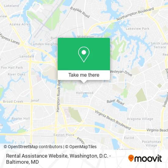
See Rental Assistance Website, Virginia Beach, on the map
Public Transit to Rental Assistance Website in Virginia Beach
Wondering how to get to Rental Assistance Website in Virginia Beach? Moovit helps you find the best way to get to Rental Assistance Website with step-by-step directions from the nearest public transit station.
Moovit provides free maps and live directions to help you navigate through your city. View schedules, routes, timetables, and find out how long does it take to get to Rental Assistance Website in real time.
Looking for the nearest stop or station to Rental Assistance Website? Check out this list of stops closest to your destination: Baker & Hampshire; Newtown & Lake Edward; Newtown Road Station.
Bus: 020, 027, 022.
Want to see if there’s another route that gets you there at an earlier time? Moovit helps you find alternative routes or times. Get directions from and directions to Rental Assistance Website easily from the Moovit App or Website.
We make riding to Rental Assistance Website easy, which is why over 1.5 million users, including users in Virginia Beach, trust Moovit as the best app for public transit. You don’t need to download an individual bus app or train app, Moovit is your all-in-one transit app that helps you find the best bus time or train time available.
For information on prices of bus, costs and ride fares to Rental Assistance Website, please check the Moovit app.
Use the app to navigate to popular places including to the airport, hospital, stadium, grocery store, mall, coffee shop, school, college, and university.
Rental Assistance Website Address: 749 Trellis Way Virginia Beach, VA 23462 street in Virginia Beach
- Brandywine Apartments,
- Amurcon Realty Company,
- Hamptons,
- B and B Real Estate Rehab and Wholesale,
- Luxury Brown Sports Bar & Dance Club,
- Martins Soul Food,
- Club Royale Blue,
- Queen African Hair Braiding,
- Virginia Prep,
- New Life House of Prayer Cof Church,
- Precision Kutts,
- MR. Vladyslav Vorobiov,
- Rhema Outreach Center,
- Summer Haven Apartments,
- ATM,
- Mimmie's Learning Academy,
- Round Bay Road Norfolk VA,
- Wesleyan Courts Apartments,
- Honeycomb Hair Bar,
- Rays Trucking
Places Near Rental Assistance Website (Virginia Beach)
- National Theatre, Washington,
- National Zoo, Washington,
- Washington National Cathedral, Washington,
- National Museum of African American History and Culture, Washington,
- Sibley Memorial Hospital, Washington,
- The Anthem, Washington,
- Georgetown, Washington,
- M&T Bank Stadium, Baltimore,
- Camden Yards, Baltimore,
- Marriott Marquis Washington, DC, Washington,
- Basilica of the National Shrine, Washington,
- Westfield Montgomery Mall, Montgomery County,
- Amazon Hq2, Arlington County,
- Museum Of The Bible, Washington,
- Washington DC VA Medical Center, Washington,
- Pennsylvania Ave NW (3rd st and pennsylvania), Washington,
- PG Mall, Prince George's County,
- Rock Creek Tennis Center, Washington,
- Capital One Arena, Washington,
- Warner Theatre, Washington
How to get to popular places in Washington, D.C. - Baltimore, MD with public transit
Get around Virginia Beach by public transit!
Traveling around Virginia Beach has never been so easy. See step by step directions as you travel to any attraction, street or major public transit station. View bus and train schedules, arrival times, service alerts and detailed routes on a map, so you know exactly how to get to anywhere in Virginia Beach.
When traveling to any destination around Virginia Beach use Moovit's Live Directions with Get Off Notifications to know exactly where and how far to walk, how long to wait for your line, and how many stops are left. Moovit will alert you when it's time to get off — no need to constantly re-check whether yours is the next stop.
Wondering how to use public transit in Virginia Beach or how to pay for public transit in Virginia Beach? Moovit public transit app can help you navigate your way with public transit easily, and at minimum cost. It includes public transit fees, ticket prices, and costs. Looking for a map of Virginia Beach public transit lines? Moovit public transit app shows all public transit maps in Virginia Beach with all Bus, Train, Metro, Light Rail and Ferry routes and stops on an interactive map.
Washington, D.C. - Baltimore, MD has 5 transit type(s), including: Bus, Train, Metro, Light Rail and Ferry, operated by several transit agencies, including WMATA, Montgomery County Ride On, Fairfax Connector, TheBus, PRTC, DASH - Alexandria, Arlington Transit (ART), RTA of Central Maryland, MDOT MTA, MDOT MTA Light RailLink, MDOT MTA Commuter Bus, MDOT MTA Local Bus, FXBGO!, Virginia Railway Express (VRE) and MARC