How to get to Rental Made Simple by bus?
Click on the bus route to see step by step directions with maps, line arrival times and updated time schedules.
From Florida National University (FNU), Hialeah
65 minFrom San Judas Tadeo Church, Miami
65 minFrom Loews Hotel, Miami
61 minFrom Lincoln Road Mall & Lincoln Road, Miami Beach
73 minFrom Trump National Doral Miami, North Westside
52 minFrom Miami Passport Agency, Miami
43 minFrom Miami Escorts, Miami Beach
72 minFrom Consulado General de Honduras en Miami, Miami
78 minFrom Walmart Supercenter, Hialeah
81 minFrom Century Medical Center, Miami
40 min
How to get to Rental Made Simple by train?
Click on the train route to see step by step directions with maps, line arrival times and updated time schedules.
Bus stops near Rental Made Simple in Miami
Train stations near Rental Made Simple in Miami
Bus lines to Rental Made Simple in Miami
What are the closest stations to Rental Made Simple?
The closest stations to Rental Made Simple are:
- Nw 36 St & Nw 25 Av is 355 yards away, 5 min walk.
- Nw 27 Av & Nw 36 St is 457 yards away, 6 min walk.
- Earlington Hts.stat.rail Southbound is 2334 yards away, 28 min walk.
- Hialeah Market Station is 4393 yards away, 52 min walk.
Which bus lines stop near Rental Made Simple?
These bus lines stop near Rental Made Simple: 27, 36.
Which train lines stop near Rental Made Simple?
These train lines stop near Rental Made Simple: GREEN, ORANGE.
What’s the nearest train station to Rental Made Simple in Miami?
The nearest train station to Rental Made Simple in Miami is Earlington Hts.stat.rail Southbound. It’s a 28 min walk away.
What’s the nearest bus station to Rental Made Simple in Miami?
The nearest bus station to Rental Made Simple in Miami is Nw 36 St & Nw 25 Av. It’s a 5 min walk away.
What time is the first train to Rental Made Simple in Miami?
The TRIRAIL is the first train that goes to Rental Made Simple in Miami. It stops nearby at 3:50 AM.
What time is the last train to Rental Made Simple in Miami?
The GREEN is the last train that goes to Rental Made Simple in Miami. It stops nearby at 12:44 AM.
What time is the first bus to Rental Made Simple in Miami?
The 27 is the first bus that goes to Rental Made Simple in Miami. It stops nearby at 3:17 AM.
What time is the last bus to Rental Made Simple in Miami?
The 27 is the last bus that goes to Rental Made Simple in Miami. It stops nearby at 3:26 AM.
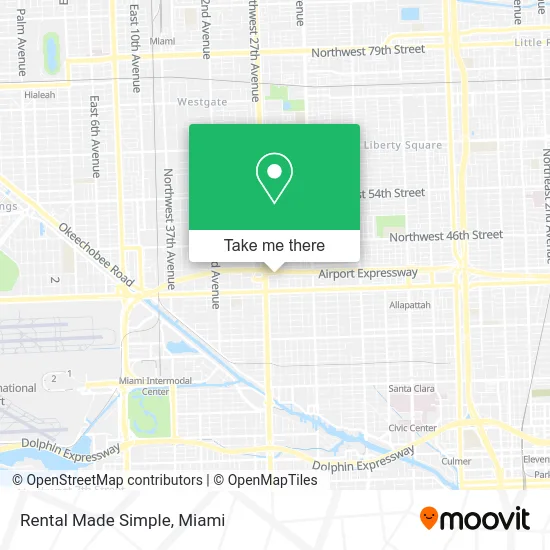
See Rental Made Simple, Miami, on the map
Public Transit to Rental Made Simple in Miami
Wondering how to get to Rental Made Simple in Miami? Moovit helps you find the best way to get to Rental Made Simple with step-by-step directions from the nearest public transit station.
Moovit provides free maps and live directions to help you navigate through your city. View schedules, routes, timetables, and find out how long does it take to get to Rental Made Simple in real time.
Looking for the nearest stop or station to Rental Made Simple? Check out this list of stops closest to your destination: Nw 36 St & Nw 25 Av; Nw 27 Av & Nw 36 St; Earlington Hts.stat.rail Southbound; Hialeah Market Station.
Bus: 27, 36.Train: GREEN, ORANGE, TRIRAIL.
Want to see if there’s another route that gets you there at an earlier time? Moovit helps you find alternative routes or times. Get directions from and directions to Rental Made Simple easily from the Moovit App or Website.
We make riding to Rental Made Simple easy, which is why over 1.5 million users, including users in Miami, trust Moovit as the best app for public transit. You don’t need to download an individual bus app or train app, Moovit is your all-in-one transit app that helps you find the best bus time or train time available.
For information on prices of bus and train, costs and ride fares to Rental Made Simple, please check the Moovit app.
Use the app to navigate to popular places including to the airport, hospital, stadium, grocery store, mall, coffee shop, school, college, and university.
Rental Made Simple Address: NW 39th St Miami, FL 33142 street in Miami
- Fonsek Cleaning Ser,
- E G Maziad,
- Diverse Value Services,
- Handy Pro Castillo,
- Healing with Rae,
- Prime Soul Food,
- Tabueno305,
- Rolando's License Restoration,
- Bosslady Catering Services,
- Dapper Kitchen,
- TJ Car Wash & Detailing,
- Mai's Skin & Bodycare Treatment,
- Amy Nailstech,
- Bimar,
- Roadside Auto Tech,
- Aka Shine,
- Slick Recovery,
- Aqua Blasters,
- Gopherwood Construction,
- Kglass
Places Near Rental Made Simple (Miami)
- Sawgrass mall ( FL ), Miami Beach,
- Miami-Dade County Courthouse, Miami,
- Miami VA Hospital, Miami,
- Dolphin Mall, Miami,
- Aventura Mall, Miami Beach,
- Miami Design District, Miami,
- Brickell City Centre, Miami,
- Aventura Mall, Miami,
- Richard E. Gerstein Justice Building, Miami,
- Port of Miami Cruise Terminal, Miami,
- Wynwood, Miami,
- Marlins Park, Miami,
- Little Havana, Miami,
- Bayside Marketplace, Miami,
- Dolphin Mall Bus, Miami,
- Keiser University Flagship Campus, West Palm Beach,
- Hard Rock Stadium, Miami Gardens,
- Zoo Miami, Miami,
- Sawgrass Mall, Miami,
- Miami Freedom Park, Miami
How to get to popular places in Miami with public transit
Get around Miami by public transit!
Traveling around Miami has never been so easy. See step by step directions as you travel to any attraction, street or major public transit station. View bus and train schedules, arrival times, service alerts and detailed routes on a map, so you know exactly how to get to anywhere in Miami.
When traveling to any destination around Miami use Moovit's Live Directions with Get Off Notifications to know exactly where and how far to walk, how long to wait for your line, and how many stops are left. Moovit will alert you when it's time to get off — no need to constantly re-check whether yours is the next stop.
Wondering how to use public transit in Miami or how to pay for public transit in Miami? Moovit public transit app can help you navigate your way with public transit easily, and at minimum cost. It includes public transit fees, ticket prices, and costs. Looking for a map of Miami public transit lines? Moovit public transit app shows all public transit maps in Miami with all Bus, Train, Light Rail and Ferry routes and stops on an interactive map.
Miami has 4 transit type(s), including: Bus, Train, Light Rail and Ferry, operated by several transit agencies, including Broward County Transit, Miami-Dade Transit, Metrorail, Palm Tran, Tri-Rail, Brightline, MARTY, City of Homestead Trolley, Key West Transit, Treasure Coast Connector, GoLine IRT, Amtrak, Greyhound-us, FlixBus-us and Aventura Express Shuttle Bus