How to get to Rentinguimaraes by bus?
Click on the bus route to see step by step directions with maps, line arrival times and updated time schedules.
From Hospital Narciso Ferreira, Vila Nova De Famalicão
41 minFrom Joane, Joane
68 minFrom X-Aqua, Vila Nova do Campo
78 minFrom Quinta Solar da Bordoa, Prazins (Santo Tirso) e Corvite
63 minFrom E009 Vizela, Caldas de Vizela
30 minFrom Escola Superior de Tecnologias de Fafe, Medelo
52 minFrom Moreirense Futebol Clube, Guimarães
52 minFrom Riba D'Ave, Vila Nova De Famalicão
43 minFrom Roriz, Santo Tirso
111 minFrom Farturas Félix, Margaride (Santa Eulália), Várzea, Lagares, Varziela e Moure
34 min
How to get to Rentinguimaraes by train?
Click on the train route to see step by step directions with maps, line arrival times and updated time schedules.
Bus stops near Rentinguimaraes in Oliveira, São Paio e São Sebastião
Train stations near Rentinguimaraes in Oliveira, São Paio e São Sebastião
Bus lines to Rentinguimaraes in Oliveira, São Paio e São Sebastião
- 003, Linha Cidade (via Azurém e Madre Deus),VIEW
- 011, Campo da Feira - Moreira de Cónegos/Gandarela,VIEW
- N11, Circular | Nespereira | Gandarela,VIEW
- 022, Penha - Guimarães (Terminal) (via Matamá e São Romão),VIEW
- 180, Pinheiro - Guimarães (via S.Faustino e Covas),VIEW
- 189, Calvos - Guimarães (via Penteeiros),VIEW
- 2347, Fafe (Terminal) - Guimarães (Terminal),VIEW
- 2350, Fafe (Terminal) - Guimarães (Terminal) (via Fareja e Outeiro),VIEW
- 3876, Guimarães (Terminal) - Vizela (Ciclo),VIEW
- 9303, Guimarães (Terminal) - Vila das Aves (Igreja),VIEW
- 9306, Guimarães (Terminal) - Felgueiras (Terminal),VIEW
- 004, Circular ⟳ Guimarães (Terminal) (via Toural),VIEW
- 012, Abação (Igreja),VIEW
- 014, Largo de São Simão,VIEW
- 181, S.Paio de Vizela,VIEW
- 182, Lapa,VIEW
- 188, Guimarães (Terminal Rodoviário),VIEW
- 021, Paçô Vieira,VIEW
- N21, Circular ↻ Pedroso - Belos Ares,VIEW
- 051, Rampa da Penha,VIEW
What are the closest stations to Rentinguimaraes?
The closest stations to Rentinguimaraes are:
- São Gualter is 181 meters away, 3 min walk.
- Campo da Feira is 427 meters away, 6 min walk.
- S. Dâmaso Sul is 450 meters away, 6 min walk.
- S. Dâmaso Norte is 496 meters away, 7 min walk.
- Toural is 526 meters away, 7 min walk.
- Covas is 1842 meters away, 24 min walk.
- Guimaraes is 3531 meters away, 46 min walk.
Which bus lines stop near Rentinguimaraes?
These bus lines stop near Rentinguimaraes: 011, 022, 071, 101, 2347, 3571, 3876, 9306.
Which train line stops near Rentinguimaraes?
LINHA DE GUIMARAES (Guimaraes)
What’s the nearest train station to Rentinguimaraes in Oliveira, São Paio e São Sebastião?
The nearest train station to Rentinguimaraes in Oliveira, São Paio e São Sebastião is Covas. It’s a 24 min walk away.
What’s the nearest bus station to Rentinguimaraes in Oliveira, São Paio e São Sebastião?
The nearest bus station to Rentinguimaraes in Oliveira, São Paio e São Sebastião is São Gualter. It’s a 3 min walk away.
What time is the first train to Rentinguimaraes in Oliveira, São Paio e São Sebastião?
The LINHA DE GUIMARAES is the first train that goes to Rentinguimaraes in Oliveira, São Paio e São Sebastião. It stops nearby at 6:51 AM.
What time is the last train to Rentinguimaraes in Oliveira, São Paio e São Sebastião?
The LINHA DE GUIMARAES is the last train that goes to Rentinguimaraes in Oliveira, São Paio e São Sebastião. It stops nearby at 12:35 AM.
What time is the first bus to Rentinguimaraes in Oliveira, São Paio e São Sebastião?
The 042 is the first bus that goes to Rentinguimaraes in Oliveira, São Paio e São Sebastião. It stops nearby at 6:30 AM.
What time is the last bus to Rentinguimaraes in Oliveira, São Paio e São Sebastião?
The N41 is the last bus that goes to Rentinguimaraes in Oliveira, São Paio e São Sebastião. It stops nearby at 11:55 PM.
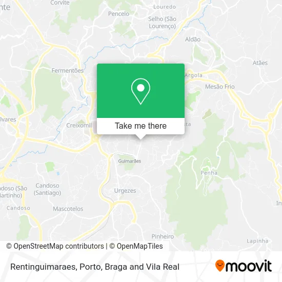
See Rentinguimaraes, Oliveira, São Paio e São Sebastião, on the map
Public Transit to Rentinguimaraes in Oliveira, São Paio e São Sebastião
Wondering how to get to Rentinguimaraes in Oliveira, São Paio e São Sebastião? Moovit helps you find the best way to get to Rentinguimaraes with step-by-step directions from the nearest public transit station.
Moovit provides free maps and live directions to help you navigate through your city. View schedules, routes, timetables, and find out how long does it take to get to Rentinguimaraes in real time.
Looking for the nearest stop or station to Rentinguimaraes? Check out this list of stops closest to your destination: São Gualter; Campo da Feira; S. Dâmaso Sul; S. Dâmaso Norte; Toural; Covas; Guimaraes.
Bus: 011, 022, 071, 101, 2347, 3571, 3876, 9306, 003, N11, 180, 004, 012, 014, 181, 182, 021, N21, 051, N51, 031, 041, N41, 042, N42.Train: LINHA DE GUIMARAES, IC.
Want to see if there’s another route that gets you there at an earlier time? Moovit helps you find alternative routes or times. Get directions from and directions to Rentinguimaraes easily from the Moovit App or Website.
We make riding to Rentinguimaraes easy, which is why over 1.5 million users, including users in Oliveira, São Paio e São Sebastião, trust Moovit as the best app for public transit. You don’t need to download an individual bus app or train app, Moovit is your all-in-one transit app that helps you find the best bus time or train time available.
For information on prices of bus and train, costs and ride fares to Rentinguimaraes, please check the Moovit app.
Use the app to navigate to popular places including to the airport, hospital, stadium, grocery store, mall, coffee shop, school, college, and university.
Rentinguimaraes Address: Avenida Dom João IV São Sebastião, 4810-533 Guimarães street in Oliveira, São Paio e São Sebastião
- Tattoon Lda,
- Shop,
- Era,
- Cvp - Cruz Vermelha Portuguesa - Delegação de Guimarães,
- Agencia Abreu,
- Nutricionista Ana Magalhães Pereira,
- Clínica Veterinária de Guimarães,
- Centro de Estética Jaqueline,
- Remax Vitória,
- Espaço de Beleza Andreia,
- Santander,
- Cartório Notarial Bruno Vieira,
- Diogo Cunha - Clínica de Implantologia e Estética Oral,
- Beth Martin PE,
- Conservatória do Registo Civil de Guimarães,
- Podoclínica Guimarães,
- Daniel Mendes Moreira e Mariana Mendes Moreira - Advogados,
- As Vaidosas - Unhas e Maquilhagem,
- Dress Yourself Consultoria de Imagem,
- Monumento Nicolino
Places Near Rentinguimaraes (Oliveira, São Paio e São Sebastião)
- Palácio de Cristal, Lordelo do Ouro e Massarelos,
- Exponor, Matosinhos e Leça da Palmeira,
- Espinho, Espinho,
- Maia, Maia,
- Hospital da Prelada, Ramalde,
- VILA do CONDE PORTO FASHION OUTLET, Modivas,
- Arrábida Shopping, Santa Marinha e São Pedro da Afurada,
- Avintes, Vila Nova De Gaia,
- Hospital Santos Silva, Vila Nova De Gaia,
- El Corte Inglés de Gaia, Mafamude e Vilar do Paraíso,
- Rua Calouste Gulbenkian, Lordelo do Ouro e Massarelos,
- Valongo, Valongo,
- Acesso ao Shopping Parque Nascente, Campanhã,
- MAR Shopping, Matosinhos e Leça da Palmeira,
- Parque Aquatico Amarante - Aqua Aventura, Amarante,
- Leça da Palmeira, Matosinhos e Leça da Palmeira,
- Canidelo, Vila Nova De Gaia,
- Hospital de Santo António, Cedofeita, Santo Ildefonso, Sé, Miragaia, São Nicolau e Vitória,
- Zoo Santo Inácio, Vila Nova De Gaia,
- Senhor de Matosinhos, Matosinhos e Leça da Palmeira
How to get to popular places in Porto, Braga and Vila Real with public transit
Get around Oliveira, São Paio e São Sebastião by public transit!
Traveling around Oliveira, São Paio e São Sebastião has never been so easy. See step by step directions as you travel to any attraction, street or major public transit station. View bus and train schedules, arrival times, service alerts and detailed routes on a map, so you know exactly how to get to anywhere in Oliveira, São Paio e São Sebastião.
When traveling to any destination around Oliveira, São Paio e São Sebastião use Moovit's Live Directions with Get Off Notifications to know exactly where and how far to walk, how long to wait for your line, and how many stops are left. Moovit will alert you when it's time to get off — no need to constantly re-check whether yours is the next stop.
Wondering how to use public transit in Oliveira, São Paio e São Sebastião or how to pay for public transit in Oliveira, São Paio e São Sebastião? Moovit public transit app can help you navigate your way with public transit easily, and at minimum cost. It includes public transit fees, ticket prices, and costs. Looking for a map of Oliveira, São Paio e São Sebastião public transit lines? Moovit public transit app shows all public transit maps in Oliveira, São Paio e São Sebastião with all Bus, Train, Metro, Ferry, Funicular and Gondola routes and stops on an interactive map.
Porto, Braga and Vila Real has 6 transit type(s), including: Bus, Train, Metro, Ferry, Funicular and Gondola, operated by several transit agencies, including Metro do Porto, Metro do Porto - Metrobus, CP - Comboios de Portugal, STCP, UNIR Mobilidade da Area Metropolitana do Porto, Getbus - Aerobus, Mobiave, Valpibus, TUB - Transportes Urbanos de Braga, TuViana, Guimabus, Ave Mobilidade, Cávado Mobilidade, Transdev and Câmara Municipal de Santo Tirso