How to get to Renton Family Practice by bus?
Click on the bus route to see step by step directions with maps, line arrival times and updated time schedules.
From Alaska Airlines Baggage Office
34 minFrom Winco Foods
46 minFrom Sleep Inn
49 minFrom The Royal Room
54 minFrom Federal Detention Center Seatac
49 minFrom Radisson Hotel Seattle
33 minFrom Link Light Rail-Tukwila Int'l Blvd (Tukwila International Boulevard Station)
44 minFrom Alaska Airlines' McGee Building
52 minFrom Surestay Hotel by Best Western Seatac Airport North
32 minFrom Factoria
44 min
Bus stops near Renton Family Practice
Train station near Renton Family Practice
- Tukwila Station, 59 min walk,VIEW
Bus lines to Renton Family Practice
- 240, Bellevue Transit Center South Bellevue Station,VIEW
- 105, Renton Highlands,VIEW
- 907, Renton,VIEW
- 101, Downtown Seattle,VIEW
- 148, Renton S Renton P&R,VIEW
- 153, Renton,VIEW
- 160, Renton Kent,VIEW
- 560, 560w Westwood Village Via Sea-Tac Airport,VIEW
- 106, International District Chinatown Station Rainier Beach Station,VIEW
What are the closest stations to Renton Family Practice?
The closest stations to Renton Family Practice are:
- Park Ave N & N 1st St is 202 yards away, 3 min walk.
- Bronson Way N & Park Ave N is 246 yards away, 4 min walk.
- Mill Ave S & Houser Way S is 467 yards away, 6 min walk.
- Renton Transit Center - Bay 8 is 757 yards away, 10 min walk.
- Renton TC - Bay 4 is 796 yards away, 10 min walk.
- Renton Transit Center - Bay 9 is 811 yards away, 10 min walk.
- Tukwila Station is 5028 yards away, 59 min walk.
Which bus lines stop near Renton Family Practice?
These bus lines stop near Renton Family Practice: 106, 153, 240, 560, F LINE.
What’s the nearest bus station to Renton Family Practice?
The nearest bus station to Renton Family Practice is Park Ave N & N 1st St. It’s a 3 min walk away.
What time is the first train to Renton Family Practice?
The S LINE is the first train that goes to Renton Family Practice. It stops nearby at 5:32 AM.
What time is the last train to Renton Family Practice?
The S LINE is the last train that goes to Renton Family Practice. It stops nearby at 6:43 PM.
What time is the first bus to Renton Family Practice?
The 105 is the first bus that goes to Renton Family Practice. It stops nearby at 4:41 AM.
What time is the last bus to Renton Family Practice?
The 106 is the last bus that goes to Renton Family Practice. It stops nearby at 2:10 AM.
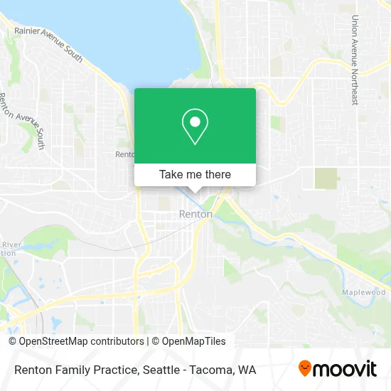
See Renton Family Practice on the map
Public Transportation to Renton Family Practice
Wondering how to get to Renton Family Practice? Moovit helps you find the best way to get to Renton Family Practice with step-by-step directions from the nearest public transit station.
Moovit provides free maps and live directions to help you navigate through your city. View schedules, routes, timetables, and find out how long does it take to get to Renton Family Practice in real time.
Looking for the nearest stop or station to Renton Family Practice? Check out this list of stops closest to your destination: Park Ave N & N 1st St; Bronson Way N & Park Ave N; Mill Ave S & Houser Way S; Renton Transit Center - Bay 8; Renton TC - Bay 4; Renton Transit Center - Bay 9; Tukwila Station.
Bus: 106, 153, 240, 560, F LINE, 105, 907, 101, 148, 160.Train: S LINE.
Want to see if there’s another route that gets you there at an earlier time? Moovit helps you find alternative routes or times. Get directions from and directions to Renton Family Practice easily from the Moovit App or Website.
We make riding to Renton Family Practice easy, which is why over 1.7 million users, including users in Renton, trust Moovit as the best app for public transit. You don’t need to download an individual bus app or train app, Moovit is your all-in-one transit app that helps you find the best bus time or train time available.
For information on prices of bus and light rail, costs and ride fares to Renton Family Practice, please check the Moovit app.
Use the app to navigate to popular places including to the airport, hospital, stadium, grocery store, mall, coffee shop, school, college, and university.
Location: Renton, Seattle - Tacoma, WA
- Maribeth Topalanchik, LMP,
- Renton Coin Shop,
- Cedar River Court Apartments,
- KCLS Renton Library,
- Seed of Abraham Pentecostal Church,
- Dr. Trevor Family Dentistry,
- Merrill Gardens,
- Coin Cloud DCM,
- Bronson Market,
- Ay! Jalisco Tienda Mexicana Y Carnicera,
- Ancient's Arts Tattoo & Okie's Piercing,
- Cedar River Trail,
- Downtown Renton,
- 405 S Exit 4,
- Renton Memorial Stadium,
- Renton Stadium (Renton Memorial Stadium),
- Boeing,
- Boeing 10-16 fitness center,
- Shell Recharge,
- Kaiser Permanente Renton Medical Center
Places Near Renton Family Practice
- Microsoft Connector Bus, Redmond,
- Seattle Art Museum, Seattle,
- Space Needle, Seattle,
- Seattle Ferry Terminal, Seattle,
- T-Mobile Park, Seattle,
- Woodland Park Zoo, Seattle,
- Seattle Aquarium, Seattle,
- Amazon.com SEA33 - Blackfoot, Seattle,
- Space Needle, Seattle,
- Pier 66, Seattle,
- Cal Anderson Park, Seattle,
- Southcenter Mall, Tukwila,
- Bellevue Square Mall, Bellevue,
- Amazon - Blackfoot (SEA33), Seattle,
- Harborview Medical Center, Seattle,
- Pier 91 Cruise Ship Terminal, Seattle,
- Pike Place Market, Seattle,
- Lumen Field, Seattle,
- Hyatt Regency-Seattle , Seattle,
- Paramount Theatre, Seattle
How to get to popular places in Seattle - Tacoma, WA with public transit
Get around Renton by public transit!
Traveling around Renton has never been so easy. See step by step directions as you travel to any attraction, street or major public transit station. View bus and train schedules, arrival times, service alerts and detailed routes on a map, so you know exactly how to get to anywhere in Renton.
When traveling to any destination around Renton use Moovit's Live Directions with Get Off Notifications to know exactly where and how far to walk, how long to wait for your line, and how many stops are left. Moovit will alert you when it's time to get off — no need to constantly re-check whether yours is the next stop.
Wondering how to use public transit in Renton or how to pay for public transit in Renton? Moovit public transit app can help you navigate your way with public transit easily, and at minimum cost. It includes public transit fees, ticket prices, and costs. Looking for a map of Renton public transit lines? Moovit public transit app shows all public transit maps in Renton with all Bus, Train, Light Rail and Ferry routes and stops on an interactive map.
Seattle - Tacoma, WA has 4 transit type(s), including: Bus, Train, Light Rail and Ferry, operated by several transit agencies, including Sound Transit, Seattle Streetcar, Metro Transit, Whatcom Transportation Authority, Mason Transit Authority, Snoqualmie Valley Transportation (SVT), Snoqualmie Valley Transportation, Amtrak, Island Transit, Kitsap Transit, Intercity Transit, Everett Transit, Community Transit, Skagit Transit and Pierce Transit