How to get to Repair&Color by bus?
Click on the bus route to see step by step directions with maps, line arrival times and updated time schedules.
From Shalom Christian Church, Indianapolis City (Balance)
59 minFrom The Good Shepherd Church, Indianapolis City (Balance)
40 minFrom Kroger Dairy (Crossroad Farms Dairy), Indianapolis City (Balance)
48 minFrom WING STOP, Beech Grove
44 minFrom Smith & Son, Indianapolis City (Balance)
38 minFrom Heartland Outdoors, Indianapolis City (Balance)
48 minFrom Crown Hill Funeral Home & Cemetery, Indianapolis City (Balance)
44 minFrom Kipp Indy Public Schools, Indianapolis City (Balance)
36 minFrom West 34th Street & Moller Road, Indianapolis
51 minFrom Newfields, Indianapolis City (Balance)
39 min
Bus stops near Repair&Color in Indianapolis City (Balance)
Bus lines to Repair&Color in Indianapolis City (Balance)
- 16, Emerson,VIEW
- 31, U S 31,VIEW
- 8, Meijer E. Wash,VIEW
- 24, Ameriplex,VIEW
- 10, Meijer Avon,VIEW
- 90, 66th,VIEW
- 92, Transit Center,VIEW
- 2, Transit Center,VIEW
- 5, East 25th St,VIEW
- 6, Harding,VIEW
- 25, W 16th St,VIEW
- 3, Arlington & 46th,VIEW
- 19, Butler University,VIEW
- 37, Transit Center,VIEW
- 13, Keystone & National,VIEW
- 56, Emerson/Thompson,VIEW
- 26, Keystone Crossing,VIEW
- GREYHOUND US0100, Atlanta - Chicago,VIEW
- GREYHOUND US0112, Montgomery - Nashville - Detroit,VIEW
- GREYHOUND US0120S, Chicago - Indianapolis,VIEW
What are the closest stations to Repair&Color?
The closest stations to Repair&Color are:
- Delaware St & Louisiana St is 120 yards away, 2 min walk.
- Washington St & Illinois St is 260 yards away, 4 min walk.
- Ctc-E is 301 yards away, 5 min walk.
- Statehouse Station Nb is 335 yards away, 5 min walk.
- Ctc-T is 494 yards away, 6 min walk.
- Ctc-S is 518 yards away, 7 min walk.
- Ctc-F is 530 yards away, 7 min walk.
- Ctc-H is 536 yards away, 7 min walk.
- Ctc-J is 562 yards away, 7 min walk.
- Indianapolis Bus Station is 704 yards away, 9 min walk.
Which bus lines stop near Repair&Color?
These bus lines stop near Repair&Color: 10, 16, 25, 34, 56, 8, 92.
What’s the nearest bus station to Repair&Color in Indianapolis City (Balance)?
The nearest bus station to Repair&Color in Indianapolis City (Balance) is Delaware St & Louisiana St. It’s a 2 min walk away.
What time is the first bus to Repair&Color in Indianapolis City (Balance)?
The GREYHOUND US0100 is the first bus that goes to Repair&Color in Indianapolis City (Balance). It stops nearby at 4:40 AM.
What time is the last bus to Repair&Color in Indianapolis City (Balance)?
The GREYHOUND US0421 is the last bus that goes to Repair&Color in Indianapolis City (Balance). It stops nearby at 7:35 PM.
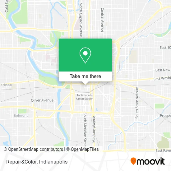
See Repair&Color, Indianapolis City (Balance), on the map
Public Transit to Repair&Color in Indianapolis City (Balance)
Wondering how to get to Repair&Color in Indianapolis City (Balance)? Moovit helps you find the best way to get to Repair&Color with step-by-step directions from the nearest public transit station.
Moovit provides free maps and live directions to help you navigate through your city. View schedules, routes, timetables, and find out how long does it take to get to Repair&Color in real time.
Looking for the nearest stop or station to Repair&Color? Check out this list of stops closest to your destination: Delaware St & Louisiana St; Washington St & Illinois St; Ctc-E; Statehouse Station Nb; Ctc-T; Ctc-S; Ctc-F; Ctc-H; Ctc-J; Indianapolis Bus Station.
Bus: 10, 16, 25, 34, 56, 8, 92, 31, 24, 90, 2, 5, 6.
Want to see if there’s another route that gets you there at an earlier time? Moovit helps you find alternative routes or times. Get directions from and directions to Repair&Color easily from the Moovit App or Website.
We make riding to Repair&Color easy, which is why over 1.5 million users, including users in Indianapolis City (Balance), trust Moovit as the best app for public transit. You don’t need to download an individual bus app or train app, Moovit is your all-in-one transit app that helps you find the best bus time or train time available.
For information on prices of bus, costs and ride fares to Repair&Color, please check the Moovit app.
Use the app to navigate to popular places including to the airport, hospital, stadium, grocery store, mall, coffee shop, school, college, and university.
Repair&Color Address: 49 W Maryland St Indianapolis, IN 46225 street in Indianapolis City (Balance)
- Circle Centre Yelp Adventure,
- Dearde LLC at Circle C,
- Tilt Studio Indianapolis,
- Princess Store,
- Chick-fil-A,
- Sugar Factory,
- Circle City Souvenirs,
- Chin Sushi,
- Bouchic by Carla,
- Circle Centre Mall,
- Cosmic Candy,
- Fao Schwartz,
- Owaly,
- Prox Salads,
- St. Elmo Steak House,
- New Day Creative,
- Limited Store,
- Direct Connect Logistix,
- Columbia,
- Circle Centre - Blue Garage
Places Near Repair&Color (Indianapolis City (Balance))
- I U Health Methodist Hospital, Indianapolis City (Balance),
- Train Ride At Castleton Mall, Indianapolis City (Balance),
- Methodist Hospital of Indianapolis, Indianapolis City (Balance),
- Indianapolis Airport Zone 2, Indianapolis City (Balance),
- Jersey Barn, Indianapolis City (Balance),
- 119 W 19th St Parking, Indianapolis City (Balance),
- THE BALT, Indianapolis City (Balance),
- Indiana Convention Center, Indianapolis City (Balance),
- Indianapolis Motor Speedway, Speedway,
- St. Vincent entrance #1, Indianapolis City (Balance),
- Lilly Corporate Center (Eli Lilly & Co), Indianapolis City (Balance),
- Plainfield, IN, Plainfield,
- St. Vincent Hospital - Indianapolis, Indianapolis City (Balance),
- Eskenazi Hospital, Indianapolis City (Balance),
- Cotter's Massage Parlor With Happy Endings, Indianapolis City (Balance),
- Indiana, Indianapolis City (Balance),
- Lucas Oil Stadium, Indianapolis City (Balance),
- Gainbridge Fieldhouse, Indianapolis City (Balance),
- Castleton Square Mall, Indianapolis,
- I-465 / I-65 Interchange, Indianapolis City (Balance)
How to get to popular places in Indianapolis with public transit
Get around Indianapolis City (Balance) by public transit!
Traveling around Indianapolis City (Balance) has never been so easy. See step by step directions as you travel to any attraction, street or major public transit station. View bus and train schedules, arrival times, service alerts and detailed routes on a map, so you know exactly how to get to anywhere in Indianapolis City (Balance).
When traveling to any destination around Indianapolis City (Balance) use Moovit's Live Directions with Get Off Notifications to know exactly where and how far to walk, how long to wait for your line, and how many stops are left. Moovit will alert you when it's time to get off — no need to constantly re-check whether yours is the next stop.
Wondering how to use public transit in Indianapolis City (Balance) or how to pay for public transit in Indianapolis City (Balance)? Moovit public transit app can help you navigate your way with public transit easily, and at minimum cost. It includes public transit fees, ticket prices, and costs. Looking for a map of Indianapolis City (Balance) public transit lines? Moovit public transit app shows all public transit maps in Indianapolis City (Balance) with all bus routes and stops on an interactive map.
Indianapolis has 1 transit type(s), including: bus, operated by several transit agencies, including IndyGo, FlixBus-us and Greyhound-us