How to get to Repower by bus?
Click on the bus route to see step by step directions with maps, line arrival times and updated time schedules.
From Fiorita Villa, Florence
90 minFrom Via Eugenio Barsanti 24, Prato
82 minFrom Pavilion 25, Florence
44 minFrom Santa Marta Faculty of Engineering, Florence
52 minFrom Santa Croce Square, Florence
52 minFrom Coverciano, Florence
72 minFrom Iris Garden, Florence
65 minFrom Datini Street, Florence
62 minFrom Michelangelo Buonarroti Street, Florence
53 min
How to get to Repower by train?
Click on the train route to see step by step directions with maps, line arrival times and updated time schedules.
Bus stops near Repower in Florence
Train station near Repower in Florence
- Le Piagge, 23 min walk,VIEW
Light Rail stations near Repower in Florence
- Peretola Airport, 44 min walk,VIEW
Bus lines to Repower in Florence
What are the closest stations to Repower?
The closest stations to Repower are:
- Del Cantone Lucchese is 412 meters away, 6 min walk.
- Railway Workshops is 432 meters away, 6 min walk.
- Pistoiese Umbria is 1138 meters away, 15 min walk.
- Le Piagge is 1742 meters away, 23 min walk.
- Peretola Airport is 3367 meters away, 44 min walk.
Which bus lines stop near Repower?
These bus lines stop near Repower: 35, 56, 68.
Which train line stops near Repower?
R (Florence)
What’s the nearest train station to Repower in Florence?
The nearest train station to Repower in Florence is Le Piagge. It’s a 23 min walk away.
What’s the nearest bus station to Repower in Florence?
The nearest bus stations to Repower in Florence are Del Cantone Lucchese and Railway Workshops. The closest one is a 6 min walk away.
What time is the first light rail to Repower in Florence?
The T2 is the first light rail that goes to Repower in Florence. It stops nearby at 5:00 AM.
What time is the last light rail to Repower in Florence?
The T2 is the last light rail that goes to Repower in Florence. It stops nearby at 12:53 AM.
What time is the first train to Repower in Florence?
The R is the first train that goes to Repower in Florence. It stops nearby at 5:15 AM.
What time is the last train to Repower in Florence?
The R is the last train that goes to Repower in Florence. It stops nearby at 12:51 AM.
What time is the first bus to Repower in Florence?
The 56 is the first bus that goes to Repower in Florence. It stops nearby at 5:45 AM.
What time is the last bus to Repower in Florence?
The 35 is the last bus that goes to Repower in Florence. It stops nearby at 1:23 AM.
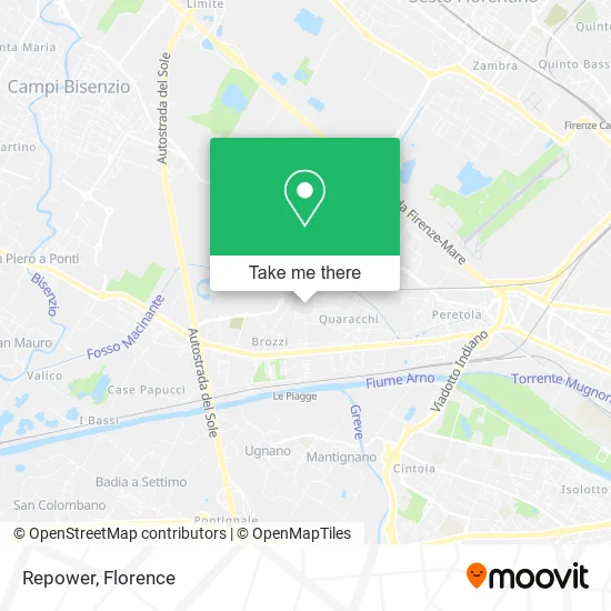
See Repower, Florence, on the map
Public Transit to Repower in Florence
Wondering how to get to Repower in Florence? Moovit helps you find the best way to get to Repower with step-by-step directions from the nearest public transit station.
Moovit provides free maps and live directions to help you navigate through your city. View schedules, routes, timetables, and find out how long does it take to get to Repower in real time.
Looking for the nearest stop or station to Repower? Check out this list of stops closest to your destination: Del Cantone Lucchese; Railway Workshops; Pistoiese Umbria; Le Piagge; Peretola Airport.
Bus: 35, 56, 68, 66, 86, 51PQF, 213.Train: R.
Want to see if there’s another route that gets you there at an earlier time? Moovit helps you find alternative routes or times. Get directions from and directions to Repower easily from the Moovit App or Website.
We make riding to Repower easy, which is why over 1.5 million users, including users in Florence, trust Moovit as the best app for public transit. You don’t need to download an individual bus app or train app, Moovit is your all-in-one transit app that helps you find the best bus time or train time available.
For information on prices of bus, train and light rail, costs and ride fares to Repower, please check the Moovit app.
Use the app to navigate to popular places including to the airport, hospital, stadium, grocery store, mall, coffee shop, school, college, and university.
Repower Address: Via dei Cattani, 50145 Firenze street in Florence
- Metel,
- Bag Manufacturing by Zhou You Qi,
- Firenze Moving Services,
- Eurcorporation Store,
- Stefy Leather Goods by Lin Defu,
- Italiana Services,
- Villa Corbinelli Alla Sala,
- Conti Luciano & C.,
- Gianni Bags by Xu Yong Zhong,
- Ecobioservices and Researches,
- Amazon Locker-Vincenzino,
- Amazon Counter,
- Il Fiorino Srl Typolithography,
- Sa.Bo.,
- INTESA SANPAOLO,
- St. Lucia alla Sala Parish,
- A.S.D. Sorms Gilbarco Cecchi,
- Hu Li Fei,
- Florence Closures,
- Vaglica Claudio by Vaglica Claudio & C.
Places Near Repower (Florence)
- Nelson Mandela Forum, Florence,
- Piero Palagi Hospital Facility-Florence, Florence,
- Visarno Arena, Florence,
- Michelangelo Square, Florence,
- Field of Mars, Florence,
- Santa Maria Novella Station, Florence,
- Asmana, Campi Bisenzio,
- Michelangelo Square, Florence,
- OOO, Florence,
- Cascine Park, Florence,
- Visarno Hippodrome, Florence,
- Tobacco Manufacture, Florence,
- IKEA Florence, Sesto Fiorentino,
- Campi Bisenzio, Campi Bisenzio,
- Verdi Theater, Florence,
- Torregalli Hospital Scandicci *, Scandicci,
- I Gigli, Campi Bisenzio,
- Mandela Forum (Nelson Mandela Forum), Florence,
- Artemio Franchi Municipal Stadium, Florence,
- Santa Maria Nuova Hospital, Florence
How to get to popular places in Florence with public transit
Get around Florence by public transit!
Traveling around Florence has never been so easy. See step by step directions as you travel to any attraction, street or major public transit station. View bus and train schedules, arrival times, service alerts and detailed routes on a map, so you know exactly how to get to anywhere in Florence.
When traveling to any destination around Florence use Moovit's Live Directions with Get Off Notifications to know exactly where and how far to walk, how long to wait for your line, and how many stops are left. Moovit will alert you when it's time to get off — no need to constantly re-check whether yours is the next stop.
Wondering how to use public transit in Florence or how to pay for public transit in Florence? Moovit public transit app can help you navigate your way with public transit easily, and at minimum cost. It includes public transit fees, ticket prices, and costs. Looking for a map of Florence public transit lines? Moovit public transit app shows all public transit maps in Florence with all Bus, Train, Light Rail, Ferry and Funicular routes and stops on an interactive map.
Florence has 5 transit type(s), including: Bus, Train, Light Rail, Ferry and Funicular, operated by several transit agencies, including Florence Urban - Tuscan Bus Lines, GEST, Livorno and Province - Tuscan Bus Lines, Arezzo, Florence and Provinces - Tuscan Bus Lines, Prato and Province - Tuscan Bus Lines, Lucca and Province - Tuscan Bus Lines, Massa, Carrara and Province - Tuscan Bus Lines, Pisa and Province - Tuscan Bus Lines, Grosseto, Siena and Provinces - Tuscan Bus Lines, Arezzo, Siena and Provinces - Tuscan Bus Lines, Florence and Province - Tuscan Bus Lines, Pistoia and Province - Tuscan Bus Lines, Siena and Province - Tuscan Bus Lines, Arezzo and Province - Tuscan Bus Lines and Trenitalia