Reppaz stop - Saturday schedule
| Line | Direction | Time |
|---|---|---|
| 273 | Commeire | 7:07 AM |
| 273 | Orsières, Gare | 7:19 AM |
| 273 | Orsières, Gare | 11:55 AM |
| 273 | Reppaz | 11:55 AM |
| 273 | Reppaz | 1:05 PM |
| 273 | Orsières, Gare | 1:06 PM |
| 273 | Commeire | 4:40 PM |
| 273 | Orsières, Gare | 5:06 PM |
| 273 | Reppaz | 5:37 PM |
| 273 | Orsières, Gare | 5:38 PM |
Directions to Reppaz stop (Geneve) with public transit
The following transit lines have routes that pass near Reppaz
 Bus: 273, 210, 211, 271, 272.
- Train: R82, R.
- Cable Car: SL, SL.
How to get to Reppaz stop by train?
Click on the train route to see step by step directions with maps, line arrival times and updated time schedules.
Bus stops near Reppaz stop in Geneve
- Maligue, 10 min walk,
- Orsières, La Place, 27 min walk,
- Orsières, Gare, 30 min walk,
Train stations near Reppaz station in Geneve
- Orsières, 30 min walk,
Cable Car stations near Reppaz station in Geneve
- La Breya, 38 min walk,
- La Pasay, 48 min walk,
Bus lines to Reppaz stop in Geneve
- 273, Reppaz,
- 210, Orsières, Gare,
- 211, Aosta, Autostazione,
- 271, Champex, Télé,
- 272, Orsières, Gare,
What are the closest stations to Reppaz?
The closest stations to Reppaz are:
- Maligue is 753 meters away, 10 min walk.
- Orsières, La Place is 2099 meters away, 27 min walk.
- Orsières, Gare is 2296 meters away, 30 min walk.
- Orsières is 2322 meters away, 30 min walk.
- La Breya is 2965 meters away, 38 min walk.
- La Pasay is 3730 meters away, 48 min walk.
Which train line stops near Reppaz?
R82 (Sembrancher→Orsières)
What’s the nearest train station to Reppaz in Geneve?
The nearest train station to Reppaz in Geneve is Orsières. It’s a 30 min walk away.
What’s the nearest bus station to Reppaz in Geneve?
The nearest bus station to Reppaz in Geneve is Maligue. It’s a 10 min walk away.
See Reppaz stop, Geneve, on the map
Public transit to Reppaz stop in Geneve
Looking for directions to Reppaz in Geneve, Switzerland?
Download the Moovit App to find the current schedule and step-by-step directions for Train or Bus routes that pass through Reppaz.
Looking for the nearest stops closest to Reppaz ? Check out this list of closest stops to your destination: Maligue; Orsières; Orsières; Orsières; La Breya; La Pasay.
Bus: 273, 210, 211, 271, 272.Train: R82, R.Cable Car: SL, SL.
We make riding on public transit to Reppaz easy, which is why over 1.5 million users, including users in Geneve trust Moovit as the best app for public transit.
Use the app to navigate to popular places including to the airport, hospital, stadium, grocery store, mall, coffee shop, school, college, and university.
The first line to this stop is 273, at 7:07 AM, and the last line is 273 at 5:38 PM.
13 Reppaz, Orsières, Switzerland
This stop serves Service d'automobiles TMR’s lines
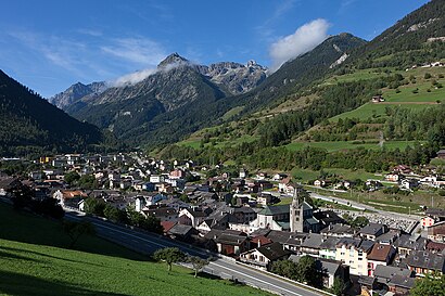
Orsières is a municipality in the district of Entremont in the canton of Valais in Switzerland.Wiki
- Maligue,
- Orsières, La Place,
- Orsières, Gare
Bus stops near Reppaz stop
- Orsières
Train station near Reppaz station
- Chavannes-De-B., Champs-Blancs,
- Vignogn, Baselgia,
- Gundetswil, Hofacker,
- Bronschhofen, Maugwil,
- Villars-Sur-Ollon (Télécabine),
- Rueyres-St-Laurent, Village,
- Rebstein-Marbach, Bahnhof,
- Grand-Saconnex, Taverney,
- Miglieglia, Paese,
- Versoix, Canal De Versoix,
- Oberwil Bl, Hüslimatt,
- Sion, Dixence,
- Tegerfelden, Kirche,
- Baar Lindenpark,
- Rubigen, Beitenwil,
- Eisten, Ganter,
- Zürich Affoltern,
- Biel/Bienne, Rolex,
- Meyrin, Gare,
- Viry, Essertet
Popular public transit stations in Geneve
Get around Geneve by public transit!
Traveling around Geneve has never been so easy. See step by step directions as you travel to any attraction, street or major public transit station. View bus and train schedules, arrival times, service alerts and detailed routes on a map, so you know exactly how to get to anywhere in Geneve.
When traveling to any destination around Geneve use Moovit's Live Directions with Get Off Notifications to know exactly where and how far to walk, how long to wait for your line, and how many stops are left. Moovit will alert you when it's time to get off — no need to constantly re-check whether yours is the next stop.
Wondering how to use public transit in Geneve or how to pay for public transit in Geneve? Moovit public transit app can help you navigate your way with public transit easily, and at minimum cost. It includes public transit fees, ticket prices, and costs. Looking for a map of Geneve public transit lines? Moovit public transit app shows all public transit maps in Geneve with all Bus, Train, Metro, Light Rail, Ferry, Cable Car and Funicular routes and stops on an interactive map.
Geneve has 7 transit type(s), including: Bus, Train, Metro, Light Rail, Ferry, Cable Car and Funicular, operated by several transit agencies, including Schweizerische Bundesbahnen SBB, Nyon-St-Cergue-Morez, Société Nationale des Chemins de fer Français, TPG, SBB Infrastruktur AG Bahnersatz, Transports Publics de l'agglomération d'Annemasse, Bus Nyon-Prangins, Alpbus Fournier, CGN SA, Transports Publics Neuchâtelois SA (tc), But, PostAuto AG, Transports Publics de la Région Nyonnaise, SMGN and Bus Buchserberg