How to get to Reprografía Vulcano by bus?
Click on the bus route to see step by step directions with maps, line arrival times and updated time schedules.
From Plaza De Las Comendadoras, Área Metropolitana De Madrid Y Corredor Del Henares
42 minFrom Calle Marqués de Viana, Madrid
35 minFrom Lucero, Madrid
76 minFrom Francos Rodríguez, Madrid
57 minFrom Cruz Roja, Área Metropolitana De Madrid Y Corredor Del Henares
38 minFrom Diversia, Alcobendas
75 minFrom Vista Alegre, Madrid
67 minFrom Parada de Taxi de la Estación de Atocha, Madrid
36 minFrom Calle General Ricardos, Madrid
69 minFrom Palacio De Vistalegre, Área Metropolitana De Madrid Y Corredor Del Henares
65 min
How to get to Reprografía Vulcano by metro?
Click on the metro route to see step by step directions with maps, line arrival times and updated time schedules.
From Plaza De Las Comendadoras, Área Metropolitana De Madrid Y Corredor Del Henares
35 minFrom Calle Marqués de Viana, Madrid
37 minFrom Lucero, Madrid
45 minFrom Francos Rodríguez, Madrid
36 minFrom Cruz Roja, Área Metropolitana De Madrid Y Corredor Del Henares
35 minFrom Diversia, Alcobendas
85 minFrom Vista Alegre, Madrid
47 minFrom Parada de Taxi de la Estación de Atocha, Madrid
39 minFrom Calle General Ricardos, Madrid
57 minFrom Palacio De Vistalegre, Área Metropolitana De Madrid Y Corredor Del Henares
47 min
Bus stops near Reprografía Vulcano in Madrid
Metro stations near Reprografía Vulcano in Madrid
Bus lines to Reprografía Vulcano in Madrid
What are the closest stations to Reprografía Vulcano?
The closest stations to Reprografía Vulcano are:
- José Del Hierro - Mandarina is 338 meters away, 5 min walk.
- Ciudad Lineal is 360 meters away, 5 min walk.
- Arturo Soria - Marqués De Pico Velasco is 365 meters away, 5 min walk.
- Fernández Caro - Agastia is 404 meters away, 6 min walk.
- Barrio De La Concepción is 809 meters away, 11 min walk.
Which bus lines stop near Reprografía Vulcano?
These bus lines stop near Reprografía Vulcano: 146, 70.
Which metro lines stop near Reprografía Vulcano?
These metro lines stop near Reprografía Vulcano: M-5, M-7, M-9.
What’s the nearest metro station to Reprografía Vulcano in Madrid?
The nearest metro station to Reprografía Vulcano in Madrid is Ciudad Lineal. It’s a 5 min walk away.
What’s the nearest bus station to Reprografía Vulcano in Madrid?
The nearest bus stations to Reprografía Vulcano in Madrid are José Del Hierro - Mandarina and Arturo Soria - Marqués De Pico Velasco. The closest one is a 5 min walk away.
What time is the first metro to Reprografía Vulcano in Madrid?
The M-7 is the first metro that goes to Reprografía Vulcano in Madrid. It stops nearby at 6:05 AM.
What time is the last metro to Reprografía Vulcano in Madrid?
The M-5 is the last metro that goes to Reprografía Vulcano in Madrid. It stops nearby at 2:15 AM.
What time is the first bus to Reprografía Vulcano in Madrid?
The 21 is the first bus that goes to Reprografía Vulcano in Madrid. It stops nearby at 7:02 AM.
What time is the last bus to Reprografía Vulcano in Madrid?
The 21 is the last bus that goes to Reprografía Vulcano in Madrid. It stops nearby at 12:05 AM.
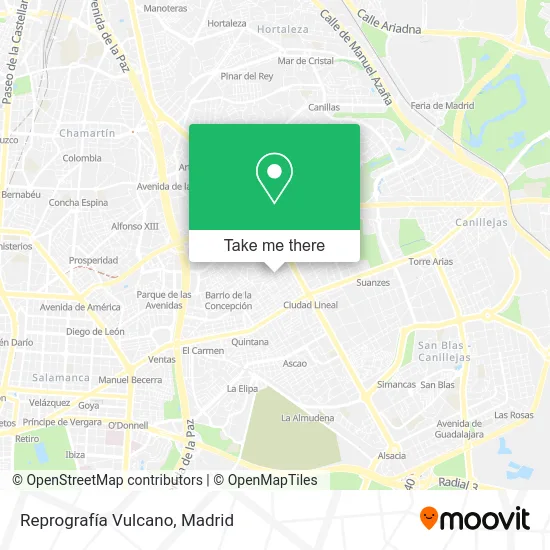
See Reprografía Vulcano, Madrid, on the map
Public Transit to Reprografía Vulcano in Madrid
Wondering how to get to Reprografía Vulcano in Madrid? Moovit helps you find the best way to get to Reprografía Vulcano with step-by-step directions from the nearest public transit station.
Moovit provides free maps and live directions to help you navigate through your city. View schedules, routes, timetables, and find out how long does it take to get to Reprografía Vulcano in real time.
Looking for the nearest stop or station to Reprografía Vulcano? Check out this list of stops closest to your destination: José Del Hierro - Mandarina; Ciudad Lineal; Arturo Soria - Marqués De Pico Velasco; Fernández Caro - Agastia; Barrio De La Concepción.
Bus: 146, 70, 48, 21.Metro: M-5, M-7, M-9.
Want to see if there’s another route that gets you there at an earlier time? Moovit helps you find alternative routes or times. Get directions from and directions to Reprografía Vulcano easily from the Moovit App or Website.
We make riding to Reprografía Vulcano easy, which is why over 1.5 million users, including users in Madrid, trust Moovit as the best app for public transit. You don’t need to download an individual bus app or train app, Moovit is your all-in-one transit app that helps you find the best bus time or train time available.
For information on prices of bus and metro, costs and ride fares to Reprografía Vulcano, please check the Moovit app.
Use the app to navigate to popular places including to the airport, hospital, stadium, grocery store, mall, coffee shop, school, college, and university.
Reprografía Vulcano Address: Calle de José del Hierro, 41 street in Madrid
- Clinica Veterinaria José del Hierro,
- El Rey del Calzado. Reparación y Duplicado de Llaves,
- Tienda Especializada José del Hierro 52,
- Luthier,
- Calle Polibea 1,
- Calle de José del Hierro 39,
- Onsa,
- Ifitend,
- Calle de Angel Larra 6,
- Calle Rosalía Trujillo 8,
- Ahorramas,
- Calle de Manipa, 48,
- Calle de Manipa,
- Ipanema,
- Calle de los Misterios,
- Calle de la Mandarina 6,
- Calle Prudencio Álvaro 49,
- Farmacia - Calle José Del Hierro 42,
- Colegio Santa María Del Carmen,
- Calle Sol Naciente 3
Places Near Reprografía Vulcano (Madrid)
- Tres Aguas, Alcorcón,
- Centro Comercial La Vaguada, Área Metropolitana De Madrid Y Corredor Del Henares,
- Plaza Mayor, Madrid,
- Centro Comercial Oasiz Madrid, Área Metropolitana De Madrid Y Corredor Del Henares,
- Plenilunio, Área Metropolitana De Madrid Y Corredor Del Henares,
- Sala La Riviera, Madrid,
- Hospital Universitario La Paz, Madrid,
- Estacion de Chamartin, Madrid,
- Centro Comercial La Gavia, Área Metropolitana De Madrid Y Corredor Del Henares,
- Estadio Wanda Metropolitano, Área Metropolitana De Madrid Y Corredor Del Henares,
- Mendez Alvaro, Madrid,
- Mercadillo de Majadahonda, Majadahonda,
- Centro Comercial Islazul, Área Metropolitana De Madrid Y Corredor Del Henares,
- Calle de López de Hoyos 169, Madrid,
- Rastro De Madrid, Área Metropolitana De Madrid Y Corredor Del Henares,
- Palacio De Vistalegre, Área Metropolitana De Madrid Y Corredor Del Henares,
- Hospital Universitario Ramón y Cajal, Madrid,
- Wizink Center, Madrid,
- Nassica, Área Metropolitana De Madrid Y Corredor Del Henares,
- Hospital Clínico Universitario San Carlos, Madrid
How to get to popular places in Madrid with public transit
Get around Madrid by public transit!
Traveling around Madrid has never been so easy. See step by step directions as you travel to any attraction, street or major public transit station. View bus and train schedules, arrival times, service alerts and detailed routes on a map, so you know exactly how to get to anywhere in Madrid.
When traveling to any destination around Madrid use Moovit's Live Directions with Get Off Notifications to know exactly where and how far to walk, how long to wait for your line, and how many stops are left. Moovit will alert you when it's time to get off — no need to constantly re-check whether yours is the next stop.
Wondering how to use public transit in Madrid or how to pay for public transit in Madrid? Moovit public transit app can help you navigate your way with public transit easily, and at minimum cost. It includes public transit fees, ticket prices, and costs. Looking for a map of Madrid public transit lines? Moovit public transit app shows all public transit maps in Madrid with all Bus, Train, Metro and Light Rail routes and stops on an interactive map.
Madrid has 4 transit type(s), including: Bus, Train, Metro and Light Rail, operated by several transit agencies, including Metro de Madrid, Metro Ligero, Tranvía de Parla, Renfe Cercanías - Servicios de Autobús especiales, Renfe Cercanias, Renfe Cercanías, EMT, Interurbanos, Urbanos de Alcalá de Henares, Urbanos de Alcobendas, Urbanos de Alcorcón, Urbanos de Algete, Urbanos de Aranjuez, Urbanos de Arganda del Rey and Urbanos de Arroyomolinos