How to get to Repsol by bus?
Click on the bus route to see step by step directions with maps, line arrival times and updated time schedules.
From Hospital Clínico San Carlos-Urgencias, Madrid
57 minFrom Calle Fermin Caballero, Madrid
61 minFrom Autovía del Sur A-4 (Carretera de Andalucía), Madrid
99 minFrom Parque de Pradolongo, Madrid
95 minFrom Feria de San Isidro-Madrid, Madrid
82 minFrom Palacio Vistalegre, Madrid
88 minFrom Centro Comercial Plaza Norte 2, Área Metropolitana De Madrid Y Corredor Del Henares
64 minFrom Caja Mágica, Área Metropolitana De Madrid Y Corredor Del Henares
89 minFrom Caixa Forum, Madrid
53 minFrom Club Deportivo Somontes, Madrid
68 min
How to get to Repsol by train?
Click on the train route to see step by step directions with maps, line arrival times and updated time schedules.
How to get to Repsol by metro?
Click on the metro route to see step by step directions with maps, line arrival times and updated time schedules.
From Hospital Clínico San Carlos-Urgencias, Madrid
28 minFrom Calle Fermin Caballero, Madrid
35 minFrom Parque de Pradolongo, Madrid
61 minFrom Feria de San Isidro-Madrid, Madrid
45 minFrom Palacio Vistalegre, Madrid
45 minFrom Centro Comercial Plaza Norte 2, Área Metropolitana De Madrid Y Corredor Del Henares
82 minFrom Caja Mágica, Área Metropolitana De Madrid Y Corredor Del Henares
63 minFrom Caixa Forum, Madrid
40 min
Bus stops near Repsol in Área Metropolitana De Madrid Y Corredor Del Henares
Metro stations near Repsol in Área Metropolitana De Madrid Y Corredor Del Henares
Bus lines to Repsol in Área Metropolitana De Madrid Y Corredor Del Henares
What are the closest stations to Repsol?
The closest stations to Repsol are:
- Metro Arturo Soria is 131 meters away, 2 min walk.
- Arturo Soria is 269 meters away, 4 min walk.
- Ulises - Arturo Soria is 303 meters away, 4 min walk.
- López De Hoyos - Arturo Soria is 319 meters away, 5 min walk.
- Pinar Del Rey is 1780 meters away, 23 min walk.
Which bus lines stop near Repsol?
These bus lines stop near Repsol: 120, 70, 9.
Which train lines stop near Repsol?
These train lines stop near Repsol: C10, C7.
Which metro lines stop near Repsol?
These metro lines stop near Repsol: M-4, M-9.
What’s the nearest metro station to Repsol in Área Metropolitana De Madrid Y Corredor Del Henares?
The nearest metro station to Repsol in Área Metropolitana De Madrid Y Corredor Del Henares is Arturo Soria. It’s a 4 min walk away.
What’s the nearest bus station to Repsol in Área Metropolitana De Madrid Y Corredor Del Henares?
The nearest bus station to Repsol in Área Metropolitana De Madrid Y Corredor Del Henares is Metro Arturo Soria. It’s a 2 min walk away.
What time is the first metro to Repsol in Área Metropolitana De Madrid Y Corredor Del Henares?
The M-4 is the first metro that goes to Repsol in Área Metropolitana De Madrid Y Corredor Del Henares. It stops nearby at 6:05 AM.
What time is the last metro to Repsol in Área Metropolitana De Madrid Y Corredor Del Henares?
The M-4 is the last metro that goes to Repsol in Área Metropolitana De Madrid Y Corredor Del Henares. It stops nearby at 1:54 AM.
What time is the first bus to Repsol in Área Metropolitana De Madrid Y Corredor Del Henares?
The N2 is the first bus that goes to Repsol in Área Metropolitana De Madrid Y Corredor Del Henares. It stops nearby at 3:09 AM.
What time is the last bus to Repsol in Área Metropolitana De Madrid Y Corredor Del Henares?
The N3 is the last bus that goes to Repsol in Área Metropolitana De Madrid Y Corredor Del Henares. It stops nearby at 3:25 AM.
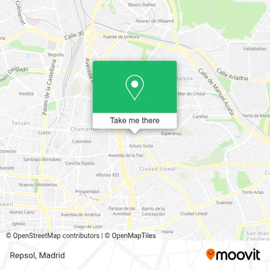
See Repsol, Área Metropolitana De Madrid Y Corredor Del Henares, on the map
Public Transit to Repsol in Área Metropolitana De Madrid Y Corredor Del Henares
Wondering how to get to Repsol in Área Metropolitana De Madrid Y Corredor Del Henares? Moovit helps you find the best way to get to Repsol with step-by-step directions from the nearest public transit station.
Moovit provides free maps and live directions to help you navigate through your city. View schedules, routes, timetables, and find out how long does it take to get to Repsol in real time.
Looking for the nearest stop or station to Repsol? Check out this list of stops closest to your destination: Metro Arturo Soria; Arturo Soria; Ulises - Arturo Soria; López De Hoyos - Arturo Soria; Pinar Del Rey.
Bus: 120, 70, 9, 11, N3, 122, 53, 72, 73, N2.Train: C10, C7.Metro: M-4, M-9, M-8.
Want to see if there’s another route that gets you there at an earlier time? Moovit helps you find alternative routes or times. Get directions from and directions to Repsol easily from the Moovit App or Website.
We make riding to Repsol easy, which is why over 1.5 million users, including users in Área Metropolitana De Madrid Y Corredor Del Henares, trust Moovit as the best app for public transit. You don’t need to download an individual bus app or train app, Moovit is your all-in-one transit app that helps you find the best bus time or train time available.
For information on prices of metro, bus and train, costs and ride fares to Repsol, please check the Moovit app.
Use the app to navigate to popular places including to the airport, hospital, stadium, grocery store, mall, coffee shop, school, college, and university.
Repsol Address: Calle de Arturo Soria street in Área Metropolitana De Madrid Y Corredor Del Henares
- Piscina De Las Almenas,
- El Bund,
- Santo Angel,
- Calle de Arturo Soria / Calle Santo Ángel,
- Notre Maison,
- Calle de las Cañas 4,
- Empanadas Malvon Arturo Soria,
- La Abuela Restaurante Cafeteria,
- CORREOS, calle de las Cañas,
- Peña Vargas S.a.,
- Oficina Correos,
- Calle de Arturo Soria & Calle de las Cañas,
- Travesía de las Cañas,
- Calle de Arturo Soria 103- 107,
- Bueso Pineda,
- Calle de Arturo Soria 189,
- Calle Celeste,
- BURGER KING,
- Barrio Pacho Arcadio,
- ESIC (Campus de Arturo Soria)
Places Near Repsol (Área Metropolitana De Madrid Y Corredor Del Henares)
- Wizink Center, Madrid,
- Estacion de Chamartin, Madrid,
- Estadio Wanda Metropolitano, Área Metropolitana De Madrid Y Corredor Del Henares,
- Hospital Universitario Ramón y Cajal, Madrid,
- Nassica, Área Metropolitana De Madrid Y Corredor Del Henares,
- Mendez Alvaro, Madrid,
- Tres Aguas, Alcorcón,
- Hospital Clínico Universitario San Carlos, Madrid,
- Centro Comercial La Gavia, Área Metropolitana De Madrid Y Corredor Del Henares,
- Rastro De Madrid, Área Metropolitana De Madrid Y Corredor Del Henares,
- Sala La Riviera, Madrid,
- Mercadillo de Majadahonda, Majadahonda,
- Calle de López de Hoyos 169, Madrid,
- Palacio De Vistalegre, Área Metropolitana De Madrid Y Corredor Del Henares,
- Plaza Mayor, Madrid,
- Centro Comercial Oasiz Madrid, Área Metropolitana De Madrid Y Corredor Del Henares,
- Plenilunio, Área Metropolitana De Madrid Y Corredor Del Henares,
- Centro Comercial Islazul, Área Metropolitana De Madrid Y Corredor Del Henares,
- Hospital Universitario La Paz, Madrid,
- Centro Comercial La Vaguada, Área Metropolitana De Madrid Y Corredor Del Henares
How to get to popular places in Madrid with public transit
Get around Área Metropolitana De Madrid Y Corredor Del Henares by public transit!
Traveling around Área Metropolitana De Madrid Y Corredor Del Henares has never been so easy. See step by step directions as you travel to any attraction, street or major public transit station. View bus and train schedules, arrival times, service alerts and detailed routes on a map, so you know exactly how to get to anywhere in Área Metropolitana De Madrid Y Corredor Del Henares.
When traveling to any destination around Área Metropolitana De Madrid Y Corredor Del Henares use Moovit's Live Directions with Get Off Notifications to know exactly where and how far to walk, how long to wait for your line, and how many stops are left. Moovit will alert you when it's time to get off — no need to constantly re-check whether yours is the next stop.
Wondering how to use public transit in Área Metropolitana De Madrid Y Corredor Del Henares or how to pay for public transit in Área Metropolitana De Madrid Y Corredor Del Henares? Moovit public transit app can help you navigate your way with public transit easily, and at minimum cost. It includes public transit fees, ticket prices, and costs. Looking for a map of Área Metropolitana De Madrid Y Corredor Del Henares public transit lines? Moovit public transit app shows all public transit maps in Área Metropolitana De Madrid Y Corredor Del Henares with all Bus, Train, Metro and Light Rail routes and stops on an interactive map.
Madrid has 4 transit type(s), including: Bus, Train, Metro and Light Rail, operated by several transit agencies, including Metro de Madrid, Metro Ligero, Tranvía de Parla, Renfe Cercanías - Servicios de Autobús especiales, Renfe Cercanias, Renfe Cercanías, EMT, Interurbanos, Urbanos de Alcalá de Henares, Urbanos de Alcobendas, Urbanos de Alcorcón, Urbanos de Algete, Urbanos de Aranjuez, Urbanos de Arganda del Rey and Urbanos de Arroyomolinos