How to get to Repsol by bus?
Click on the bus route to see step by step directions with maps, line arrival times and updated time schedules.
From IPCA - Escola Superior de Gestão, Barcelos, Vila Boa e Vila Frescainha (São Martinho e São Pedro)
87 minFrom Vila de Prado, Vila De Prado
205 minFrom Elevador de Santa Luzia, Viana do Castelo (Santa Maria Maior e Monserrate) e Meadela
22 minFrom Várzea, Barcelos
126 minFrom Santuário de Santa Luzia, Viana do Castelo (Santa Maria Maior e Monserrate) e Meadela
44 minFrom Barcelos, Barcelos
90 minFrom IMTT Viana Castelo - Instituto da Mobilidade e dos Transportes Terrestres, Areosa
34 minFrom Instituto Politécnico Viana do Castelo, Viana do Castelo (Santa Maria Maior e Monserrate) e Meadela
26 minFrom Central de Camionagem de Barcelos, Barcelos
85 min
How to get to Repsol by train?
Click on the train route to see step by step directions with maps, line arrival times and updated time schedules.
From Elevador de Santa Luzia, Viana do Castelo (Santa Maria Maior e Monserrate) e Meadela
68 minFrom Várzea, Barcelos
94 minFrom Barcelos, Barcelos
77 minFrom Instituto Politécnico Viana do Castelo, Viana do Castelo (Santa Maria Maior e Monserrate) e Meadela
73 minFrom Vila Praia de Âncora, Vila Praia de Âncora
155 minFrom Central de Camionagem de Barcelos, Barcelos
84 min
Bus stops near Repsol in São Romão de Neiva
Train station near Repsol in São Romão de Neiva
- Alvaraes, 54 min walk,VIEW
Bus lines to Repsol in São Romão de Neiva
What are the closest stations to Repsol?
The closest stations to Repsol are:
- Chafé (Monte Nascente) is 425 meters away, 6 min walk.
- Centro de Saúde de Chafé 1 is 990 meters away, 13 min walk.
- Alvaraes is 4238 meters away, 54 min walk.
Which bus lines stop near Repsol?
These bus lines stop near Repsol: 1021, 1023, 120, M21.
Which train line stops near Repsol?
R (Nine)
What’s the nearest bus station to Repsol in São Romão de Neiva?
The nearest bus station to Repsol in São Romão de Neiva is Chafé (Monte Nascente). It’s a 6 min walk away.
What time is the first train to Repsol in São Romão de Neiva?
The R is the first train that goes to Repsol in São Romão de Neiva. It stops nearby at 5:17 AM.
What time is the last train to Repsol in São Romão de Neiva?
The R is the last train that goes to Repsol in São Romão de Neiva. It stops nearby at 11:29 PM.
What time is the first bus to Repsol in São Romão de Neiva?
The 14 is the first bus that goes to Repsol in São Romão de Neiva. It stops nearby at 6:41 AM.
What time is the last bus to Repsol in São Romão de Neiva?
The 14 is the last bus that goes to Repsol in São Romão de Neiva. It stops nearby at 11:12 PM.
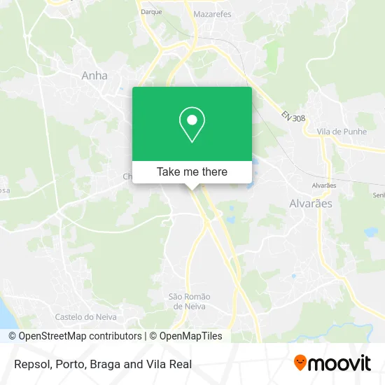
See Repsol, São Romão de Neiva, on the map
Public Transit to Repsol in São Romão de Neiva
Wondering how to get to Repsol in São Romão de Neiva? Moovit helps you find the best way to get to Repsol with step-by-step directions from the nearest public transit station.
Moovit provides free maps and live directions to help you navigate through your city. View schedules, routes, timetables, and find out how long does it take to get to Repsol in real time.
Looking for the nearest stop or station to Repsol? Check out this list of stops closest to your destination: Chafé (Monte Nascente); Centro de Saúde de Chafé 1; Alvaraes.
Bus: 1021, 1023, 120, M21, 14.Train: R, IR, IR.
Want to see if there’s another route that gets you there at an earlier time? Moovit helps you find alternative routes or times. Get directions from and directions to Repsol easily from the Moovit App or Website.
We make riding to Repsol easy, which is why over 1.5 million users, including users in São Romão de Neiva, trust Moovit as the best app for public transit. You don’t need to download an individual bus app or train app, Moovit is your all-in-one transit app that helps you find the best bus time or train time available.
For information on prices of bus and train, costs and ride fares to Repsol, please check the Moovit app.
Use the app to navigate to popular places including to the airport, hospital, stadium, grocery store, mall, coffee shop, school, college, and university.
Repsol Address: Estrada Nacional 13 street in São Romão de Neiva
- E.s. Neiva B,
- Nacex,
- Grossão,
- FR Pneus,
- Delta Cafés,
- R. a 374,
- AutoCávado - Mitsubishi,
- Hyundai - S & B Motors,
- Churrascaria do Minho,
- REPSOL,
- SOS 28,
- Casa Peixoto,
- Zona Industrial Nº1 de Neiva,
- SOS 28,
- VCT-00007,
- Atlante,
- Auto Reno Minho,
- Chevrolet, Opel, Isuzu,
- Triagem,
- Escritórios
Places Near Repsol (São Romão de Neiva)
- Canidelo, Vila Nova De Gaia,
- Exponor, Matosinhos e Leça da Palmeira,
- Parque Aquatico Amarante - Aqua Aventura, Amarante,
- Hospital de Santo António, Cedofeita, Santo Ildefonso, Sé, Miragaia, São Nicolau e Vitória,
- Palácio de Cristal, Lordelo do Ouro e Massarelos,
- El Corte Inglés de Gaia, Mafamude e Vilar do Paraíso,
- MAR Shopping, Matosinhos e Leça da Palmeira,
- Maia, Maia,
- Espinho, Espinho,
- Valongo, Valongo,
- Arrábida Shopping, Santa Marinha e São Pedro da Afurada,
- Avintes, Vila Nova De Gaia,
- VILA do CONDE PORTO FASHION OUTLET, Modivas,
- Rua Calouste Gulbenkian, Lordelo do Ouro e Massarelos,
- Leça da Palmeira, Matosinhos e Leça da Palmeira,
- Zoo Santo Inácio, Vila Nova De Gaia,
- Acesso ao Shopping Parque Nascente, Campanhã,
- Senhor de Matosinhos, Matosinhos e Leça da Palmeira,
- Hospital Santos Silva, Vila Nova De Gaia,
- Hospital da Prelada, Ramalde
How to get to popular places in Porto, Braga and Vila Real with public transit
Get around São Romão de Neiva by public transit!
Traveling around São Romão de Neiva has never been so easy. See step by step directions as you travel to any attraction, street or major public transit station. View bus and train schedules, arrival times, service alerts and detailed routes on a map, so you know exactly how to get to anywhere in São Romão de Neiva.
When traveling to any destination around São Romão de Neiva use Moovit's Live Directions with Get Off Notifications to know exactly where and how far to walk, how long to wait for your line, and how many stops are left. Moovit will alert you when it's time to get off — no need to constantly re-check whether yours is the next stop.
Wondering how to use public transit in São Romão de Neiva or how to pay for public transit in São Romão de Neiva? Moovit public transit app can help you navigate your way with public transit easily, and at minimum cost. It includes public transit fees, ticket prices, and costs. Looking for a map of São Romão de Neiva public transit lines? Moovit public transit app shows all public transit maps in São Romão de Neiva with all Bus, Train, Metro, Ferry, Funicular and Gondola routes and stops on an interactive map.
Porto, Braga and Vila Real has 6 transit type(s), including: Bus, Train, Metro, Ferry, Funicular and Gondola, operated by several transit agencies, including Metro do Porto, Metro do Porto - Metrobus, CP - Comboios de Portugal, STCP, UNIR Mobilidade da Area Metropolitana do Porto, Getbus - Aerobus, Mobiave, Valpibus, TUB - Transportes Urbanos de Braga, TuViana, Guimabus, Ave Mobilidade, Cávado Mobilidade, Transdev and Câmara Municipal de Santo Tirso