How to get to Rescomer by bus?
Click on the bus route to see step by step directions with maps, line arrival times and updated time schedules.
From La Fortuna, Área Metropolitana De Madrid Y Corredor Del Henares
47 minFrom Calle del Aguacate 13, Madrid
37 minFrom Avenida Real de Pinto 7-9, Madrid
76 minFrom Centro Comercial Tres Aguas, Área Metropolitana De Madrid Y Corredor Del Henares
61 minFrom Hospital HM Puerta del Sur, Móstoles
46 minFrom San Martín de la Vega, Madrid
44 minFrom Coliseum Alfonso Pérez, Getafe
77 minFrom Cerro De Los Ángeles, Área Metropolitana De Madrid Y Corredor Del Henares
105 minFrom Centro Salud Aguacate, Madrid
37 minFrom Hospital Infanta Cristina., Área Metropolitana De Madrid Y Corredor Del Henares
79 min
How to get to Rescomer by train?
Click on the train route to see step by step directions with maps, line arrival times and updated time schedules.
How to get to Rescomer by metro?
Click on the metro route to see step by step directions with maps, line arrival times and updated time schedules.
From Calle del Aguacate 13, Madrid
92 minFrom Avenida Real de Pinto 7-9, Madrid
54 minFrom Centro Comercial Tres Aguas, Área Metropolitana De Madrid Y Corredor Del Henares
55 minFrom Hospital HM Puerta del Sur, Móstoles
36 minFrom San Martín de la Vega, Madrid
78 minFrom Coliseum Alfonso Pérez, Getafe
41 minFrom Centro Salud Aguacate, Madrid
92 min
Bus stops near Rescomer in Fuenlabrada
Metro station near Rescomer in Fuenlabrada
- Hospital De Fuenlabrada, 12 min walk,VIEW
Train station near Rescomer in Fuenlabrada
- Fuenlabrada, 23 min walk,VIEW
Bus lines to Rescomer in Fuenlabrada
- 2, Ref Naranjo,VIEW
- 491, Madrid (Aluche) - Fuenlabrada (B.º Naranjo),VIEW
- 492, Madrid (Aluche) - Fuenlabrada (P. Granada),VIEW
- 3, Circular Roja,VIEW
- 493, Av. Pablo Iglesias - Centro Comercial,VIEW
- 526, Av. Estados - Est. Parque De Los Estados,VIEW
- N803, Galicia - El Naranjo,VIEW
- 1, Ferial,VIEW
- 13, Directo Tren,VIEW
- 5, Nocturna,VIEW
What are the closest stations to Rescomer?
The closest stations to Rescomer are:
- Zamora - Av. Provincias is 51 meters away, 1 min walk.
- Av. Europa - Móstoles is 296 meters away, 4 min walk.
- Av. Cantabria - Castilla La Vieja is 394 meters away, 6 min walk.
- Móstoles - Austria is 485 meters away, 7 min walk.
- Móstoles - Colegio is 538 meters away, 8 min walk.
- Hospital De Fuenlabrada is 888 meters away, 12 min walk.
- Fuenlabrada is 1753 meters away, 23 min walk.
Which bus lines stop near Rescomer?
These bus lines stop near Rescomer: 471, 493, 526.
Which train line stops near Rescomer?
C5 (Fuenlabrada)
Which metro line stops near Rescomer?
M-12 (MetroSur Andén 2)
What’s the nearest metro station to Rescomer in Fuenlabrada?
The nearest metro station to Rescomer in Fuenlabrada is Hospital De Fuenlabrada. It’s a 12 min walk away.
What’s the nearest train station to Rescomer in Fuenlabrada?
The nearest train station to Rescomer in Fuenlabrada is Fuenlabrada. It’s a 23 min walk away.
What’s the nearest bus station to Rescomer in Fuenlabrada?
The nearest bus station to Rescomer in Fuenlabrada is Zamora - Av. Provincias. It’s a 1 min walk away.
What time is the first metro to Rescomer in Fuenlabrada?
The M-12 is the first metro that goes to Rescomer in Fuenlabrada. It stops nearby at 6:05 AM.
What time is the last metro to Rescomer in Fuenlabrada?
The M-12 is the last metro that goes to Rescomer in Fuenlabrada. It stops nearby at 2:10 AM.
What time is the first train to Rescomer in Fuenlabrada?
The C5 is the first train that goes to Rescomer in Fuenlabrada. It stops nearby at 5:30 AM.
What time is the last train to Rescomer in Fuenlabrada?
The C5 is the last train that goes to Rescomer in Fuenlabrada. It stops nearby at 12:38 AM.
What time is the first bus to Rescomer in Fuenlabrada?
The 5 is the first bus that goes to Rescomer in Fuenlabrada. It stops nearby at 3:00 AM.
What time is the last bus to Rescomer in Fuenlabrada?
The 5 is the last bus that goes to Rescomer in Fuenlabrada. It stops nearby at 2:54 AM.
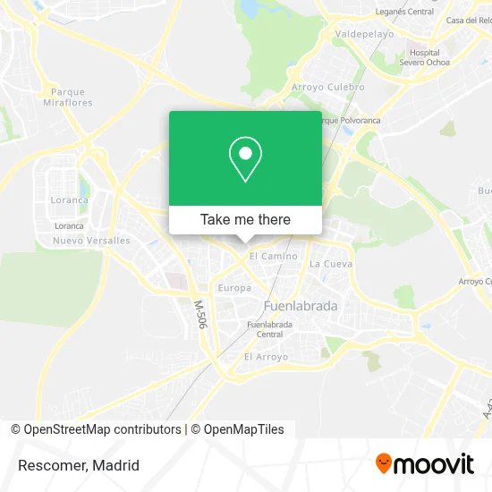
See Rescomer, Fuenlabrada, on the map
Public Transit to Rescomer in Fuenlabrada
Wondering how to get to Rescomer in Fuenlabrada? Moovit helps you find the best way to get to Rescomer with step-by-step directions from the nearest public transit station.
Moovit provides free maps and live directions to help you navigate through your city. View schedules, routes, timetables, and find out how long does it take to get to Rescomer in real time.
Looking for the nearest stop or station to Rescomer? Check out this list of stops closest to your destination: Zamora - Av. Provincias; Av. Europa - Móstoles; Av. Cantabria - Castilla La Vieja; Móstoles - Austria; Móstoles - Colegio; Hospital De Fuenlabrada; Fuenlabrada.
Bus: 471, 493, 526, 2, 491, 492, 3, N803, 1, 13.Train: C5.Metro: M-12.
Want to see if there’s another route that gets you there at an earlier time? Moovit helps you find alternative routes or times. Get directions from and directions to Rescomer easily from the Moovit App or Website.
We make riding to Rescomer easy, which is why over 1.5 million users, including users in Fuenlabrada, trust Moovit as the best app for public transit. You don’t need to download an individual bus app or train app, Moovit is your all-in-one transit app that helps you find the best bus time or train time available.
For information on prices of bus, metro and train, costs and ride fares to Rescomer, please check the Moovit app.
Use the app to navigate to popular places including to the airport, hospital, stadium, grocery store, mall, coffee shop, school, college, and university.
Rescomer Address: Calle Castilla La Vieja, 13 28941 Fuenlabrada street in Fuenlabrada
- Oficina Correos,
- Artículos Publicitariis María Méndez,
- Iber Limostar,
- Caprisshisha,
- Electricidad Jmb,
- Calle Soria, 1,
- Hermanos Sobrino,
- Chusant Cuerpo y Mente,
- La Dulce Marina,
- Merca Mapi,
- Fisanmadrid,
- Panadería y Cafetería Colombiana Don Sabor,
- Calle Soria,
- Restaurante Bar Javi,
- Bar Braseria Oportuno,
- Clinica Ibermedic,
- Paredes,
- Calle Valladolid, 3,
- Redpiso Fuenlabrada - La Serna,
- Correos
Places Near Rescomer (Fuenlabrada)
- Mendez Alvaro, Madrid,
- Tres Aguas, Alcorcón,
- Plaza Mayor, Madrid,
- Centro Comercial La Gavia, Área Metropolitana De Madrid Y Corredor Del Henares,
- Calle de López de Hoyos 169, Madrid,
- Sala La Riviera, Madrid,
- Rastro De Madrid, Área Metropolitana De Madrid Y Corredor Del Henares,
- Mercadillo de Majadahonda, Majadahonda,
- Hospital Universitario Ramón y Cajal, Madrid,
- Nassica, Área Metropolitana De Madrid Y Corredor Del Henares,
- Centro Comercial La Vaguada, Área Metropolitana De Madrid Y Corredor Del Henares,
- Wizink Center, Madrid,
- Hospital Clínico Universitario San Carlos, Madrid,
- Hospital Universitario La Paz, Madrid,
- Estacion de Chamartin, Madrid,
- Centro Comercial Islazul, Área Metropolitana De Madrid Y Corredor Del Henares,
- Plenilunio, Área Metropolitana De Madrid Y Corredor Del Henares,
- Estadio Wanda Metropolitano, Área Metropolitana De Madrid Y Corredor Del Henares,
- Palacio De Vistalegre, Área Metropolitana De Madrid Y Corredor Del Henares,
- Centro Comercial Oasiz Madrid, Área Metropolitana De Madrid Y Corredor Del Henares
How to get to popular places in Madrid with public transit
Get around Fuenlabrada by public transit!
Traveling around Fuenlabrada has never been so easy. See step by step directions as you travel to any attraction, street or major public transit station. View bus and train schedules, arrival times, service alerts and detailed routes on a map, so you know exactly how to get to anywhere in Fuenlabrada.
When traveling to any destination around Fuenlabrada use Moovit's Live Directions with Get Off Notifications to know exactly where and how far to walk, how long to wait for your line, and how many stops are left. Moovit will alert you when it's time to get off — no need to constantly re-check whether yours is the next stop.
Wondering how to use public transit in Fuenlabrada or how to pay for public transit in Fuenlabrada? Moovit public transit app can help you navigate your way with public transit easily, and at minimum cost. It includes public transit fees, ticket prices, and costs. Looking for a map of Fuenlabrada public transit lines? Moovit public transit app shows all public transit maps in Fuenlabrada with all Bus, Train, Metro and Light Rail routes and stops on an interactive map.
Madrid has 4 transit type(s), including: Bus, Train, Metro and Light Rail, operated by several transit agencies, including Metro de Madrid, Metro Ligero, Tranvía de Parla, Renfe Cercanías - Servicios de Autobús especiales, Renfe Cercanias, Renfe Cercanías, EMT, Interurbanos, Urbanos de Alcalá de Henares, Urbanos de Alcobendas, Urbanos de Alcorcón, Urbanos de Algete, Urbanos de Aranjuez, Urbanos de Arganda del Rey and Urbanos de Arroyomolinos