Directions to Rescuer (Uberaba) with public transportation
The following transit lines have routes that pass near Rescuer
How to get to Rescuer by bus?
Click on the bus route to see step by step directions with maps, line arrival times and updated time schedules.
From tim shopping estação, Centro
42 minFrom Rua Alcides Munhoz, Mercês
61 minFrom Rua Myltho Anselmo da Silva, Mercês
66 minFrom Rua Gen. Mario Tourinho, Campina Do Siqueira
50 minFrom Grupo Barigui, Campina Do Siqueira
59 minFrom Linha C42 Pinhais/Bairro Alto, Bairro Alto
73 minFrom Templo Maior (IURD), Rebouças
29 minFrom Rua João Chede, Cic
70 minFrom Rua Coronel João Guilherme Guimarães, Bom Retiro
54 minFrom Hospital Ônix Mateus Leme, Bom Retiro
54 min
Bus stops near Rescuer in Uberaba
Bus lines to Rescuer in Uberaba
- 471 VILA SÃO PAULO, Praça Rui Barbosa → Vila São Paulo,VIEW
- X14 REFORÇO HAUER, Marumbi → Terminal Hauer,VIEW
- 030 INTERBAIRROS III, Terminal Santa Cândida → Terminal Capão Raso,VIEW
- 188 MAD. PILARZINHO / UBERABA, Praça Rui Barbosa ↺ Uberaba (Circular),VIEW
- 338 CENTENÁRIO / HAUER, Terminal Hauer → Terminal Centenário,VIEW
- 472 UBERABA, Praça Rui Barbosa → Uberaba,VIEW
- 516 CANAL BELÉM / SALGADO FILHO, Terminal Hauer ↻ Canal Belém (Circular),VIEW
What are the closest stations to Rescuer?
The closest stations to Rescuer are:
- R. Simão Brante, 954 is 230 meters away, 3 min walk.
- Av. Senador Salgado Filho, 5051 is 294 meters away, 4 min walk.
- R. Pres. Wilson, 227 is 386 meters away, 6 min walk.
Which bus lines stop near Rescuer?
These bus lines stop near Rescuer: 030 INTERBAIRROS III, 338 CENTENÁRIO / HAUER, 472 UBERABA, E01 URANO / GUADALUPE, E99 SÃO JOSÉ / GUADALUPE (VIA T. CENTRAL).
What’s the nearest bus station to Rescuer in Uberaba?
The nearest bus station to Rescuer in Uberaba is R. Simão Brante, 954. It’s a 3 min walk away.
What time is the first bus to Rescuer in Uberaba?
The 188 MAD. PILARZINHO / UBERABA is the first bus that goes to Rescuer in Uberaba. It stops nearby at 3:15 AM.
What time is the last bus to Rescuer in Uberaba?
The 188 MAD. PILARZINHO / UBERABA is the last bus that goes to Rescuer in Uberaba. It stops nearby at 2:33 AM.
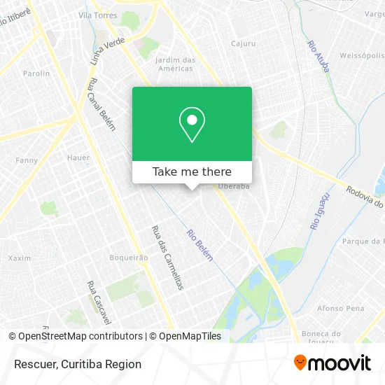
See Rescuer, Uberaba, on the map
Public Transit to Rescuer in Uberaba
Wondering how to get to Rescuer in Uberaba? Moovit helps you find the best way to get to Rescuer with step-by-step directions from the nearest public transit station.
Moovit provides free maps and live directions to help you navigate through your city. View schedules, routes, timetables, and find out how long does it take to get to Rescuer in real time.
Looking for the nearest stop or station to Rescuer? Check out this list of stops closest to your destination: R. Simão Brante; Av. Senador Salgado Filho; R. Pres. Wilson.
Bus: 030 INTERBAIRROS III, 338 CENTENÁRIO / HAUER, 472 UBERABA, E01 URANO / GUADALUPE, E99 SÃO JOSÉ / GUADALUPE (VIA T. CENTRAL), 471 VILA SÃO PAULO, X14 REFORÇO HAUER, 188 MAD. PILARZINHO / UBERABA, 516 CANAL BELÉM / SALGADO FILHO.
Want to see if there’s another route that gets you there at an earlier time? Moovit helps you find alternative routes or times. Get directions from and directions to Rescuer easily from the Moovit App or Website.
We make riding to Rescuer easy, which is why over 1.5 million users, including users in Uberaba, trust Moovit as the best app for public transit. You don’t need to download an individual bus app or train app, Moovit is your all-in-one transit app that helps you find the best bus time or train time available.
For information on prices of bus, costs and ride fares to Rescuer, please check the Moovit app.
Use the app to navigate to popular places including to the airport, hospital, stadium, grocery store, mall, coffee shop, school, college, and university.
Rescuer Address: Travessa Ferreira, 138 Uberaba Curitiba-PR 81570-550 street in Uberaba
- Rua Elias Moyses Schelela 570,
- Condominio Ouro Preto,
- Apepr - Associacao dos Profissionais de Estetica do Parana,
- Black Motos,
- Kartesul Embalagens Encartelados,
- Distribuidora de Gas Angeloni,
- Rua Rodolfo Bernardelli 107,
- Maria Helena Kowalski,
- Fabiane Vitalino,
- Rua Coronel José Carvalho de Oliveira 1621,
- Carmen R Brante,
- Igreja Fonte Da Vida,
- Associação Religiosa Budista Sul Brasil,
- Linha 338 Alimentador Centenário / Hauer,
- SAAB Diesel Transporte Rodoviario de Carga,
- Le Blanc Brechó,
- Templo Budista Higashi Honganji,
- Arenhart & Cia,
- ASP Associação Sul Paranaense da Igreja Adventista do Sétimo Dia,
- Avenida Senador Salgado Filho
Places Near Rescuer (Uberaba)
- Hhhhh, Fazendinha,
- Hospital de Clínicas (HC - UFPR), Centro,
- Hospital do Rocio, Campo,
- Rua General Mário Tourinho, Campina Do Siqueira,
- Parque Barigui, Mercês,
- Rua Martim Afonso 558, Mercês,
- Hospital Angelina Caron, Campina Grande Do Sul,
- Shopping Palladium, Portão,
- Park Shopping Barigüi, Mossunguê,
- Jardim Botânico de Curitiba PR, Centro,
- Hospital Universitário Evangélico de Curitiba, Bigorrilho,
- Hospital Madalena Sofia, Bairro Alto,
- Shopping Estação, Rebouças,
- Jockey Plaza Shopping Center, Tarumã,
- Campo Largo, Campo,
- Hospital Erasto Gaertner, Jardim Das Américas,
- Arena Da Baixada - Curitiba,
- Hospital Nossa Senhora Das Graças, Mercês,
- Hospital Da Cruz Vermelha, Batel,
- Pontifícia Universidade Católica do Paraná (PUCPR), Prado Velho
How to get to popular places in Curitiba Region with public transit
Get around Uberaba by public transit!
Traveling around Uberaba has never been so easy. See step by step directions as you travel to any attraction, street or major public transit station. View bus and train schedules, arrival times, service alerts and detailed routes on a map, so you know exactly how to get to anywhere in Uberaba.
When traveling to any destination around Uberaba use Moovit's Live Directions with Get Off Notifications to know exactly where and how far to walk, how long to wait for your line, and how many stops are left. Moovit will alert you when it's time to get off — no need to constantly re-check whether yours is the next stop.
Wondering how to use public transit in Uberaba or how to pay for public transit in Uberaba? Moovit public transit app can help you navigate your way with public transit easily, and at minimum cost. It includes public transit fees, ticket prices, and costs. Looking for a map of Uberaba public transit lines? Moovit public transit app shows all public transit maps in Uberaba with all Bus and Cable Car routes and stops on an interactive map.
Curitiba Region has 2 transit type(s), including: Bus and Cable Car, operated by several transit agencies, including Sistema Integrado de Mobilidade (URBS), Sistema Integrado de Mobilidade (AMEP), URBS (Cartões bancários e Dinheiro), URBS (Cartões bancários / Cartão URBS), AMEP (Cartões bancários / Cartão MetroCard), AMEP (Cartões bancários / Cartão MetroCard / Dinheiro), Viação Colombo (Dinheiro), TRIAR (Cartão TRIAR / Dinheiro), Empresa Curitiba Cerro Azul (Dinheiro), Expresso Nossa Senhora da Penha (Dinheiro), Empresa Campo Alto Tijucas (Dinheiro), Auto Viação São José (Cartão VEM / Dinheiro), BRT S/A (Cartão VEM / Dinheiro), TransPiedade (Cartão Cidadão / Dinheiro) and Oceânica Sul (Cartão Transporte / Dinheiro)