Directions to Response Robotics Test Facility (Montgomery County) with public transportation
The following transit lines have routes that pass near Response Robotics Test Facility
 Bus: 54, 56, NIST SHUTTLE.
- Train: MARC.
How to get to Response Robotics Test Facility by bus?
Click on the bus route to see step by step directions with maps, line arrival times and updated time schedules.
From Georgia Ave & Icc Park & Ride Lot, Montgomery County
69 minFrom Canopy By Hilton Washington DC Bethesda North North Bethesda, Montgomery County
73 minFrom Montgomery College-Rockville, Montgomery County
48 minFrom Walmart Supercenter, Montgomery County
58 minFrom Rockville, MD, Montgomery County
36 minFrom Pike & Rose (Pike and Rose), Montgomery County
70 minFrom Park Potomac Place, Montgomery County
58 minFrom HJF, Montgomery County
65 minFrom Bullis School, Montgomery County
72 minFrom Glenstone Museum, Montgomery County
68 min
How to get to Response Robotics Test Facility by train?
Click on the train route to see step by step directions with maps, line arrival times and updated time schedules.
Bus stops near Response Robotics Test Facility in Montgomery County
Train station near Response Robotics Test Facility in Montgomery County
- Metropolitan Grove Marc Wb, 9 min walk,VIEW
Bus lines to Response Robotics Test Facility in Montgomery County
What are the closest stations to Response Robotics Test Facility?
The closest stations to Response Robotics Test Facility are:
- Muddy Branch Rd & Pensacola Dr is 238 yards away, 3 min walk.
- Quince Orchard Rd & Purchase St is 666 yards away, 9 min walk.
- Metropolitan Grove Marc Wb is 739 yards away, 9 min walk.
- Nist Administration Building 101 is 1517 yards away, 18 min walk.
Which bus lines stop near Response Robotics Test Facility?
These bus lines stop near Response Robotics Test Facility: 54, 56.
Which train line stops near Response Robotics Test Facility?
MARC (Inbound - Brunswick)
What’s the nearest train station to Response Robotics Test Facility in Montgomery County?
The nearest train station to Response Robotics Test Facility in Montgomery County is Metropolitan Grove Marc Wb. It’s a 9 min walk away.
What’s the nearest bus station to Response Robotics Test Facility in Montgomery County?
The nearest bus station to Response Robotics Test Facility in Montgomery County is Muddy Branch Rd & Pensacola Dr. It’s a 3 min walk away.
What time is the first train to Response Robotics Test Facility in Montgomery County?
The MARC is the first train that goes to Response Robotics Test Facility in Montgomery County. It stops nearby at 5:27 AM.
What time is the last train to Response Robotics Test Facility in Montgomery County?
The MARC is the last train that goes to Response Robotics Test Facility in Montgomery County. It stops nearby at 8:00 PM.
What time is the first bus to Response Robotics Test Facility in Montgomery County?
The 54 is the first bus that goes to Response Robotics Test Facility in Montgomery County. It stops nearby at 5:04 AM.
What time is the last bus to Response Robotics Test Facility in Montgomery County?
The 54 is the last bus that goes to Response Robotics Test Facility in Montgomery County. It stops nearby at 12:08 AM.
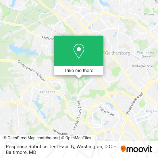
See Response Robotics Test Facility, Montgomery County, on the map
Public Transit to Response Robotics Test Facility in Montgomery County
Wondering how to get to Response Robotics Test Facility in Montgomery County? Moovit helps you find the best way to get to Response Robotics Test Facility with step-by-step directions from the nearest public transit station.
Moovit provides free maps and live directions to help you navigate through your city. View schedules, routes, timetables, and find out how long does it take to get to Response Robotics Test Facility in real time.
Looking for the nearest stop or station to Response Robotics Test Facility? Check out this list of stops closest to your destination: Muddy Branch Rd & Pensacola Dr; Quince Orchard Rd & Purchase St; Metropolitan Grove Marc Wb; Nist Administration Building 101.
Bus: 54, 56, NIST SHUTTLE.Train: MARC.
Want to see if there’s another route that gets you there at an earlier time? Moovit helps you find alternative routes or times. Get directions from and directions to Response Robotics Test Facility easily from the Moovit App or Website.
We make riding to Response Robotics Test Facility easy, which is why over 1.7 million users, including users in Montgomery County, trust Moovit as the best app for public transit. You don’t need to download an individual bus app or train app, Moovit is your all-in-one transit app that helps you find the best bus time or train time available.
For information on prices of bus and train, costs and ride fares to Response Robotics Test Facility, please check the Moovit app.
Use the app to navigate to popular places including to the airport, hospital, stadium, grocery store, mall, coffee shop, school, college, and university.
Response Robotics Test Facility Address: 4 Qhm And Hh street in Montgomery County
- Cultural Center of Tecro,
- Summit Hall Elementary,
- I-270 Exit 10 (Clopper Rd. / West Diamond Ave.),
- Astrazeneca HQ,
- Life Time Athletic ,
- Blink Charging,
- Diamond Avenue Park & Ride,
- MD 117 / W Diamond Ave & Bureau Dr Far Side WB,
- Astrazeneca 950 WRL,
- Astra Zeneca,
- Chick-fil-A,
- Muddy Branch Square,
- Nist Building,
- Igreja Batista Brasileira,
- Aldi,
- Hibachi Sushi Supreme Buffet,
- LA Fitness,
- Shell Recharge,
- Target,
- Lowe's Home Improvement
Places Near Response Robotics Test Facility (Montgomery County)
- Marriott Marquis Washington, DC, Washington,
- M&T Bank Stadium, Baltimore,
- National Theatre, Washington,
- Camden Yards, Baltimore,
- Basilica of the National Shrine, Washington,
- Amazon Hq2, Arlington County,
- Capital One Arena, Washington,
- National Museum of African American History and Culture, Washington,
- Westfield Montgomery Mall, Montgomery County,
- Rock Creek Tennis Center, Washington,
- PG Mall, Prince George's County,
- The Anthem, Washington,
- Warner Theatre, Washington,
- Museum Of The Bible, Washington,
- Georgetown, Washington,
- National Zoo, Washington,
- Sibley Memorial Hospital, Washington,
- Washington National Cathedral, Washington,
- Pennsylvania Ave NW (3rd st and pennsylvania), Washington,
- Washington DC VA Medical Center, Washington
How to get to popular places in Washington, D.C. - Baltimore, MD with public transit
Get around Montgomery County by public transit!
Traveling around Montgomery County has never been so easy. See step by step directions as you travel to any attraction, street or major public transit station. View bus and train schedules, arrival times, service alerts and detailed routes on a map, so you know exactly how to get to anywhere in Montgomery County.
When traveling to any destination around Montgomery County use Moovit's Live Directions with Get Off Notifications to know exactly where and how far to walk, how long to wait for your line, and how many stops are left. Moovit will alert you when it's time to get off — no need to constantly re-check whether yours is the next stop.
Wondering how to use public transit in Montgomery County or how to pay for public transit in Montgomery County? Moovit public transit app can help you navigate your way with public transit easily, and at minimum cost. It includes public transit fees, ticket prices, and costs. Looking for a map of Montgomery County public transit lines? Moovit public transit app shows all public transit maps in Montgomery County with all Bus, Train, Metro, Light Rail and Ferry routes and stops on an interactive map.
Washington, D.C. - Baltimore, MD has 5 transit type(s), including: Bus, Train, Metro, Light Rail and Ferry, operated by several transit agencies, including WMATA, Montgomery County Ride On, Fairfax Connector, TheBus, PRTC, DASH - Alexandria, Arlington Transit (ART), RTA of Central Maryland, MDOT MTA, MDOT MTA Light RailLink, MDOT MTA Commuter Bus, MDOT MTA Local Bus, FXBGO!, Virginia Railway Express (VRE) and MARC