How to get to Rest Tufh by bus?
Click on the bus route to see step by step directions with maps, line arrival times and updated time schedules.
From Villa Sur, Aguascalientes
47 minFrom Agropecuario Viñedos San Marcos, Aguascalientes
40 minFrom Fraccionamiento Los Naranjos, Aguascalientes
35 minFrom Pintores Mexicanos Colonia, Aguascalientes
34 minFrom Fraccionamiento Las Cumbres II, Aguascalientes
28 minFrom Hacienda San Martín, Aguascalientes
43 minFrom Bosch, Aguascalientes
48 minFrom Farmacia Homeopática y Naturista La Fuente de las Hadas, Aguascalientes
42 minFrom Clínica Santuario, Aguascalientes
44 minFrom Zona Centro, Aguascalientes
42 min
Bus stops near Rest Tufh in Aguascalientes
Bus lines to Rest Tufh in Aguascalientes
- RUTA 04, Jesús María - Mahatma Gandhi,VIEW
- RUTA 08, UTMA - Centro (Rivero y Gutiérrez),VIEW
- RUTA 16, Bellavista - Hacienda Nueva,VIEW
- RUTA 19, Vistas de Oriente - Pocitos,VIEW
- RUTA 27, Vicente Guerrero - Valle de los Cactus,VIEW
- RUTA 28, Chichimeco - Mahatma Gandhi,VIEW
- RUTA 36, Lunaria - Centro (Mercado Terán),VIEW
- RUTA 37, UTMA - Hacienda San Marcos,VIEW
- RUTA 43, San Antonio - UTMA,VIEW
- RUTA 43, UTMA - Lomas de New York - San Antonio,VIEW
- RUTA 48, Bellavista - Centro (Panteón de la Cruz),VIEW
- RUTA 10, Uaa Sur,VIEW
- RUTA 09, Los Laureles,VIEW
- RUTA 12, Vicente Guerrero,VIEW
- RUTA 46, Calvillito,VIEW
- RUTA 01, Vicente Guerrero - Margaritas,VIEW
- RUTA 03, La Ribera - UAA Sur,VIEW
- RUTA 06, Jesús María - Mahatma Gandhi,VIEW
- RUTA 07, Villas Las Palmas - Centro (Jardínde Zaragoza),VIEW
- RUTA 29, Lomas del Ajedrez -Centro (Jardínde Zaragoza),VIEW
What are the closest stations to Rest Tufh?
The closest stations to Rest Tufh are:
- Centro (Mercado Terán) is 199 meters away, 3 min walk.
- General Emiliano Zapata, 106 is 208 meters away, 3 min walk.
- Ortega, 125 is 303 meters away, 5 min walk.
- Oriente, 109 is 354 meters away, 5 min walk.
- 5 De Mayo, 401 is 354 meters away, 5 min walk.
- Licenciado Adolfo López Mateos Poniente, 303 is 849 meters away, 11 min walk.
Which bus lines stop near Rest Tufh?
These bus lines stop near Rest Tufh: RUTA 01, RUTA 04, RUTA 05, RUTA 34, RUTA 37, RUTA 43.
What’s the nearest bus station to Rest Tufh in Aguascalientes?
The nearest bus stations to Rest Tufh in Aguascalientes are Centro (Mercado Terán) and General Emiliano Zapata, 106. The closest one is a 3 min walk away.
What time is the first bus to Rest Tufh in Aguascalientes?
The RUTA 41 is the first bus that goes to Rest Tufh in Aguascalientes. It stops nearby at 5:55 AM.
What time is the last bus to Rest Tufh in Aguascalientes?
The RUTA 43 is the last bus that goes to Rest Tufh in Aguascalientes. It stops nearby at 10:21 PM.
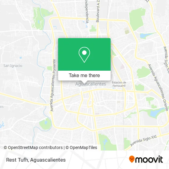
See Rest Tufh, Aguascalientes, on the map
Public Transit to Rest Tufh in Aguascalientes
Wondering how to get to Rest Tufh in Aguascalientes? Moovit helps you find the best way to get to Rest Tufh with step-by-step directions from the nearest public transit station.
Moovit provides free maps and live directions to help you navigate through your city. View schedules, routes, timetables, and find out how long does it take to get to Rest Tufh in real time.
Looking for the nearest stop or station to Rest Tufh? Check out this list of stops closest to your destination: Centro (Mercado Terán); General Emiliano Zapata; Ortega; Oriente; 5 De Mayo; Licenciado Adolfo López Mateos Poniente.
Bus: RUTA 01, RUTA 04, RUTA 05, RUTA 34, RUTA 37, RUTA 43, RUTA 08, RUTA 16, RUTA 19, RUTA 27, RUTA 10, RUTA 09, RUTA 12, RUTA 46, RUTA 03, RUTA 06, RUTA 07, RUTA 29, RUTA 23, RUTA 24, RUTA 25, RUTA 41, RUTA 41.
Want to see if there’s another route that gets you there at an earlier time? Moovit helps you find alternative routes or times. Get directions from and directions to Rest Tufh easily from the Moovit App or Website.
We make riding to Rest Tufh easy, which is why over 1.5 million users, including users in Aguascalientes, trust Moovit as the best app for public transit. You don’t need to download an individual bus app or train app, Moovit is your all-in-one transit app that helps you find the best bus time or train time available.
For information on prices of bus, costs and ride fares to Rest Tufh, please check the Moovit app.
Use the app to navigate to popular places including to the airport, hospital, stadium, grocery store, mall, coffee shop, school, college, and university.
Rest Tufh Address: Calle Alarcón 115, Aguascalientes Centro, 20000 Aguascalientes, Aguascalientes street in Aguascalientes
- Desarrollo y Lotificación de Terrenos de Aguascalientes, S.A. de C.V.,
- Rox Studio - Roxana Muahs,
- Dmm Distribuidora de Marcos y Molduras,
- Tienda de Abarrotes-Alarcón,
- Salon de Belleza Rosita,
- Dolce Delizia Pasteles,
- Bastet,
- La Casa del Pay,
- Unidad Medica Gorostiza,
- Nellys Sport,
- Monte Providencia Suc. Aguascalientes I,
- Dycomyc Papeleria,
- Plaza Tecnomarket,
- Rancho La m,
- Municipio de Jesus Maria,
- Salce Tattoo Studio,
- Laboratorio De Análisis Clínicos Gorostiza,
- Pasteles Artesanales Indra,
- Copiamase,
- Dee Dee's Pizza
Places Near Rest Tufh (Aguascalientes)
- Aeropuerto de Aguascalientes S.A. de C.V., Aguascalientes,
- Parque Las Tres Centurias, Aguascalientes,
- La Isla San Marcos, Aguascalientes,
- Villasuncion, Aguascalientes,
- Hospital Imss No. 3, Aguascalientes,
- Villas de Nuestra Señora de la Asunción, Aguascalientes,
- clinica 3 uaa, Aguascalientes,
- Centro, Aguascalientes,
- Isla San Marcos, Aguascalientes,
- Imss Clinica 1, Aguascalientes,
- Centro Comercial Altaria, Aguascalientes,
- Ciudad industrial, Aguascalientes,
- ESPACIOS, Aguascalientes,
- Universidad Autónoma de Aguascalientes, Aguascalientes,
- Jesús María, Aguascalientes,
- Blvd. Luis Donaldo Colosio, Aguascalientes,
- Nuevo Hospital Hidalgo, Aguascalientes,
- Terminal De Combis, Aguascalientes,
- Central De Autobuses, Aguascalientes,
- Agropecuario, Aguascalientes
How to get to popular places in Aguascalientes with public transit
Get around Aguascalientes by public transit!
Traveling around Aguascalientes has never been so easy. See step by step directions as you travel to any attraction, street or major public transit station. View bus and train schedules, arrival times, service alerts and detailed routes on a map, so you know exactly how to get to anywhere in Aguascalientes.
When traveling to any destination around Aguascalientes use Moovit's Live Directions with Get Off Notifications to know exactly where and how far to walk, how long to wait for your line, and how many stops are left. Moovit will alert you when it's time to get off — no need to constantly re-check whether yours is the next stop.
Wondering how to use public transit in Aguascalientes or how to pay for public transit in Aguascalientes? Moovit public transit app can help you navigate your way with public transit easily, and at minimum cost. It includes public transit fees, ticket prices, and costs. Looking for a map of Aguascalientes public transit lines? Moovit public transit app shows all public transit maps in Aguascalientes with all bus routes and stops on an interactive map.
Aguascalientes has 1 transit type(s), including: bus, operated by several transit agencies, including Coordinación General de Movilidad