Directions to Rest y Alimentos 7 (Santa Isabel Cholula) with public transportation
The following transit lines have routes that pass near Rest y Alimentos 7
How to get to Rest y Alimentos 7 by bus?
Click on the bus route to see step by step directions with maps, line arrival times and updated time schedules.
From Colonia Azcarate, San Andrés Cholula
56 minFrom MAC, San Andrés Cholula
31 minFrom Centro Comercial Cruz del Sur, San Pedro Cholula
52 minFrom Guadalupe Victoria, Puebla
53 minFrom La Joya, Puebla
61 minFrom Agua Azul, San Andrés Cholula
40 minFrom Fraccionamiento Camino Real, Puebla
44 minFrom San Francisco Totimehuacan, Puebla
61 minFrom IMSS Hospital General Regional #20 La Margarita, Puebla
58 minFrom Presidencia Mpal de Cuautlancingo, San Pedro Cholula
67 min
Bus stops near Rest y Alimentos 7 in Santa Isabel Cholula
Bus lines to Rest y Alimentos 7 in Santa Isabel Cholula
- CORREDOR ATLIXCAYOTL, Lomas de Angelopolis - Via Atlixcayotl - Av. Juarez (Circular),VIEW
- TRANSPORTE NOCTURNO, Paseo Bravo - Caseta Atlixco (Circuito),VIEW
- A6, Estadios,VIEW
- RUTA LOMAS DE ANGELÓPOLIS, Ramal 1 Interior De Lomas De Angelópolis,VIEW
- RUTA AZTECA C, Ramal 1, San Esteban - Villa De Los Ángeles,VIEW
- RUTA AZTECA B, Ramal 1, Lomas Flor Del Bosque - Villa De Los Ángeles (Regreso),VIEW
- RUTA PUEBLA, Ramal Puebla - Izucar De Matamoros,VIEW
What are the closest stations to Rest y Alimentos 7?
The closest stations to Rest y Alimentos 7 are:
- Boulevard Interamericano, 102 is 13 meters away, 1 min walk.
- Boulevard Europa, 17 is 715 meters away, 10 min walk.
- Vía Atlixcáyotl, 91 is 823 meters away, 11 min walk.
- Carretera Federal Puebla - Atlixco, 8105 is 1015 meters away, 13 min walk.
- Boulevard De Los Reyes, 6244 is 1029 meters away, 14 min walk.
Which bus lines stop near Rest y Alimentos 7?
These bus lines stop near Rest y Alimentos 7: A6, CORREDOR ATLIXCAYOTL.
What’s the nearest bus station to Rest y Alimentos 7 in Santa Isabel Cholula?
The nearest bus station to Rest y Alimentos 7 in Santa Isabel Cholula is Boulevard Interamericano, 102. It’s a 1 min walk away.
What time is the first bus to Rest y Alimentos 7 in Santa Isabel Cholula?
The TRANSPORTE NOCTURNO is the first bus that goes to Rest y Alimentos 7 in Santa Isabel Cholula. It stops nearby at 3:08 AM.
What time is the last bus to Rest y Alimentos 7 in Santa Isabel Cholula?
The TRANSPORTE NOCTURNO is the last bus that goes to Rest y Alimentos 7 in Santa Isabel Cholula. It stops nearby at 2:15 AM.
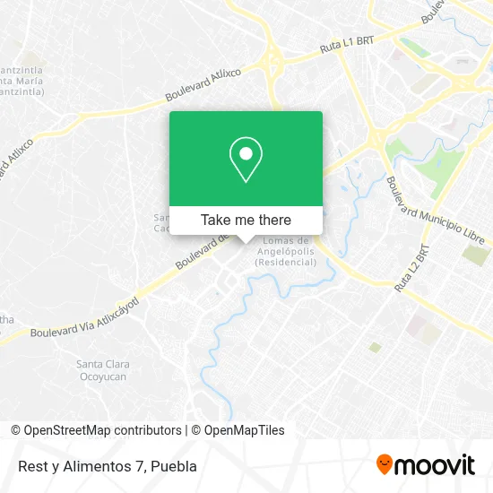
See Rest y Alimentos 7, Santa Isabel Cholula, on the map
Public Transit to Rest y Alimentos 7 in Santa Isabel Cholula
Wondering how to get to Rest y Alimentos 7 in Santa Isabel Cholula? Moovit helps you find the best way to get to Rest y Alimentos 7 with step-by-step directions from the nearest public transit station.
Moovit provides free maps and live directions to help you navigate through your city. View schedules, routes, timetables, and find out how long does it take to get to Rest y Alimentos 7 in real time.
Looking for the nearest stop or station to Rest y Alimentos 7? Check out this list of stops closest to your destination: Boulevard Interamericano; Boulevard Europa; Vía Atlixcáyotl; Carretera Federal Puebla - Atlixco; Boulevard De Los Reyes.
Bus: A6, CORREDOR ATLIXCAYOTL, TRANSPORTE NOCTURNO, RUTA LOMAS DE ANGELÓPOLIS, RUTA AZTECA C, RUTA AZTECA B, RUTA PUEBLA.
Want to see if there’s another route that gets you there at an earlier time? Moovit helps you find alternative routes or times. Get directions from and directions to Rest y Alimentos 7 easily from the Moovit App or Website.
We make riding to Rest y Alimentos 7 easy, which is why over 1.5 million users, including users in Santa Isabel Cholula, trust Moovit as the best app for public transit. You don’t need to download an individual bus app or train app, Moovit is your all-in-one transit app that helps you find the best bus time or train time available.
For information on prices of bus, costs and ride fares to Rest y Alimentos 7, please check the Moovit app.
Use the app to navigate to popular places including to the airport, hospital, stadium, grocery store, mall, coffee shop, school, college, and university.
Rest y Alimentos 7 Address: Boulevard Interamericano, Fracc Lomas de Angelópolis, 72830 San Andrés Cholula, Puebla street in Santa Isabel Cholula
- Paradise Lomas de Angelopolis,
- The Shack Puebla,
- Estado Natural Angelop,
- Dansdans Academy Puebl,
- Consultorio y Farmacias Todos Santos,
- Luis Bravo Salón Lomas,
- La Costurería. Plaza Aquara,
- Angelópolis Clínica Veterinaria,
- Nativa Restaur,
- Plaza Aquara,
- Laboratorios Exakta,
- Computación y Tecnología del Sur de Puebla, S.A. de C.V.,
- Centro Kumon Plaza Aquara,
- Aquara Escuela de Natación,
- Vittorio's Lomas de Angelopolis,
- Papeleria Pape Lomas,
- Pescados y Mariscos La Almeja,
- Reparacion de Celulares Lomas de Angelopolis Puebla,
- Banco Multiva,
- San Antonio Cacalotepec
Places Near Rest y Alimentos 7 (Santa Isabel Cholula)
- 25 Zona Militar, Puebla,
- SAT, San Andrés Cholula,
- Hospital Traumatología y Ortopedia de Puebla, San Pedro Cholula,
- Galerías Serdán, San Pedro Cholula,
- Hospital General Regional 36 IMSS San Alejandro, San Andrés Cholula,
- Centro Integral de Servicios CIS, San Andrés Cholula,
- Centro Comercial Angelópolis, San Andrés Cholula,
- Zona de los Fuertes, Puebla,
- Estadio Cuauhtémoc, Puebla,
- Tres Cruces, Puebla,
- Hospital Imss La Margarita, Puebla,
- Secretaria de Finanzas, Puebla,
- Parque Puebla, Puebla,
- Parque Ecologico, Pue., San Andrés Cholula,
- Plaza Las Animas, Puebla,
- Ciudad Universitaria, Puebla,
- Ciudad Judicial del Estado de Puebla, San Andrés Cholula,
- Centro de Desarrollo Comunitario Tres Cruces, Puebla,
- Plaza Dorada Centro Comercial, Puebla,
- Complejo Cultural Universitario, Ocoyucan
How to get to popular places in Puebla with public transit
Get around Santa Isabel Cholula by public transit!
Traveling around Santa Isabel Cholula has never been so easy. See step by step directions as you travel to any attraction, street or major public transit station. View bus and train schedules, arrival times, service alerts and detailed routes on a map, so you know exactly how to get to anywhere in Santa Isabel Cholula.
When traveling to any destination around Santa Isabel Cholula use Moovit's Live Directions with Get Off Notifications to know exactly where and how far to walk, how long to wait for your line, and how many stops are left. Moovit will alert you when it's time to get off — no need to constantly re-check whether yours is the next stop.
Wondering how to use public transit in Santa Isabel Cholula or how to pay for public transit in Santa Isabel Cholula? Moovit public transit app can help you navigate your way with public transit easily, and at minimum cost. It includes public transit fees, ticket prices, and costs. Looking for a map of Santa Isabel Cholula public transit lines? Moovit public transit app shows all public transit maps in Santa Isabel Cholula with all bus routes and stops on an interactive map.
Puebla has 1 transit type(s), including: bus, operated by several transit agencies, including RUTA, RUTA Alimentadoras, Rutas Convencionales and Líneas temporales