How to get to Restaurant Image by bus?
Click on the bus route to see step by step directions with maps, line arrival times and updated time schedules.
From SW 137th Ave / US-1, Princeton-Goulds
52 minFrom Robert Morgan Educational Center, Kendale Lakes-Tamiami
99 minFrom Herbert Ammons Middle School, Kendale Lakes-Tamiami
94 minFrom Cutler Bay, FL, Princeton-Goulds
128 minFrom Zoo Miami, Kendale Lakes-Tamiami
133 minFrom South Dade Senior High School, Homestead
56 minFrom SW 184 St & US 1, Kendall-Palmetto Bay
70 minFrom US 1@SW 248 St, Princeton-Goulds
58 minFrom Eureka Drive & U.S. 1, Kendall-Palmetto Bay
64 minFrom Baptist homestead hospital, Homestead
57 min
Bus stops near Restaurant Image in Homestead
Bus lines to Restaurant Image in Homestead
What are the closest stations to Restaurant Image?
The closest stations to Restaurant Image are:
- San Remo Community is 231 yards away, 4 min walk.
- Sw 167 Av @ Sw 336 St is 290 yards away, 4 min walk.
- Sw 328 St & Sw 167 Av (W/f) is 927 yards away, 12 min walk.
Which bus line stops near Restaurant Image?
344 (344 - Homestead Park Pl/English Av)
What’s the nearest bus station to Restaurant Image in Homestead?
The nearest bus stations to Restaurant Image in Homestead are San Remo Community and Sw 167 Av @ Sw 336 St. The closest one is a 4 min walk away.
What time is the first bus to Restaurant Image in Homestead?
The 344 is the first bus that goes to Restaurant Image in Homestead. It stops nearby at 6:10 AM.
What time is the last bus to Restaurant Image in Homestead?
The 344 is the last bus that goes to Restaurant Image in Homestead. It stops nearby at 8:16 PM.
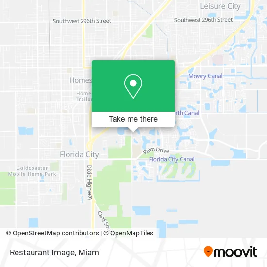
See Restaurant Image, Homestead, on the map
Public Transit to Restaurant Image in Homestead
Wondering how to get to Restaurant Image in Homestead? Moovit helps you find the best way to get to Restaurant Image with step-by-step directions from the nearest public transit station.
Moovit provides free maps and live directions to help you navigate through your city. View schedules, routes, timetables, and find out how long does it take to get to Restaurant Image in real time.
Looking for the nearest stop or station to Restaurant Image? Check out this list of stops closest to your destination: San Remo Community; Sw 167 Av @ Sw 336 St; Sw 328 St & Sw 167 Av (W/f).
Bus: 344, EAST/WEST, HOMELR, HOMECR.
Want to see if there’s another route that gets you there at an earlier time? Moovit helps you find alternative routes or times. Get directions from and directions to Restaurant Image easily from the Moovit App or Website.
We make riding to Restaurant Image easy, which is why over 1.5 million users, including users in Homestead, trust Moovit as the best app for public transit. You don’t need to download an individual bus app or train app, Moovit is your all-in-one transit app that helps you find the best bus time or train time available.
For information on prices of bus, costs and ride fares to Restaurant Image, please check the Moovit app.
Use the app to navigate to popular places including to the airport, hospital, stadium, grocery store, mall, coffee shop, school, college, and university.
Restaurant Image Address: 1541 SE 12th Ave Homestead, FL 33034 street in Homestead
- Iglesia Cristiana El Deseado de las Naciones,
- Get Your Roll on,
- Palm Bakery,
- Eastside Baptist Church,
- Kike's Driving School,
- Decroly Learning Child Care Center,
- Sina Medical Center,
- Day Care Principitos,
- Avella Park,
- MC Roofing Service,
- Keller Williams Realty,
- Dadeschools,
- El Trailer,
- AT&T,
- Biscayne National Park,
- BJ's,
- Gateway Environmental K-8 LRNG Ctr,
- Presto! ATM,
- Brains & Brawn,
- Exit 1/Florida City/S
Places Near Restaurant Image (Homestead)
- Zoo Miami, Miami,
- Miami Freedom Park, Miami,
- Bayside Marketplace, Miami,
- Marlins Park, Miami,
- Wynwood, Miami,
- Miami Design District, Miami,
- Sawgrass mall ( FL ), Miami Beach,
- Little Havana, Miami,
- Miami-Dade County Courthouse, Miami,
- Dolphin Mall, Miami,
- Richard E. Gerstein Justice Building, Miami,
- Hard Rock Stadium, Miami Gardens,
- Keiser University Flagship Campus, West Palm Beach,
- Dolphin Mall Bus, Miami,
- Aventura Mall, Miami Beach,
- Miami VA Hospital, Miami,
- Brickell City Centre, Miami,
- Aventura Mall, Miami,
- Port of Miami Cruise Terminal, Miami,
- Sawgrass Mall, Miami
How to get to popular places in Miami with public transit
Get around Homestead by public transit!
Traveling around Homestead has never been so easy. See step by step directions as you travel to any attraction, street or major public transit station. View bus and train schedules, arrival times, service alerts and detailed routes on a map, so you know exactly how to get to anywhere in Homestead.
When traveling to any destination around Homestead use Moovit's Live Directions with Get Off Notifications to know exactly where and how far to walk, how long to wait for your line, and how many stops are left. Moovit will alert you when it's time to get off — no need to constantly re-check whether yours is the next stop.
Wondering how to use public transit in Homestead or how to pay for public transit in Homestead? Moovit public transit app can help you navigate your way with public transit easily, and at minimum cost. It includes public transit fees, ticket prices, and costs. Looking for a map of Homestead public transit lines? Moovit public transit app shows all public transit maps in Homestead with all Bus, Train, Light Rail and Ferry routes and stops on an interactive map.
Miami has 4 transit type(s), including: Bus, Train, Light Rail and Ferry, operated by several transit agencies, including Broward County Transit, Miami-Dade Transit, Metrorail, Palm Tran, Tri-Rail, Brightline, MARTY, City of Homestead Trolley, Key West Transit, Treasure Coast Connector, GoLine IRT, Amtrak, Greyhound-us, FlixBus-us and Aventura Express Shuttle Bus