How to get to Restaurante Ch by bus?
Click on the bus route to see step by step directions with maps, line arrival times and updated time schedules.
From Ciudad Financiera Banco Santander, Boadilla Del Monte
80 minFrom C.C. Parque Oeste, Alcorcón
52 minFrom Tanatorio De Móstoles, Área Metropolitana De Madrid Y Corredor Del Henares
70 minFrom San Jose De Valderas, Área Metropolitana De Madrid Y Corredor Del Henares
75 minFrom Calle Alfredo Nobel 10, Alcorcón
77 minFrom Tanatorio Alcorcón, Alcorcón
55 minFrom Parque Polvoranca, Leganés
138 minFrom Jowke, Alcorcón
63 minFrom C.C. El Corte Inglés (San José de Valderas), Alcorcón
65 minFrom Calle del Trueno 32, Leganés
57 min
Bus stops near Restaurante Ch in Móstoles
Bus lines to Restaurante Ch in Móstoles
What are the closest stations to Restaurante Ch?
The closest stations to Restaurante Ch are:
- Tamarindo - Almendro is 705 meters away, 10 min walk.
- Av. Rosales - Tamarindo is 1295 meters away, 17 min walk.
Which bus lines stop near Restaurante Ch?
These bus lines stop near Restaurante Ch: 5, 534, 535, 538, 547.
What’s the nearest bus station to Restaurante Ch in Móstoles?
The nearest bus station to Restaurante Ch in Móstoles is Tamarindo - Almendro. It’s a 10 min walk away.
What time is the first bus to Restaurante Ch in Móstoles?
The N505 is the first bus that goes to Restaurante Ch in Móstoles. It stops nearby at 3:38 AM.
What time is the last bus to Restaurante Ch in Móstoles?
The N505 is the last bus that goes to Restaurante Ch in Móstoles. It stops nearby at 2:08 AM.
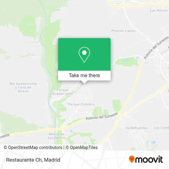
See Restaurante Ch, Móstoles, on the map
Public Transit to Restaurante Ch in Móstoles
Wondering how to get to Restaurante Ch in Móstoles? Moovit helps you find the best way to get to Restaurante Ch with step-by-step directions from the nearest public transit station.
Moovit provides free maps and live directions to help you navigate through your city. View schedules, routes, timetables, and find out how long does it take to get to Restaurante Ch in real time.
Looking for the nearest stop or station to Restaurante Ch? Check out this list of stops closest to your destination: Tamarindo - Almendro; Av. Rosales - Tamarindo.
Bus: 5, 534, 535, 538, 547, N505.
Want to see if there’s another route that gets you there at an earlier time? Moovit helps you find alternative routes or times. Get directions from and directions to Restaurante Ch easily from the Moovit App or Website.
We make riding to Restaurante Ch easy, which is why over 1.5 million users, including users in Móstoles, trust Moovit as the best app for public transit. You don’t need to download an individual bus app or train app, Moovit is your all-in-one transit app that helps you find the best bus time or train time available.
For information on prices of bus, metro, light rail and train, costs and ride fares to Restaurante Ch, please check the Moovit app.
Use the app to navigate to popular places including to the airport, hospital, stadium, grocery store, mall, coffee shop, school, college, and university.
Restaurante Ch Address: Paseo Móstoles, 193 28935 Parque Coimbra Móstoles street in Móstoles
- Shawarma El Recreo,
- Plaza China Biosca Sun,
- Oriente Próximo S.L,
- The Good Burger Tgb Mo,
- Avda Byp Tapas,
- Albia Com. Madrid Fune,
- Clínica Dental Skd,
- Herbolaro Santa Ana Mo,
- Tintorería 5asec M14,
- Hanul Romanilor,
- Ipc,
- Melo Exprés,
- Registro de la Propied,
- Valverauto,
- Instituto Belleza Camp,
- Marsan,
- Bedland Móstoles,
- Carrefour,
- Alimentación Xue Qu,
- Móvil World
Places Near Restaurante Ch (Móstoles)
- Plaza Mayor, Madrid,
- Estacion de Chamartin, Madrid,
- Sala La Riviera, Madrid,
- Palacio De Vistalegre, Área Metropolitana De Madrid Y Corredor Del Henares,
- Centro Comercial Islazul, Área Metropolitana De Madrid Y Corredor Del Henares,
- Centro Comercial La Gavia, Área Metropolitana De Madrid Y Corredor Del Henares,
- Mercadillo de Majadahonda, Majadahonda,
- Estadio Wanda Metropolitano, Área Metropolitana De Madrid Y Corredor Del Henares,
- Hospital Universitario Ramón y Cajal, Madrid,
- Nassica, Área Metropolitana De Madrid Y Corredor Del Henares,
- Hospital Clínico Universitario San Carlos, Madrid,
- Rastro De Madrid, Área Metropolitana De Madrid Y Corredor Del Henares,
- Plenilunio, Área Metropolitana De Madrid Y Corredor Del Henares,
- Calle de López de Hoyos 169, Madrid,
- Tres Aguas, Alcorcón,
- Mendez Alvaro, Madrid,
- Centro Comercial Oasiz Madrid, Área Metropolitana De Madrid Y Corredor Del Henares,
- Wizink Center, Madrid,
- Hospital Universitario La Paz, Madrid,
- Centro Comercial La Vaguada, Área Metropolitana De Madrid Y Corredor Del Henares
How to get to popular places in Madrid with public transit
Get around Móstoles by public transit!
Traveling around Móstoles has never been so easy. See step by step directions as you travel to any attraction, street or major public transit station. View bus and train schedules, arrival times, service alerts and detailed routes on a map, so you know exactly how to get to anywhere in Móstoles.
When traveling to any destination around Móstoles use Moovit's Live Directions with Get Off Notifications to know exactly where and how far to walk, how long to wait for your line, and how many stops are left. Moovit will alert you when it's time to get off — no need to constantly re-check whether yours is the next stop.
Wondering how to use public transit in Móstoles or how to pay for public transit in Móstoles? Moovit public transit app can help you navigate your way with public transit easily, and at minimum cost. It includes public transit fees, ticket prices, and costs. Looking for a map of Móstoles public transit lines? Moovit public transit app shows all public transit maps in Móstoles with all Bus, Train, Metro and Light Rail routes and stops on an interactive map.
Madrid has 4 transit type(s), including: Bus, Train, Metro and Light Rail, operated by several transit agencies, including Metro de Madrid, Metro Ligero, Tranvía de Parla, Renfe Cercanías - Servicios de Autobús especiales, Renfe Cercanias, Renfe Cercanías, EMT, Interurbanos, Urbanos de Alcalá de Henares, Urbanos de Alcobendas, Urbanos de Alcorcón, Urbanos de Algete, Urbanos de Aranjuez, Urbanos de Arganda del Rey and Urbanos de Arroyomolinos