How to get to Restaurante Gaivota Azul by bus?
Click on the bus route to see step by step directions with maps, line arrival times and updated time schedules.
From Pedra De Guaratiba, Pedra De Guaratiba
72 minFrom Posto 12, Recreio Dos Bandeirantes
62 minFrom Estrada Dos Bandeirantes, 29192, Vargem Grande
47 minFrom Brt Recreio Shopping, Recreio Dos Bandeirantes
45 minFrom Terminal Do Terreirão, Recreio Dos Bandeirantes
49 minFrom Parque Chico Mendes, Recreio Dos Bandeirantes
57 minFrom Brt Gilka Machado, Recreio Dos Bandeirantes
48 minFrom Amoedo, Recreio Dos Bandeirantes
41 minFrom Túnel da Grota Funda, Recreio Dos Bandeirantes
49 min
Bus stops near Restaurante Gaivota Azul in Rio de Janeiro Region
Bus lines to Restaurante Gaivota Azul in Rio de Janeiro Region
What are the closest stations to Restaurante Gaivota Azul?
The closest stations to Restaurante Gaivota Azul are:
- Restinga Da Marambaia is 174 meters away, 4 min walk.
- Ponto Final - Barra De Guaratiba (Linha 899) is 213 meters away, 4 min walk.
Which bus lines stop near Restaurante Gaivota Azul?
These bus lines stop near Restaurante Gaivota Azul: 867, 899.
What’s the nearest bus station to Restaurante Gaivota Azul in Rio de Janeiro Region?
The nearest bus stations to Restaurante Gaivota Azul in Rio de Janeiro Region are Restinga Da Marambaia and Ponto Final - Barra De Guaratiba (Linha 899). The closest one is a 4 min walk away.
What time is the first bus to Restaurante Gaivota Azul in Rio de Janeiro Region?
The SN 867 is the first bus that goes to Restaurante Gaivota Azul in Rio de Janeiro Region. It stops nearby at 3:30 AM.
What time is the last bus to Restaurante Gaivota Azul in Rio de Janeiro Region?
The SN 867 is the last bus that goes to Restaurante Gaivota Azul in Rio de Janeiro Region. It stops nearby at 3:36 AM.
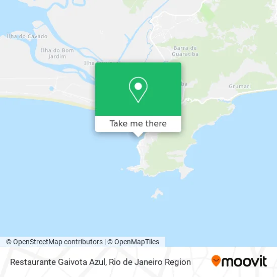
See Restaurante Gaivota Azul, Rio de Janeiro Region, on the map
Public Transit to Restaurante Gaivota Azul in Rio de Janeiro Region
Wondering how to get to Restaurante Gaivota Azul in Rio de Janeiro Region? Moovit helps you find the best way to get to Restaurante Gaivota Azul with step-by-step directions from the nearest public transit station.
Moovit provides free maps and live directions to help you navigate through your city. View schedules, routes, timetables, and find out how long does it take to get to Restaurante Gaivota Azul in real time.
Looking for the nearest stop or station to Restaurante Gaivota Azul? Check out this list of stops closest to your destination: Restinga Da Marambaia; Ponto Final - Barra De Guaratiba (Linha 899).
Bus: 867, 899, SN 867, SV 899.
Want to see if there’s another route that gets you there at an earlier time? Moovit helps you find alternative routes or times. Get directions from and directions to Restaurante Gaivota Azul easily from the Moovit App or Website.
We make riding to Restaurante Gaivota Azul easy, which is why over 1.5 million users, including users in Rio de Janeiro Region, trust Moovit as the best app for public transit. You don’t need to download an individual bus app or train app, Moovit is your all-in-one transit app that helps you find the best bus time or train time available.
For information on prices of bus, costs and ride fares to Restaurante Gaivota Azul, please check the Moovit app.
Use the app to navigate to popular places including to the airport, hospital, stadium, grocery store, mall, coffee shop, school, college, and university.
Restaurante Gaivota Azul Address: Estrada Burle Marx street in Rio de Janeiro Region
- Clube Kanaloa Rio Canoa Havaiana Esporte a Remo Surf Turismo,
- Le Relais de Marambaia - Chambre 2,
- Pousada do Mar Guaratiba,
- Le Relais de Marambaia,
- Stone Beach Clube,
- Pedra do Telegrafo,
- Trilha da Pedra do Telégrafo,
- Laje Marquinho Silva - Guaratiba,
- Rua Almirante Carlos Tinoco,
- Luiz Sérgio Souza de Paiva Consultório Odontológico,
- Pousada-Hostel Pe na Areia,
- Cia Ambiental,
- 2c Martins,
- Rooftop Marambaia,
- Marambaia Café (Marambaia Cafe Restaurante & Lounge Club),
- Marambaia Cafe e Bar e Restaurante,
- Salão Soft Hair,
- Clube da Praia,
- Ponte Velha da Marambaia,
- Centro de Avaliação do Exército
Places Near Restaurante Gaivota Azul (Rio de Janeiro Region)
- Niterói, Niterói,
- Avenida Venezuela 134, Saúde,
- Museu Do Amanhã, Centro,
- Feira Livre da Gloria, Glória,
- Shopping Downtown, Barra Da Tijuca,
- Shopping RioSul, Botafogo,
- Praia do Arpoador, Ipanema,
- Hospital Federal Do Andaraí, Andaraí,
- Shopping Rio Sul, Botafogo,
- Rua Licínio Cardoso, São Francisco Xavier,
- Avenida Rio Branco, Centro,
- Norte Shopping, Cachambi,
- Hospital Federal Cardoso Fontes, Jacarepaguá,
- Rodoviária Novo Rio (Rodoviária do Rio de Janeiro), Santo Cristo,
- Rio De Janeiro,
- Shopping Nova América, Del Castilho,
- Rua Ulysses Guimarães 16, Cidade Nova,
- Feirão De Malhas, Duque De Caxias,
- Hospital Pedro Ernesto, Vila Isabel,
- Hospital Municipal Ronaldo Gazolla, Acari
How to get to popular places in Rio de Janeiro Region with public transit
Get around Rio de Janeiro Region by public transit!
Traveling around Rio de Janeiro Region has never been so easy. See step by step directions as you travel to any attraction, street or major public transit station. View bus and train schedules, arrival times, service alerts and detailed routes on a map, so you know exactly how to get to anywhere in Rio de Janeiro Region.
When traveling to any destination around Rio de Janeiro Region use Moovit's Live Directions with Get Off Notifications to know exactly where and how far to walk, how long to wait for your line, and how many stops are left. Moovit will alert you when it's time to get off — no need to constantly re-check whether yours is the next stop.
Wondering how to use public transit in Rio de Janeiro Region or how to pay for public transit in Rio de Janeiro Region? Moovit public transit app can help you navigate your way with public transit easily, and at minimum cost. It includes public transit fees, ticket prices, and costs. Looking for a map of Rio de Janeiro Region public transit lines? Moovit public transit app shows all public transit maps in Rio de Janeiro Region with all Bus, Train, Metro, Light Rail, Ferry, Cable Car, Gondola and Funicular routes and stops on an interactive map.
Rio de Janeiro Region has 8 transit type(s), including: Bus, Train, Metro, Light Rail, Ferry, Cable Car, Gondola and Funicular, operated by several transit agencies, including TrensRJ, Metrô Rio, VLT Carioca, Barcas Rio, BRT MOBI-Rio, Auto Viação Alpha, Auto Viação Tijuca, Gire Transportes, Transurb, Viação Nossa Senhora das Graças, Consórcio INTERSUL, Braso Lisboa (Municipal), Caprichosa Auto Ônibus, Auto Viação Três Amigos and Rodoviária Âncora Matias