How to get to Restaurants by bus?
Click on the bus route to see step by step directions with maps, line arrival times and updated time schedules.
From Flagler Monument Island, Miami Beach
72 minFrom Lincoln Road, Miami Beach (South Beach), Miami Beach
51 minFrom Northside Station, Miami
55 minFrom South Point, Miami Beach
55 minFrom BAYSHORE, Miami
42 minFrom Nicklaus Children's Hospital, Miami
57 minFrom Joe's Stone Crab, Miami Beach
56 minFrom The Fillmore, Miami Beach
55 minFrom South Miami Hospital Victor E. Clark Building, Miami
83 minFrom Doral Voice, North Westside
76 min
How to get to Restaurants by train?
Click on the train route to see step by step directions with maps, line arrival times and updated time schedules.
Bus stops near Restaurants in Miami
Train station near Restaurants in Miami
- Coconut Grove, 3 min walk,VIEW
Bus lines to Restaurants in Miami
What are the closest stations to Restaurants?
The closest stations to Restaurants are:
- W Flagler St & Nw 27 Av is 24 yards away, 1 min walk.
- Nw 27 Av @ W Flagler St is 79 yards away, 2 min walk.
- Coconut Grove is 199 yards away, 3 min walk.
- Nw 22 Av & W Flagler St is 474 yards away, 6 min walk.
- Beacom Bd @ Sw 1 St is 502 yards away, 7 min walk.
- Beacom Bd @ Sw 2 St is 510 yards away, 7 min walk.
Which bus lines stop near Restaurants?
These bus lines stop near Restaurants: 11, 27.
Which train lines stop near Restaurants?
These train lines stop near Restaurants: GREEN, ORANGE.
What’s the nearest train station to Restaurants in Miami?
The nearest train station to Restaurants in Miami is Coconut Grove. It’s a 3 min walk away.
What’s the nearest bus station to Restaurants in Miami?
The nearest bus station to Restaurants in Miami is W Flagler St & Nw 27 Av. It’s a 1 min walk away.
What time is the first train to Restaurants in Miami?
The GREEN is the first train that goes to Restaurants in Miami. It stops nearby at 5:11 AM.
What time is the last train to Restaurants in Miami?
The GREEN is the last train that goes to Restaurants in Miami. It stops nearby at 12:53 AM.
What time is the first bus to Restaurants in Miami?
The 27 is the first bus that goes to Restaurants in Miami. It stops nearby at 3:09 AM.
What time is the last bus to Restaurants in Miami?
The 27 is the last bus that goes to Restaurants in Miami. It stops nearby at 3:34 AM.
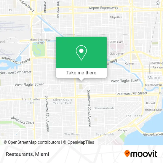
See Restaurants, Miami, on the map
Public Transit to Restaurants in Miami
Wondering how to get to Restaurants in Miami? Moovit helps you find the best way to get to Restaurants with step-by-step directions from the nearest public transit station.
Moovit provides free maps and live directions to help you navigate through your city. View schedules, routes, timetables, and find out how long does it take to get to Restaurants in real time.
Looking for the nearest stop or station to Restaurants? Check out this list of stops closest to your destination: W Flagler St & Nw 27 Av; Nw 27 Av @ W Flagler St; Coconut Grove; Nw 22 Av & W Flagler St; Beacom Bd @ Sw 1 St; Beacom Bd @ Sw 2 St.
Bus: 11, 27, 211, MIAHAVA, 22, 208, 207.Train: GREEN, ORANGE.
Want to see if there’s another route that gets you there at an earlier time? Moovit helps you find alternative routes or times. Get directions from and directions to Restaurants easily from the Moovit App or Website.
We make riding to Restaurants easy, which is why over 1.5 million users, including users in Miami, trust Moovit as the best app for public transit. You don’t need to download an individual bus app or train app, Moovit is your all-in-one transit app that helps you find the best bus time or train time available.
For information on prices of bus, train and light rail, costs and ride fares to Restaurants, please check the Moovit app.
Use the app to navigate to popular places including to the airport, hospital, stadium, grocery store, mall, coffee shop, school, college, and university.
Restaurants Address: 50 NW 24th Ave Miami, FL 33125 street in Miami
- Patrizia Bozzi,
- El Palenque Pizzeria,
- Food Mart,
- ATM,
- Da Coven,
- Access,
- Aqua Pharmacy,
- My Angel Service,
- City Parking Inc Lot 1,
- de la Cruz Financials & Insurance Inc,
- Botanica Ashe Orunmila,
- Pet Shop Eddyrolexdj.,
- Miami Senior High School,
- Company Inc.,
- USPS,
- Leon Healthy Living Centers,
- W. Flagler ST and 27 AV,
- Roberto Soto Pressure Cleaning & Pintura,
- New York Oven Pizzeria,
- Chicago's Pizzeria
Places Near Restaurants (Miami)
- Hard Rock Stadium, Miami Gardens,
- Richard E. Gerstein Justice Building, Miami,
- Miami Freedom Park, Miami,
- Wynwood, Miami,
- Little Havana, Miami,
- Miami Design District, Miami,
- Miami-Dade County Courthouse, Miami,
- Brickell City Centre, Miami,
- Aventura Mall, Miami,
- Sawgrass Mall, Miami,
- Dolphin Mall, Miami,
- Dolphin Mall Bus, Miami,
- Miami VA Hospital, Miami,
- Marlins Park, Miami,
- Keiser University Flagship Campus, West Palm Beach,
- Sawgrass mall ( FL ), Miami Beach,
- Zoo Miami, Miami,
- Aventura Mall, Miami Beach,
- Bayside Marketplace, Miami,
- Port of Miami Cruise Terminal, Miami
How to get to popular places in Miami with public transit
Get around Miami by public transit!
Traveling around Miami has never been so easy. See step by step directions as you travel to any attraction, street or major public transit station. View bus and train schedules, arrival times, service alerts and detailed routes on a map, so you know exactly how to get to anywhere in Miami.
When traveling to any destination around Miami use Moovit's Live Directions with Get Off Notifications to know exactly where and how far to walk, how long to wait for your line, and how many stops are left. Moovit will alert you when it's time to get off — no need to constantly re-check whether yours is the next stop.
Wondering how to use public transit in Miami or how to pay for public transit in Miami? Moovit public transit app can help you navigate your way with public transit easily, and at minimum cost. It includes public transit fees, ticket prices, and costs. Looking for a map of Miami public transit lines? Moovit public transit app shows all public transit maps in Miami with all Bus, Train, Light Rail and Ferry routes and stops on an interactive map.
Miami has 4 transit type(s), including: Bus, Train, Light Rail and Ferry, operated by several transit agencies, including Broward County Transit, Miami-Dade Transit, Metrorail, Palm Tran, Tri-Rail, Brightline, MARTY, City of Homestead Trolley, Key West Transit, Treasure Coast Connector, GoLine IRT, Amtrak, Greyhound-us, FlixBus-us and Aventura Express Shuttle Bus