How to get to Restinga by bus?
Click on the bus route to see step by step directions with maps, line arrival times and updated time schedules.
From Instituto Politécnico Viana do Castelo, Viana do Castelo (Santa Maria Maior e Monserrate) e Meadela
61 minFrom Central de Camionagem Póvoa de Varzim, Póvoa de Varzim, Beiriz e Argivai
54 minFrom Central de Camionagem de Barcelos, Barcelos
52 minFrom Várzea, Barcelos
102 minFrom Barcelos, Barcelos
57 minFrom IPCA - Escola Superior de Gestão, Barcelos, Vila Boa e Vila Frescainha (São Martinho e São Pedro)
54 minFrom Beiriz, Póvoa de Varzim, Beiriz e Argivai
102 minFrom Zona Industrial Nº1 de Neiva, São Romão de Neiva
42 minFrom Hospital da Luz Póvoa de Varzim, A Ver-O-Mar, Amorim e Terroso
55 minFrom Aver-o-Mar, A Ver-O-Mar, Amorim e Terroso
68 min
Bus stops near Restinga in Apúlia e Fão
Bus lines to Restinga in Apúlia e Fão
- 120, Póvoa de Varzim - Viana do Castelo,VIEW
- 211, Braga (Terminal) - Esposende (Terminal),VIEW
- 215, Barcelos - Apúlia (por Esposende),VIEW
- 216, Barcelos - Esposende (via Vila Seca),VIEW
- 402, Esposende - Vila Chã (por Marinhas),VIEW
- 403, Esposende - Gemeses (por Gandra),VIEW
- 404, Esposende - Forjães,VIEW
- 405, Esposende - Apúlia - Cedovém - Esposende,VIEW
- 409, Circular | Marinhas - Góios - Cepães,VIEW
- 413, Esposende - Curvos,VIEW
- 3006, Esposende (CCT) (via Aguçadora),VIEW
What are the closest stations to Restinga?
The closest stations to Restinga are:
- Esposende (Hospital) | Escola Sec. is 31 meters away, 1 min walk.
- Escola SEc. Esposende is 124 meters away, 3 min walk.
Which bus lines stop near Restinga?
These bus lines stop near Restinga: 120, 215.
What’s the nearest bus station to Restinga in Apúlia e Fão?
The nearest bus station to Restinga in Apúlia e Fão is Esposende (Hospital) | Escola Sec.. It’s a 1 min walk away.
What time is the first bus to Restinga in Apúlia e Fão?
The 404 is the first bus that goes to Restinga in Apúlia e Fão. It stops nearby at 6:21 AM.
What time is the last bus to Restinga in Apúlia e Fão?
The 3006 is the last bus that goes to Restinga in Apúlia e Fão. It stops nearby at 8:59 PM.
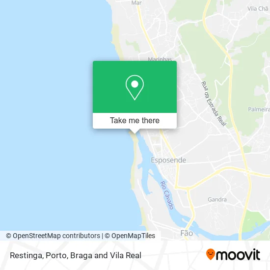
See Restinga, Apúlia e Fão, on the map
Public Transit to Restinga in Apúlia e Fão
Wondering how to get to Restinga in Apúlia e Fão? Moovit helps you find the best way to get to Restinga with step-by-step directions from the nearest public transit station.
Moovit provides free maps and live directions to help you navigate through your city. View schedules, routes, timetables, and find out how long does it take to get to Restinga in real time.
Looking for the nearest stop or station to Restinga? Check out this list of stops closest to your destination: Esposende (Hospital) | Escola Sec.; Escola SEc. Esposende.
Bus: 120, 215, 211, 216, 402, 3006.
Want to see if there’s another route that gets you there at an earlier time? Moovit helps you find alternative routes or times. Get directions from and directions to Restinga easily from the Moovit App or Website.
We make riding to Restinga easy, which is why over 1.5 million users, including users in Apúlia e Fão, trust Moovit as the best app for public transit. You don’t need to download an individual bus app or train app, Moovit is your all-in-one transit app that helps you find the best bus time or train time available.
For information on prices of bus, costs and ride fares to Restinga, please check the Moovit app.
Use the app to navigate to popular places including to the airport, hospital, stadium, grocery store, mall, coffee shop, school, college, and university.
Location: Apúlia e Fão, Porto, Braga and Vila Real
- Parque Natural do Litoral Norte,
- Esposende 2000-Actividades Desportivas e Recreativas Em,
- Hygge,
- Varandas do Cávado,
- Marine Lounge,
- Koa Restaurant & Pool Bar,
- Villa Spozendus,
- Restaurante Varandas do Cavado,
- Kris,
- Pescávado - Comércio de Artigos de Lazer,
- Farol de Esposende,
- Forte de São João Baptista,
- Savanna Caffé,
- Hotel Suave Mar,
- Bida Bar,
- Doce Pimenta,
- Alpha - Academia de Estudos e Formação,
- Escola de Condução Zende,
- Phillipe,
- Carlos Matias - Clínica de Ortopedia e Traumatologia
Places Near Restinga (Apúlia e Fão)
- Espinho, Espinho,
- El Corte Inglés de Gaia, Mafamude e Vilar do Paraíso,
- Hospital da Prelada, Ramalde,
- Maia, Maia,
- Avintes, Vila Nova De Gaia,
- Rua Calouste Gulbenkian, Lordelo do Ouro e Massarelos,
- MAR Shopping, Matosinhos e Leça da Palmeira,
- Leça da Palmeira, Matosinhos e Leça da Palmeira,
- Palácio de Cristal, Lordelo do Ouro e Massarelos,
- Valongo, Valongo,
- VILA do CONDE PORTO FASHION OUTLET, Modivas,
- Arrábida Shopping, Santa Marinha e São Pedro da Afurada,
- Hospital Santos Silva, Vila Nova De Gaia,
- Parque Aquatico Amarante - Aqua Aventura, Amarante,
- Zoo Santo Inácio, Vila Nova De Gaia,
- Estádio do Dragão, Campanhã,
- Acesso ao Shopping Parque Nascente, Campanhã,
- Senhor de Matosinhos, Matosinhos e Leça da Palmeira,
- Canidelo, Vila Nova De Gaia,
- Hospital de Santo António, Cedofeita, Santo Ildefonso, Sé, Miragaia, São Nicolau e Vitória
How to get to popular places in Porto, Braga and Vila Real with public transit
Get around Apúlia e Fão by public transit!
Traveling around Apúlia e Fão has never been so easy. See step by step directions as you travel to any attraction, street or major public transit station. View bus and train schedules, arrival times, service alerts and detailed routes on a map, so you know exactly how to get to anywhere in Apúlia e Fão.
When traveling to any destination around Apúlia e Fão use Moovit's Live Directions with Get Off Notifications to know exactly where and how far to walk, how long to wait for your line, and how many stops are left. Moovit will alert you when it's time to get off — no need to constantly re-check whether yours is the next stop.
Wondering how to use public transit in Apúlia e Fão or how to pay for public transit in Apúlia e Fão? Moovit public transit app can help you navigate your way with public transit easily, and at minimum cost. It includes public transit fees, ticket prices, and costs. Looking for a map of Apúlia e Fão public transit lines? Moovit public transit app shows all public transit maps in Apúlia e Fão with all Bus, Train, Metro, Ferry, Funicular and Gondola routes and stops on an interactive map.
Porto, Braga and Vila Real has 6 transit type(s), including: Bus, Train, Metro, Ferry, Funicular and Gondola, operated by several transit agencies, including Metro do Porto, Metro do Porto - Metrobus, CP - Comboios de Portugal, STCP, UNIR Mobilidade da Area Metropolitana do Porto, Getbus - Aerobus, Mobiave, Valpibus, TUB - Transportes Urbanos de Braga, TuViana, Guimabus, Ave Mobilidade, Cávado Mobilidade, Transdev and Câmara Municipal de Santo Tirso