How to get to Reston Community Garden by bus?
Click on the bus route to see step by step directions with maps, line arrival times and updated time schedules.
From Navy Federal Credit Union, Fairfax County
78 minFrom Hookers & Blow, Fairfax County
28 minFrom The Ritz-Carlton, Tysons Corner, Fairfax County
46 minFrom Tysons Corner Center, Fairfax County
49 minFrom Sterling VA USA, Loudoun County
82 minFrom Vienna, Virginia, Fairfax County
63 minFrom Leesburg VA-684, Fairfax County
27 minFrom Tysons Galleria, Fairfax County
47 minFrom Kaiser Permanente Tysons Corner Medical Center, Fairfax County
45 minFrom Oakton, Virginia, Fairfax County
79 min
How to get to Reston Community Garden by metro?
Click on the metro route to see step by step directions with maps, line arrival times and updated time schedules.
From Hookers & Blow, Fairfax County
55 minFrom The Ritz-Carlton, Tysons Corner, Fairfax County
44 minFrom Tysons Corner Center, Fairfax County
42 minFrom Leesburg VA-684, Fairfax County
35 minFrom Tysons Galleria, Fairfax County
43 minFrom Kaiser Permanente Tysons Corner Medical Center, Fairfax County
52 min
Bus stops near Reston Community Garden in Fairfax County
Metro station near Reston Community Garden in Fairfax County
- Reston Town Center, 38 min walk,VIEW
Bus lines to Reston Community Garden in Fairfax County
What are the closest stations to Reston Community Garden?
The closest stations to Reston Community Garden are:
- Wiehle Ave @ Fairway Dr is 12 yards away, 1 min walk.
- Wiehle Ave @ Inlet Ct is 349 yards away, 5 min walk.
- Wiehle Av @ North Shore Dr is 622 yards away, 8 min walk.
- Reston Town Center is 3213 yards away, 38 min walk.
Which bus lines stop near Reston Community Garden?
These bus lines stop near Reston Community Garden: 552, 558, 574, RIBS1, RIBS3.
Which metro line stops near Reston Community Garden?
SILVER (New Carrollton)
What’s the nearest bus station to Reston Community Garden in Fairfax County?
The nearest bus station to Reston Community Garden in Fairfax County is Wiehle Ave @ Fairway Dr. It’s a 1 min walk away.
What time is the first metro to Reston Community Garden in Fairfax County?
The SILVER is the first metro that goes to Reston Community Garden in Fairfax County. It stops nearby at 5:00 AM.
What time is the last metro to Reston Community Garden in Fairfax County?
The SILVER is the last metro that goes to Reston Community Garden in Fairfax County. It stops nearby at 12:52 AM.
What time is the first bus to Reston Community Garden in Fairfax County?
The RIBS1 is the first bus that goes to Reston Community Garden in Fairfax County. It stops nearby at 5:22 AM.
What time is the last bus to Reston Community Garden in Fairfax County?
The RIBS3 is the last bus that goes to Reston Community Garden in Fairfax County. It stops nearby at 12:29 AM.
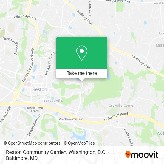
See Reston Community Garden, Fairfax County, on the map
Public Transit to Reston Community Garden in Fairfax County
Wondering how to get to Reston Community Garden in Fairfax County? Moovit helps you find the best way to get to Reston Community Garden with step-by-step directions from the nearest public transit station.
Moovit provides free maps and live directions to help you navigate through your city. View schedules, routes, timetables, and find out how long does it take to get to Reston Community Garden in real time.
Looking for the nearest stop or station to Reston Community Garden? Check out this list of stops closest to your destination: Wiehle Ave @ Fairway Dr; Wiehle Ave @ Inlet Ct; Wiehle Av @ North Shore Dr; Reston Town Center.
Bus: 552, 558, 574, RIBS1, RIBS3, 559.Metro: SILVER.
Want to see if there’s another route that gets you there at an earlier time? Moovit helps you find alternative routes or times. Get directions from and directions to Reston Community Garden easily from the Moovit App or Website.
We make riding to Reston Community Garden easy, which is why over 1.5 million users, including users in Fairfax County, trust Moovit as the best app for public transit. You don’t need to download an individual bus app or train app, Moovit is your all-in-one transit app that helps you find the best bus time or train time available.
For information on prices of bus and metro, costs and ride fares to Reston Community Garden, please check the Moovit app.
Use the app to navigate to popular places including to the airport, hospital, stadium, grocery store, mall, coffee shop, school, college, and university.
Reston Community Garden Address: Wiehle Ave Reston, VA 20190 street in Fairfax County
- Wma Life Coaching,
- Garden-Lady Gardening Services,
- Edmund R Sledzik & Association,
- Duke, Theodore J,
- Ruffin C Bernard Rev III,
- Lake Anne,
- Stanley Martin Homes at Tall Oaks,
- Mr O Driving School,
- Bentana Woods Park,
- Assert Fitness,
- Uplands Recreation Area,
- Saad Rehab,
- Moving & Redecorating Services,
- Savage Burrito,
- Brand Strides,
- Goprose Legal Services,
- Saldivar Concrete Works,
- Home & Holiday Designs,
- Humane Raccoon Removal Fairfax County,
- Devon O'Reilly - Compass Real Estate
Places Near Reston Community Garden (Fairfax County)
- Camden Yards, Baltimore,
- Westfield Montgomery Mall, Montgomery County,
- Washington DC VA Medical Center, Washington,
- Marriott Marquis Washington, DC, Washington,
- Amazon Hq2, Arlington County,
- National Museum of African American History and Culture, Washington,
- Warner Theatre, Washington,
- Capital One Arena, Washington,
- The Anthem, Washington,
- Washington National Cathedral, Washington,
- Pennsylvania Ave NW (3rd st and pennsylvania), Washington,
- Museum Of The Bible, Washington,
- Sibley Memorial Hospital, Washington,
- PG Mall, Prince George's County,
- Georgetown, Washington,
- M&T Bank Stadium, Baltimore,
- National Zoo, Washington,
- Rock Creek Tennis Center, Washington,
- Basilica of the National Shrine, Washington,
- National Theatre, Washington
How to get to popular places in Washington, D.C. - Baltimore, MD with public transit
Get around Fairfax County by public transit!
Traveling around Fairfax County has never been so easy. See step by step directions as you travel to any attraction, street or major public transit station. View bus and train schedules, arrival times, service alerts and detailed routes on a map, so you know exactly how to get to anywhere in Fairfax County.
When traveling to any destination around Fairfax County use Moovit's Live Directions with Get Off Notifications to know exactly where and how far to walk, how long to wait for your line, and how many stops are left. Moovit will alert you when it's time to get off — no need to constantly re-check whether yours is the next stop.
Wondering how to use public transit in Fairfax County or how to pay for public transit in Fairfax County? Moovit public transit app can help you navigate your way with public transit easily, and at minimum cost. It includes public transit fees, ticket prices, and costs. Looking for a map of Fairfax County public transit lines? Moovit public transit app shows all public transit maps in Fairfax County with all Bus, Train, Metro, Light Rail and Ferry routes and stops on an interactive map.
Washington, D.C. - Baltimore, MD has 5 transit type(s), including: Bus, Train, Metro, Light Rail and Ferry, operated by several transit agencies, including WMATA, Montgomery County Ride On, Fairfax Connector, TheBus, PRTC, DASH - Alexandria, Arlington Transit (ART), RTA of Central Maryland, MDOT MTA, MDOT MTA Light RailLink, MDOT MTA Commuter Bus, MDOT MTA Local Bus, FXBGO!, Virginia Railway Express (VRE) and MARC