How to get to Reston Trail B Ball Court by bus?
Click on the bus route to see step by step directions with maps, line arrival times and updated time schedules.
From Hilton McLean Tysons Corner, Fairfax County
108 minFrom Hookers & Blow, Fairfax County
52 minFrom George Mason University, Fairfax County
136 minFrom The Watermark Hotel, Fairfax County
98 minFrom Arabx Com Inc, Fairfax County
81 minFrom Fair Oaks Mall, Fairfax County
49 minFrom Mosaic District, Fairfax County
111 minFrom EagleBank Arena, Fairfax County
141 minFrom Leesburg VA-684, Fairfax County
69 minFrom Tysons Corner Center, Fairfax County
85 min
How to get to Reston Trail B Ball Court by metro?
Click on the metro route to see step by step directions with maps, line arrival times and updated time schedules.
Bus stops near Reston Trail B Ball Court in Fairfax County
Metro station near Reston Trail B Ball Court in Fairfax County
- Reston Town Center, 48 min walk,VIEW
Bus lines to Reston Trail B Ball Court in Fairfax County
What are the closest stations to Reston Trail B Ball Court?
The closest stations to Reston Trail B Ball Court are:
- Glade Dr @ Acton Dr is 636 yards away, 8 min walk.
- Soapstone Dr @ Catalpa Ct is 974 yards away, 12 min walk.
- Reston Town Center is 4072 yards away, 48 min walk.
Which bus lines stop near Reston Trail B Ball Court?
These bus lines stop near Reston Trail B Ball Court: 605, 951, RIBS2.
Which metro line stops near Reston Trail B Ball Court?
SILVER (Ashburn)
What’s the nearest bus station to Reston Trail B Ball Court in Fairfax County?
The nearest bus station to Reston Trail B Ball Court in Fairfax County is Glade Dr @ Acton Dr. It’s a 8 min walk away.
What time is the first metro to Reston Trail B Ball Court in Fairfax County?
The SILVER is the first metro that goes to Reston Trail B Ball Court in Fairfax County. It stops nearby at 5:00 AM.
What time is the last metro to Reston Trail B Ball Court in Fairfax County?
The SILVER is the last metro that goes to Reston Trail B Ball Court in Fairfax County. It stops nearby at 12:52 AM.
What time is the first bus to Reston Trail B Ball Court in Fairfax County?
The 557 is the first bus that goes to Reston Trail B Ball Court in Fairfax County. It stops nearby at 6:04 AM.
What time is the last bus to Reston Trail B Ball Court in Fairfax County?
The 951 is the last bus that goes to Reston Trail B Ball Court in Fairfax County. It stops nearby at 7:24 PM.
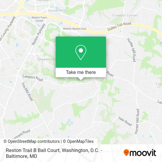
See Reston Trail B Ball Court, Fairfax County, on the map
Public Transit to Reston Trail B Ball Court in Fairfax County
Wondering how to get to Reston Trail B Ball Court in Fairfax County? Moovit helps you find the best way to get to Reston Trail B Ball Court with step-by-step directions from the nearest public transit station.
Moovit provides free maps and live directions to help you navigate through your city. View schedules, routes, timetables, and find out how long does it take to get to Reston Trail B Ball Court in real time.
Looking for the nearest stop or station to Reston Trail B Ball Court? Check out this list of stops closest to your destination: Glade Dr @ Acton Dr; Soapstone Dr @ Catalpa Ct; Reston Town Center.
Bus: 605, 951, RIBS2, 557.Metro: SILVER.
Want to see if there’s another route that gets you there at an earlier time? Moovit helps you find alternative routes or times. Get directions from and directions to Reston Trail B Ball Court easily from the Moovit App or Website.
We make riding to Reston Trail B Ball Court easy, which is why over 1.5 million users, including users in Fairfax County, trust Moovit as the best app for public transit. You don’t need to download an individual bus app or train app, Moovit is your all-in-one transit app that helps you find the best bus time or train time available.
For information on prices of bus and metro, costs and ride fares to Reston Trail B Ball Court, please check the Moovit app.
Use the app to navigate to popular places including to the airport, hospital, stadium, grocery store, mall, coffee shop, school, college, and university.
Reston Trail B Ball Court Address: Myrtle Ln Reston, VA 20191 street in Fairfax County
- Coalition-Asian Pacific Amrcn,
- International Media Consulting,
- Knueven Soap,
- Decoster Group,
- Gary Braithwaite Field at Quartermaster,
- Koester Financial,
- Lanzone Fine Arts,
- Burt Rosenberg Ministries,
- J Christofferson Consulting,
- AmpUp,
- Gerry Connolly Cross County Trl & Lawyers Rd,
- Walker Nature Center Campfire Ring,
- American Needlepoint Guild Inc,
- Restoration Church,
- Reston Cleaners,
- South Lakes High School Track,
- Alegrias Bakery,
- Holiday,
- Elite Guns & Gear,
- Hall Locksmiths
Places Near Reston Trail B Ball Court (Fairfax County)
- Museum Of The Bible, Washington,
- Warner Theatre, Washington,
- Rock Creek Tennis Center, Washington,
- Washington National Cathedral, Washington,
- Westfield Montgomery Mall, Montgomery County,
- Amazon Hq2, Arlington County,
- The Anthem, Washington,
- Sibley Memorial Hospital, Washington,
- Marriott Marquis Washington, DC, Washington,
- PG Mall, Prince George's County,
- Basilica of the National Shrine, Washington,
- M&T Bank Stadium, Baltimore,
- Camden Yards, Baltimore,
- National Zoo, Washington,
- Washington DC VA Medical Center, Washington,
- Capital One Arena, Washington,
- National Mall, Washington,
- Pennsylvania Ave NW (3rd st and pennsylvania), Washington,
- National Museum of African American History and Culture, Washington,
- Georgetown, Washington
How to get to popular places in Washington, D.C. - Baltimore, MD with public transit
Get around Fairfax County by public transit!
Traveling around Fairfax County has never been so easy. See step by step directions as you travel to any attraction, street or major public transit station. View bus and train schedules, arrival times, service alerts and detailed routes on a map, so you know exactly how to get to anywhere in Fairfax County.
When traveling to any destination around Fairfax County use Moovit's Live Directions with Get Off Notifications to know exactly where and how far to walk, how long to wait for your line, and how many stops are left. Moovit will alert you when it's time to get off — no need to constantly re-check whether yours is the next stop.
Wondering how to use public transit in Fairfax County or how to pay for public transit in Fairfax County? Moovit public transit app can help you navigate your way with public transit easily, and at minimum cost. It includes public transit fees, ticket prices, and costs. Looking for a map of Fairfax County public transit lines? Moovit public transit app shows all public transit maps in Fairfax County with all Bus, Train, Metro, Light Rail and Ferry routes and stops on an interactive map.
Washington, D.C. - Baltimore, MD has 5 transit type(s), including: Bus, Train, Metro, Light Rail and Ferry, operated by several transit agencies, including WMATA, Montgomery County Ride On, Fairfax Connector, TheBus, PRTC, DASH - Alexandria, Arlington Transit (ART), RTA of Central Maryland, MDOT MTA, MDOT MTA Light RailLink, MDOT MTA Commuter Bus, MDOT MTA Local Bus, FXBGO!, Virginia Railway Express (VRE) and MARC