How to get to Restorefast by bus?
Click on the bus route to see step by step directions with maps, line arrival times and updated time schedules.
From Silver Spring, Maryland, Montgomery County
41 minFrom Wheaton, Maryland, Montgomery County
25 minFrom Suburban Hospital, Montgomery County
46 minFrom RIO Washingtonian Center, Montgomery County
50 minFrom Brookside Gardens, Montgomery County
37 minFrom Intelligence Community Campus—Bethesda, Montgomery County
52 minFrom Clyde's of Chevy Chase, Montgomery County
48 minFrom Bullis School, Montgomery County
44 minFrom Avalon Theatre, Washington
68 minFrom 5454 Wisconsin, Montgomery County
48 min
How to get to Restorefast by train?
Click on the train route to see step by step directions with maps, line arrival times and updated time schedules.
How to get to Restorefast by metro?
Click on the metro route to see step by step directions with maps, line arrival times and updated time schedules.
From Silver Spring, Maryland, Montgomery County
58 minFrom Wheaton, Maryland, Montgomery County
65 minFrom Suburban Hospital, Montgomery County
34 minFrom Brookside Gardens, Montgomery County
86 minFrom Clyde's of Chevy Chase, Montgomery County
22 minFrom Avalon Theatre, Washington
35 minFrom 5454 Wisconsin, Montgomery County
25 min
Bus stops near Restorefast in Montgomery County
Train station near Restorefast in Montgomery County
- Garrett Park Marc Eb, 41 min walk,VIEW
Bus lines to Restorefast in Montgomery County
What are the closest stations to Restorefast?
The closest stations to Restorefast are:
- Rockville Pike & Rose Ave is 167 yards away, 3 min walk.
- Old Georgetown Rd & Grand Park Ave is 404 yards away, 5 min walk.
- North Bethesda Station & Bay B is 574 yards away, 7 min walk.
- North Bethesda is 595 yards away, 8 min walk.
- Rockville Pk+Marinelli Rd is 618 yards away, 8 min walk.
- Garrett Park Marc Eb is 3475 yards away, 41 min walk.
Which bus lines stop near Restorefast?
These bus lines stop near Restorefast: 101, 42, 46, 5, M44.
Which train line stops near Restorefast?
MARC (Inbound - Brunswick)
Which metro line stops near Restorefast?
RED (Shady Grove)
What’s the nearest bus station to Restorefast in Montgomery County?
The nearest bus station to Restorefast in Montgomery County is Rockville Pike & Rose Ave. It’s a 3 min walk away.
What time is the first metro to Restorefast in Montgomery County?
The RED is the first metro that goes to Restorefast in Montgomery County. It stops nearby at 5:04 AM.
What time is the last metro to Restorefast in Montgomery County?
The RED is the last metro that goes to Restorefast in Montgomery County. It stops nearby at 12:38 AM.
What time is the first train to Restorefast in Montgomery County?
The MARC is the first train that goes to Restorefast in Montgomery County. It stops nearby at 5:39 AM.
What time is the last train to Restorefast in Montgomery County?
The MARC is the last train that goes to Restorefast in Montgomery County. It stops nearby at 7:45 PM.
What time is the first bus to Restorefast in Montgomery County?
The 26 is the first bus that goes to Restorefast in Montgomery County. It stops nearby at 4:37 AM.
What time is the last bus to Restorefast in Montgomery County?
The 5 is the last bus that goes to Restorefast in Montgomery County. It stops nearby at 1:42 AM.
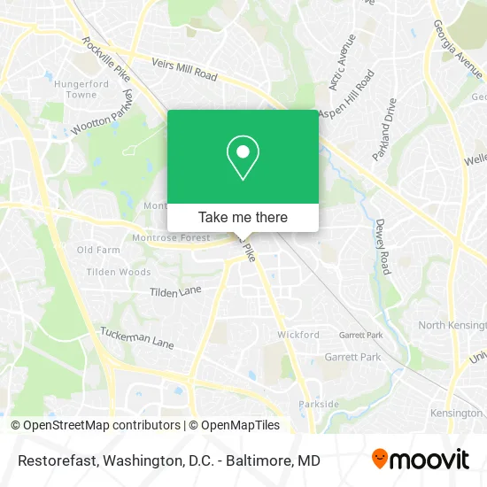
See Restorefast, Montgomery County, on the map
Public Transit to Restorefast in Montgomery County
Wondering how to get to Restorefast in Montgomery County? Moovit helps you find the best way to get to Restorefast with step-by-step directions from the nearest public transit station.
Moovit provides free maps and live directions to help you navigate through your city. View schedules, routes, timetables, and find out how long does it take to get to Restorefast in real time.
Looking for the nearest stop or station to Restorefast? Check out this list of stops closest to your destination: Rockville Pike & Rose Ave; Old Georgetown Rd & Grand Park Ave; North Bethesda Station & Bay B; North Bethesda; Rockville Pk+Marinelli Rd; Garrett Park Marc Eb.
Bus: 101, 42, 46, 5, M44, 26, 81, M42, RED.Train: MARC.Metro: RED.
Want to see if there’s another route that gets you there at an earlier time? Moovit helps you find alternative routes or times. Get directions from and directions to Restorefast easily from the Moovit App or Website.
We make riding to Restorefast easy, which is why over 1.5 million users, including users in Montgomery County, trust Moovit as the best app for public transit. You don’t need to download an individual bus app or train app, Moovit is your all-in-one transit app that helps you find the best bus time or train time available.
For information on prices of bus, metro and train, costs and ride fares to Restorefast, please check the Moovit app.
Use the app to navigate to popular places including to the airport, hospital, stadium, grocery store, mall, coffee shop, school, college, and university.
Restorefast Address: 909 Rose Ave Rockville, MD 20852 street in Montgomery County
- Big Media Agency,
- Classic Settlements,
- Industrious,
- 355code,
- Eit 2,
- Artifact Homes,
- Gashette & Ginyard,
- Oztan Studio,
- Visionworks,
- Canopy By Hilton Washington DC Bethesda North North Bethesda,
- 911 Prose Street,
- Emagine It,
- Beiser Law Firm,
- Louis Espejo Od MS,
- Laseraway,
- Canopy-Washington DC Bethesda North,
- Robert Half Recruiters & Employment Agency,
- Divaris Real Estate,
- Canopy Central Cafe and Bar,
- EvGateway
Places Near Restorefast (Montgomery County)
- Rock Creek Tennis Center, Washington,
- Washington National Cathedral, Washington,
- Washington DC VA Medical Center, Washington,
- Pennsylvania Ave NW (3rd st and pennsylvania), Washington,
- National Mall, Washington,
- Basilica of the National Shrine, Washington,
- Georgetown, Washington,
- Museum Of The Bible, Washington,
- Warner Theatre, Washington,
- M&T Bank Stadium, Baltimore,
- National Zoo, Washington,
- Marriott Marquis Washington, DC, Washington,
- PG Mall, Prince George's County,
- Capital One Arena, Washington,
- Westfield Montgomery Mall, Montgomery County,
- Amazon Hq2, Arlington County,
- Camden Yards, Baltimore,
- Sibley Memorial Hospital, Washington,
- National Museum of African American History and Culture, Washington,
- The Anthem, Washington
How to get to popular places in Washington, D.C. - Baltimore, MD with public transit
Get around Montgomery County by public transit!
Traveling around Montgomery County has never been so easy. See step by step directions as you travel to any attraction, street or major public transit station. View bus and train schedules, arrival times, service alerts and detailed routes on a map, so you know exactly how to get to anywhere in Montgomery County.
When traveling to any destination around Montgomery County use Moovit's Live Directions with Get Off Notifications to know exactly where and how far to walk, how long to wait for your line, and how many stops are left. Moovit will alert you when it's time to get off — no need to constantly re-check whether yours is the next stop.
Wondering how to use public transit in Montgomery County or how to pay for public transit in Montgomery County? Moovit public transit app can help you navigate your way with public transit easily, and at minimum cost. It includes public transit fees, ticket prices, and costs. Looking for a map of Montgomery County public transit lines? Moovit public transit app shows all public transit maps in Montgomery County with all Bus, Train, Metro, Light Rail and Ferry routes and stops on an interactive map.
Washington, D.C. - Baltimore, MD has 5 transit type(s), including: Bus, Train, Metro, Light Rail and Ferry, operated by several transit agencies, including WMATA, Montgomery County Ride On, Fairfax Connector, TheBus, PRTC, DASH - Alexandria, Arlington Transit (ART), RTA of Central Maryland, MDOT MTA, MDOT MTA Light RailLink, MDOT MTA Commuter Bus, MDOT MTA Local Bus, FXBGO!, Virginia Railway Express (VRE) and MARC